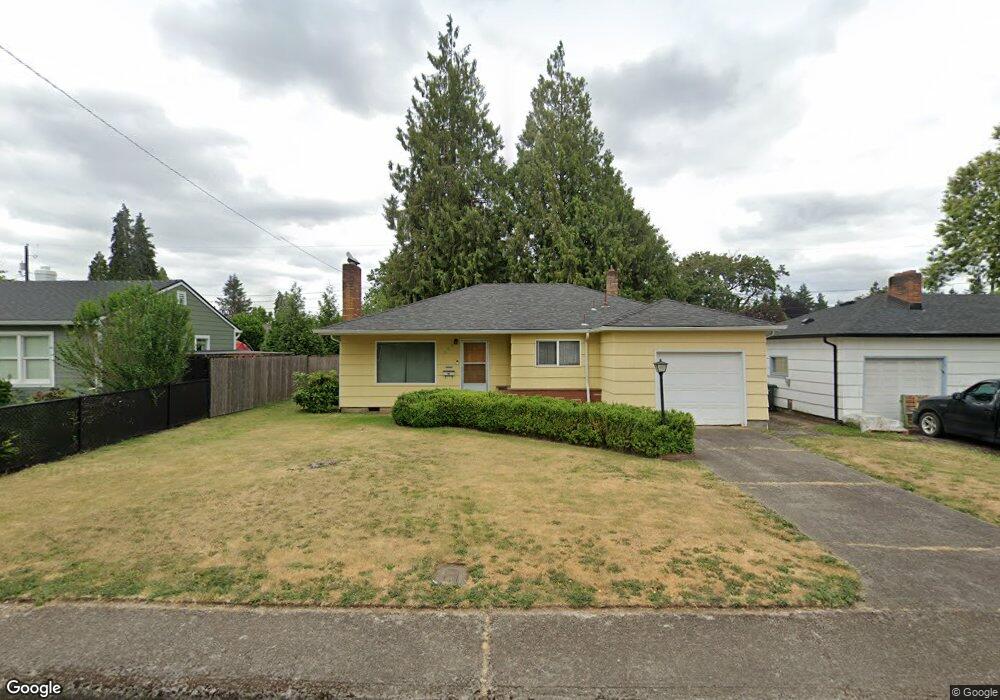
594 Menlo Dr N Keizer, OR 97303
Estimated Value: $320,000 - $380,000
3
Beds
1
Bath
1,044
Sq Ft
$340/Sq Ft
Est. Value
About This Home
This home is located at 594 Menlo Dr N, Keizer, OR 97303 and is currently estimated at $354,495, approximately $339 per square foot. 594 Menlo Dr N is a home located in Marion County with nearby schools including Cummings Elementary School, Claggett Creek Middle School, and McNary High School.
Ownership History
Date
Name
Owned For
Owner Type
Purchase Details
Closed on
Aug 2, 2011
Sold by
Howell Bill
Bought by
Howell Ryan Lee
Current Estimated Value
Home Financials for this Owner
Home Financials are based on the most recent Mortgage that was taken out on this home.
Original Mortgage
$97,465
Interest Rate
4.05%
Mortgage Type
FHA
Purchase Details
Closed on
Sep 9, 2003
Sold by
Todays Homes Llc
Bought by
Ruddell Cameron P and Ruddell Amy M
Home Financials for this Owner
Home Financials are based on the most recent Mortgage that was taken out on this home.
Original Mortgage
$146,400
Interest Rate
5.25%
Mortgage Type
Purchase Money Mortgage
Create a Home Valuation Report for This Property
The Home Valuation Report is an in-depth analysis detailing your home's value as well as a comparison with similar homes in the area
Home Values in the Area
Average Home Value in this Area
Purchase History
| Date | Buyer | Sale Price | Title Company |
|---|---|---|---|
| Howell Ryan Lee | $100,000 | Amerititle | |
| Ruddell Cameron P | $183,000 | First American |
Source: Public Records
Mortgage History
| Date | Status | Borrower | Loan Amount |
|---|---|---|---|
| Previous Owner | Howell Ryan Lee | $97,465 | |
| Previous Owner | Ruddell Cameron P | $146,400 | |
| Closed | Ruddell Cameron P | $36,600 |
Source: Public Records
Tax History Compared to Growth
Tax History
| Year | Tax Paid | Tax Assessment Tax Assessment Total Assessment is a certain percentage of the fair market value that is determined by local assessors to be the total taxable value of land and additions on the property. | Land | Improvement |
|---|---|---|---|---|
| 2025 | $2,673 | $159,450 | -- | -- |
| 2024 | $2,673 | $154,810 | -- | -- |
| 2023 | $2,543 | $150,310 | $0 | $0 |
| 2022 | $2,396 | $145,940 | $0 | $0 |
| 2021 | $2,321 | $141,690 | $0 | $0 |
| 2020 | $2,261 | $137,570 | $0 | $0 |
| 2019 | $2,174 | $133,570 | $0 | $0 |
| 2018 | $2,212 | $0 | $0 | $0 |
| 2017 | $1,988 | $0 | $0 | $0 |
| 2016 | $1,906 | $0 | $0 | $0 |
| 2015 | $1,907 | $0 | $0 | $0 |
| 2014 | $1,845 | $0 | $0 | $0 |
Source: Public Records
Map
Nearby Homes
- 4407 Toni Ave N
- 530 Larry Ave N
- 382 Cummings Ln N
- 870 Rafael Ave N
- 211 Sunset Ave N
- 132 Sunset Ave N Unit 168
- 550 Churchdale Ave N Unit 570
- 459 Churchdale Ave N
- 3796 Hart Dr N
- 724 Lost Ln N
- 4575 Clark Ave NE
- 4937 Chehalis Ct N
- 1202 Leo St NE
- 430 Chemawa Rd N
- 1038 Juniper St N
- 521 Chemawa Rd N
- 797 Dearborn Ave NE
- 500 Bever Dr NE
- 1001 Ring St NE Unit 1007
- 1009 Ring St NE Unit 1015
- 592 Menlo Dr N
- 618 Menlo Dr N
- 588 Menlo Dr N
- 620 Menlo Dr N
- 605 Marino Dr N
- 585 Marino Dr N
- 625 Marino Dr N
- 645 Marino Dr N
- 575 Marino Dr N
- 578 Menlo Dr N
- 644 Menlo Dr N
- 597 Menlo Dr N
- 617 Menlo Dr N
- 587 Menlo Dr N
- 565 Marino Dr N
- 627 Menlo Dr N
- 568 Menlo Dr N
- 678 Menlo Dr N
- 577 Menlo Dr N
- 647 Menlo Dr N