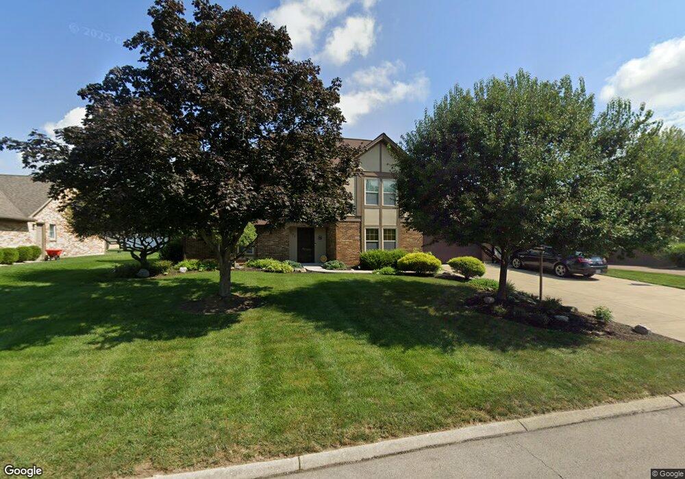
594 Oaknoll Dr Springboro, OH 45066
Clearcreek Township NeighborhoodEstimated Value: $445,146 - $482,000
4
Beds
3
Baths
2,441
Sq Ft
$188/Sq Ft
Est. Value
About This Home
This home is located at 594 Oaknoll Dr, Springboro, OH 45066 and is currently estimated at $458,787, approximately $187 per square foot. 594 Oaknoll Dr is a home located in Warren County with nearby schools including Clearcreek Elementary School, Springboro Intermediate School, and Springboro Junior High School.
Ownership History
Date
Name
Owned For
Owner Type
Purchase Details
Closed on
Aug 17, 1998
Sold by
Patrick Robert J
Bought by
Miller Roger D and Miller Tina M
Current Estimated Value
Home Financials for this Owner
Home Financials are based on the most recent Mortgage that was taken out on this home.
Original Mortgage
$159,800
Interest Rate
7.07%
Mortgage Type
New Conventional
Purchase Details
Closed on
Sep 10, 1993
Sold by
Reif Reif and Reif Neil M
Bought by
Patrick Patrick and Patrick Robert J
Purchase Details
Closed on
Jan 30, 1989
Sold by
Speaks Speaks and Speaks Norman
Bought by
Reif Reif and Reif Neil M
Purchase Details
Closed on
Aug 22, 1988
Sold by
Irving Roger and Irving B.
Bought by
Speaks Speaks and Speaks Norman
Purchase Details
Closed on
Jan 10, 1985
Sold by
Highpoint Development Co
Bought by
Irving Roger and Irving B.
Purchase Details
Closed on
Jul 3, 1980
Sold by
Highpoint Development Co
Create a Home Valuation Report for This Property
The Home Valuation Report is an in-depth analysis detailing your home's value as well as a comparison with similar homes in the area
Home Values in the Area
Average Home Value in this Area
Purchase History
| Date | Buyer | Sale Price | Title Company |
|---|---|---|---|
| Miller Roger D | $188,000 | -- | |
| Patrick Patrick | $185,000 | -- | |
| Reif Reif | $154,000 | -- | |
| Speaks Speaks | $26,500 | -- | |
| Irving Roger | -- | -- | |
| -- | -- | -- |
Source: Public Records
Mortgage History
| Date | Status | Borrower | Loan Amount |
|---|---|---|---|
| Previous Owner | Miller Roger D | $159,800 |
Source: Public Records
Tax History Compared to Growth
Tax History
| Year | Tax Paid | Tax Assessment Tax Assessment Total Assessment is a certain percentage of the fair market value that is determined by local assessors to be the total taxable value of land and additions on the property. | Land | Improvement |
|---|---|---|---|---|
| 2024 | $4,774 | $117,040 | $31,500 | $85,540 |
| 2023 | $4,081 | $93,849 | $17,220 | $76,629 |
| 2022 | $4,081 | $93,849 | $17,220 | $76,629 |
| 2021 | $3,840 | $93,849 | $17,220 | $76,629 |
| 2020 | $3,609 | $76,300 | $14,000 | $62,300 |
| 2019 | $3,344 | $76,300 | $14,000 | $62,300 |
| 2018 | $3,336 | $76,300 | $14,000 | $62,300 |
| 2017 | $3,248 | $66,693 | $12,429 | $54,264 |
| 2016 | $3,380 | $66,693 | $12,429 | $54,264 |
| 2015 | $3,407 | $66,693 | $12,429 | $54,264 |
| 2014 | $3,407 | $63,520 | $11,840 | $51,680 |
| 2013 | $3,405 | $75,120 | $14,000 | $61,120 |
Source: Public Records
Map
Nearby Homes
- 639 Birchcreek Way
- 8533 Silver Oak Ct
- 849 Wind Bluff Point
- 8455 London Ct
- 0 White Cedar Way Unit 1818661
- 1009 Highpoint Dr
- 7498 Majestic Trail
- 8590 Shelly Woods Ct
- 249 Chapel Dr
- 8234 Voltaire Ct
- 9159 Glenridge Blvd
- 79 White Beech Ct
- 9192 Glenridge Blvd
- 213 Bentridge Dr
- 7660 Horizon Hill Dr
- 9279 Maxwells Crossing
- 1211 Normandy Rue
- 1241 Normandy Rue
- 1214 Normandy Rue
- 1198 Normandy Rue
- 610 Oaknoll Dr
- 576 Oaknoll Dr
- 591 Highpoint Dr
- 573 Highpoint Dr
- 560 Oaknoll Dr
- 603 Highpoint Dr
- 591 Oaknoll Dr
- 8625 Sycamore Trails Dr
- 636 Oaknoll Dr
- 609 Oaknoll Dr
- 571 Oaknoll Dr
- 557 Highpoint Dr
- 627 Oaknoll Dr
- 8655 Sycamore Trails Dr
- 556 Oaknoll Dr
- 561 Oaknoll Dr
- 555 Oaknoll Dr
- 8565 Sycamore Trails Dr
- 555 Highpoint Dr
- 604 Highpoint Dr