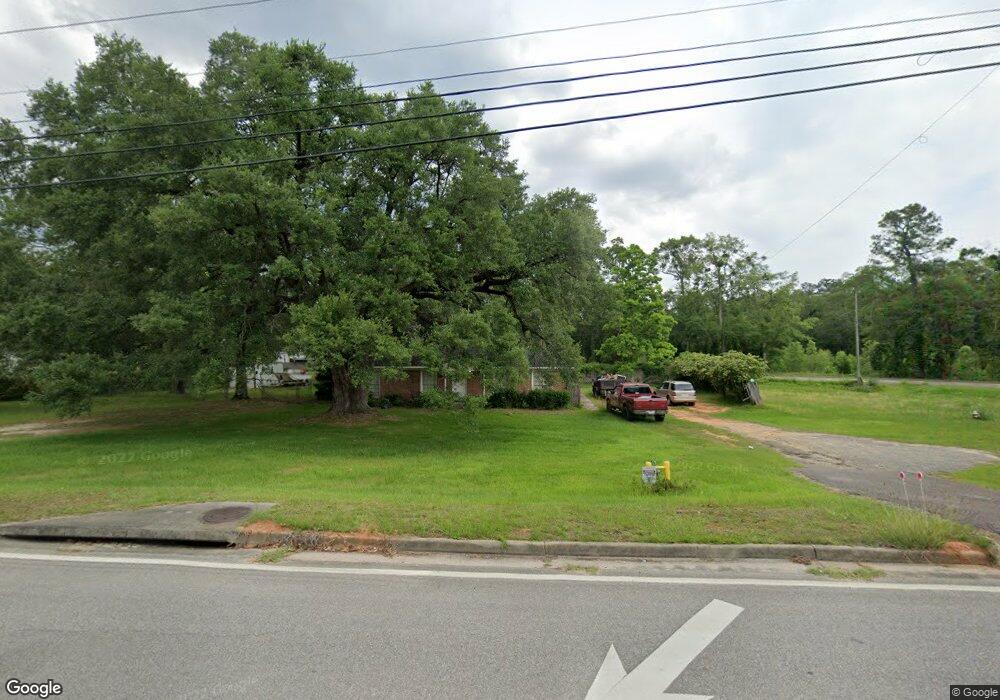
5940 Theodore Dawes Rd Theodore, AL 36582
Plantation NeighborhoodEstimated Value: $125,000 - $159,000
3
Beds
1
Bath
1,362
Sq Ft
$110/Sq Ft
Est. Value
About This Home
This home is located at 5940 Theodore Dawes Rd, Theodore, AL 36582 and is currently estimated at $149,254, approximately $109 per square foot. 5940 Theodore Dawes Rd is a home located in Mobile County with nearby schools including Nan Gray Davis Elementary School, Katherine H Hankins Middle School, and Theodore High School.
Ownership History
Date
Name
Owned For
Owner Type
Purchase Details
Closed on
Apr 8, 2021
Sold by
Wilcox Doris Jean
Bought by
Airport Properties Llc
Current Estimated Value
Purchase Details
Closed on
Jan 16, 2004
Sold by
American Tower Lp
Bought by
Upshaw Roman and Upshaw Stacy
Purchase Details
Closed on
Aug 12, 2003
Sold by
Johnston Tina W
Bought by
Wilcox Doug
Purchase Details
Closed on
Jan 4, 1999
Sold by
Jackson County Broadcasting Co Inc
Bought by
Wyok Radio Llc
Home Financials for this Owner
Home Financials are based on the most recent Mortgage that was taken out on this home.
Original Mortgage
$2,942,000
Interest Rate
6.77%
Create a Home Valuation Report for This Property
The Home Valuation Report is an in-depth analysis detailing your home's value as well as a comparison with similar homes in the area
Home Values in the Area
Average Home Value in this Area
Purchase History
| Date | Buyer | Sale Price | Title Company |
|---|---|---|---|
| Airport Properties Llc | $106,000 | None Available | |
| Upshaw Roman | -- | -- | |
| Wilcox Doug | -- | The Guarantee Title Co Llc | |
| Wyok Radio Llc | -- | -- |
Source: Public Records
Mortgage History
| Date | Status | Borrower | Loan Amount |
|---|---|---|---|
| Previous Owner | Wyok Radio Llc | $2,942,000 |
Source: Public Records
Tax History Compared to Growth
Tax History
| Year | Tax Paid | Tax Assessment Tax Assessment Total Assessment is a certain percentage of the fair market value that is determined by local assessors to be the total taxable value of land and additions on the property. | Land | Improvement |
|---|---|---|---|---|
| 2024 | $1,129 | $22,580 | $3,600 | $18,980 |
| 2023 | $870 | $17,940 | $2,000 | $15,940 |
| 2022 | $870 | $17,940 | $2,000 | $15,940 |
| 2021 | $0 | $17,940 | $2,000 | $15,940 |
| 2020 | $0 | $8,970 | $1,000 | $7,970 |
| 2019 | $0 | $8,240 | $0 | $0 |
| 2018 | $0 | $8,240 | $0 | $0 |
| 2017 | $0 | $8,560 | $0 | $0 |
| 2016 | -- | $8,660 | $0 | $0 |
| 2013 | -- | $7,620 | $0 | $0 |
Source: Public Records
Map
Nearby Homes
- 5950 Theodore Dawes Rd
- 0 Highway 90 Unit 7630566
- 0 Highway 90 Unit 7394848
- 6293 Woodside Dr S
- 6913 Gray Oaks Dr
- 6780 Boykin Rd
- 6987 Magnolia Trace
- 6028 Creek Side Trail
- 6361 Rester Rd
- 6425 Boykin Rd
- 6110 Stream Bank Dr
- 7151 Smith St
- 6134 Stream Bank Dr
- 0 Rester Rd
- 6624 Morgan Jackson Ct
- 5510 East Rd
- 7347 Broadview Dr E
- 7340 Broadview Dr E
- 6799 Foxwood Dr
- 6631 Sandra Dr
- 6500 Carol Plantation Rd
- 6490 Carol Plantation Rd
- 5966 Theodore Dawes Rd
- 6495 Lillian Dr
- 6470 Carol Plantation Rd
- 5990 Theodore Dawes Rd
- 7847 Monterey Dr
- 6475 Lillian Dr
- 6575 Carol Plantation Rd
- 9025 Plaza Rd
- 0 Bridgewood Ct Unit 169443
- 5829 Theodore Dawes Rd
- 6455 Lillian Dr
- 6455 Lillian Dr
- 6455 Lillian Dr Unit B
- 6500 Lillian Dr
- 6490 Lillian Dr
- 6440 Lillian Dr
- 6470 Lillian Dr
- 6450 Lillian Dr