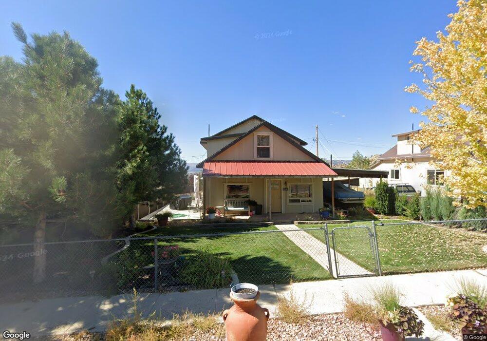
5941 N 600 E Kenilworth, UT 84529
Estimated Value: $240,000 - $343,000
Studio
--
Bath
1,530
Sq Ft
$183/Sq Ft
Est. Value
About This Home
This home is located at 5941 N 600 E, Kenilworth, UT 84529 and is currently estimated at $279,625, approximately $182 per square foot. 5941 N 600 E is a home with nearby schools including Castle Heights School, Mont Harmon Junior High School, and Carbon High School.
Ownership History
Date
Name
Owned For
Owner Type
Purchase Details
Closed on
Sep 12, 2014
Sold by
Kinsinger Sterling Neil
Bought by
Marrelli Alicia Dawn
Current Estimated Value
Purchase Details
Closed on
Apr 22, 2008
Sold by
Rudman Robin and Rudman Deborah
Bought by
Kinsinger Sterling Neil and Marrelli Alicia Dawn
Home Financials for this Owner
Home Financials are based on the most recent Mortgage that was taken out on this home.
Original Mortgage
$72,000
Interest Rate
6.11%
Mortgage Type
New Conventional
Create a Home Valuation Report for This Property
The Home Valuation Report is an in-depth analysis detailing your home's value as well as a comparison with similar homes in the area
Purchase History
| Date | Buyer | Sale Price | Title Company |
|---|---|---|---|
| Marrelli Alicia Dawn | -- | None Available | |
| Kinsinger Sterling Neil | -- | Professional Title Services |
Source: Public Records
Mortgage History
| Date | Status | Borrower | Loan Amount |
|---|---|---|---|
| Previous Owner | Kinsinger Sterling Neil | $72,000 |
Source: Public Records
Tax History
| Year | Tax Paid | Tax Assessment Tax Assessment Total Assessment is a certain percentage of the fair market value that is determined by local assessors to be the total taxable value of land and additions on the property. | Land | Improvement |
|---|---|---|---|---|
| 2025 | $1,310 | $101,428 | $10,828 | $90,600 |
| 2024 | $1,473 | $116,014 | $20,735 | $95,279 |
| 2023 | $1,378 | $117,204 | $13,750 | $103,454 |
| 2022 | $997 | $75,081 | $4,965 | $70,116 |
| 2021 | $922 | $110,090 | $7,280 | $102,810 |
| 2020 | $800 | $47,924 | $0 | $0 |
| 2019 | $578 | $42,315 | $0 | $0 |
| 2018 | $562 | $42,315 | $0 | $0 |
| 2017 | $743 | $56,825 | $0 | $0 |
| 2016 | $665 | $56,825 | $0 | $0 |
| 2015 | $665 | $56,825 | $0 | $0 |
| 2014 | $706 | $61,295 | $0 | $0 |
| 2013 | $464 | $39,928 | $0 | $0 |
Source: Public Records
Map
Nearby Homes
- 5931 N 550 E
- 49 Aspen Cove Dr Unit 49
- 109 Aspen Cove Dr Unit 109
- 5350 Dry Valley Rd Unit 61
- 24 N Dry Valley Rd Unit 24
- 6 Aspen Cove Dr Unit 6
- 5441 N Eagle Dr
- 210 Ridgeway St
- 156 D St
- 1171 W 2330 N
- 2350 N 1075 W
- 47 B St
- 182 S Main St
- 10 S 100 W
- 46 E St
- 79 Garden St
- 73 Garden St
- 564 S 300 W
- 1630 W 4200 N Unit 5
- 347 Hill St
Your Personal Tour Guide
Ask me questions while you tour the home.