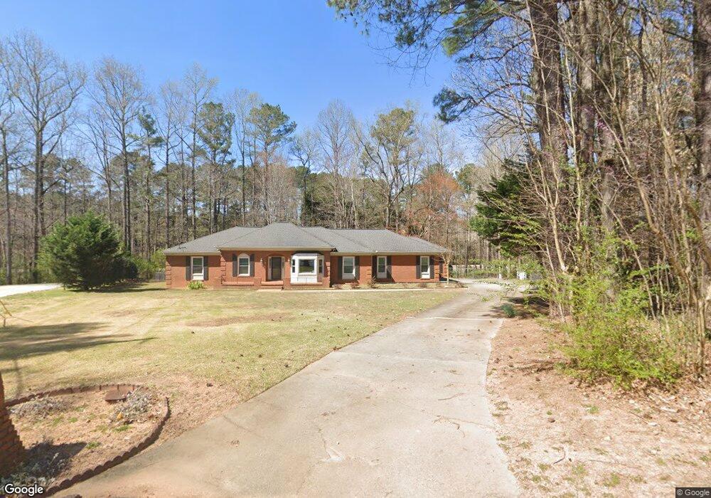
5945 Hammersmith Rd SW Stone Mountain, GA 30087
Estimated Value: $523,980 - $593,000
4
Beds
3
Baths
2,952
Sq Ft
$184/Sq Ft
Est. Value
About This Home
This home is located at 5945 Hammersmith Rd SW, Stone Mountain, GA 30087 and is currently estimated at $543,495, approximately $184 per square foot. 5945 Hammersmith Rd SW is a home located in Gwinnett County with nearby schools including Camp Creek Elementary School, Trickum Middle School, and Parkview High School.
Ownership History
Date
Name
Owned For
Owner Type
Purchase Details
Closed on
Aug 23, 2019
Sold by
Coleman Michael
Bought by
Boykin Lydia G
Current Estimated Value
Home Financials for this Owner
Home Financials are based on the most recent Mortgage that was taken out on this home.
Original Mortgage
$307,325
Outstanding Balance
$268,575
Interest Rate
3.7%
Mortgage Type
New Conventional
Estimated Equity
$274,920
Purchase Details
Closed on
Mar 8, 2012
Sold by
Billinghurst Roy A
Bought by
Coleman Michael and Coleman Angela
Home Financials for this Owner
Home Financials are based on the most recent Mortgage that was taken out on this home.
Original Mortgage
$185,500
Interest Rate
3.89%
Mortgage Type
VA
Create a Home Valuation Report for This Property
The Home Valuation Report is an in-depth analysis detailing your home's value as well as a comparison with similar homes in the area
Home Values in the Area
Average Home Value in this Area
Purchase History
| Date | Buyer | Sale Price | Title Company |
|---|---|---|---|
| Boykin Lydia G | $323,500 | -- | |
| Coleman Michael | $185,500 | -- |
Source: Public Records
Mortgage History
| Date | Status | Borrower | Loan Amount |
|---|---|---|---|
| Open | Boykin Lydia G | $307,325 | |
| Previous Owner | Coleman Michael | $185,500 |
Source: Public Records
Tax History Compared to Growth
Tax History
| Year | Tax Paid | Tax Assessment Tax Assessment Total Assessment is a certain percentage of the fair market value that is determined by local assessors to be the total taxable value of land and additions on the property. | Land | Improvement |
|---|---|---|---|---|
| 2025 | $5,474 | $173,400 | $38,960 | $134,440 |
| 2024 | $6,287 | $206,760 | $38,960 | $167,800 |
| 2023 | $6,287 | $184,040 | $42,480 | $141,560 |
| 2022 | $5,151 | $153,760 | $38,480 | $115,280 |
| 2021 | $4,696 | $128,400 | $32,080 | $96,320 |
| 2020 | $4,725 | $128,400 | $32,080 | $96,320 |
| 2019 | $1,170 | $119,120 | $32,080 | $87,040 |
| 2018 | $3,587 | $102,080 | $26,480 | $75,600 |
| 2016 | $3,414 | $93,120 | $21,280 | $71,840 |
| 2015 | $3,449 | $93,120 | $21,280 | $71,840 |
| 2014 | -- | $93,120 | $21,280 | $71,840 |
Source: Public Records
Map
Nearby Homes
- 127 Roe Hampton Ln
- 29 Lankford Rd
- 292 Old Rosser Rd
- 5887 Stow Dr
- 353 Old Rosser Rd
- 127 Old Rosser Rd SW
- 5796 Princeton Run Trail
- 5806 Princeton Run Trail
- 6156 Thorncrest Dr
- 164 Thorncrest Ct
- 2598 Bloom Cir
- 5798 Lost Grove Dr NW
- 3443 Hillyard Dr
- 6139 Wayburn St
- 5817 Lost Grove Dr NW Unit 2
- 5768 Lost Grove Dr NW
- 6133 Wayburn St
- 5945 Hammersmith Rd
- 5935 Hammersmith Rd
- 207 Roe Hampton Ln
- 5925 Hammersmith Rd
- 17 Parkstone Ct
- 21 Parkstone Ct Unit 2
- 5915 Hammersmith Rd Unit 4
- 5914 Hammersmith Rd
- 197 Roe Hampton Ln Unit 5
- 31 Parkstone Ct
- 181 Kent Valley Cir
- 171 Kent Valley Cir
- 161 Kent Valley Cir
- 151 Kent Valley Cir
- 5905 Hammersmith Rd
- 191 Kent Valley Cir
- 196 Roe Hampton Ln
- 141 Kent Valley Cir
- 187 Roe Hampton Ln Unit 5