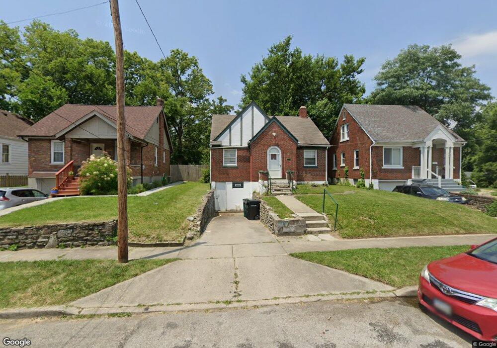
5949 Leffingwell Ave Cincinnati, OH 45224
College Hill NeighborhoodEstimated Value: $98,000 - $156,557
2
Beds
1
Bath
824
Sq Ft
$161/Sq Ft
Est. Value
About This Home
This home is located at 5949 Leffingwell Ave, Cincinnati, OH 45224 and is currently estimated at $132,389, approximately $160 per square foot. 5949 Leffingwell Ave is a home located in Hamilton County with nearby schools including Pleasant Hill Elementary School, Robert A. Taft Information Technology High School, and Western Hills High School.
Ownership History
Date
Name
Owned For
Owner Type
Purchase Details
Closed on
Jul 14, 2016
Sold by
Hamilton County Auditor
Bought by
New Dimensions Of Independence Llc
Current Estimated Value
Purchase Details
Closed on
Sep 30, 2007
Sold by
Estes Michael P and Estes Love J
Bought by
Estes Love J
Purchase Details
Closed on
Jun 1, 2002
Sold by
Cheralda Inc
Bought by
Estes Michael P
Home Financials for this Owner
Home Financials are based on the most recent Mortgage that was taken out on this home.
Original Mortgage
$25,000
Interest Rate
10%
Mortgage Type
Unknown
Create a Home Valuation Report for This Property
The Home Valuation Report is an in-depth analysis detailing your home's value as well as a comparison with similar homes in the area
Home Values in the Area
Average Home Value in this Area
Purchase History
| Date | Buyer | Sale Price | Title Company |
|---|---|---|---|
| New Dimensions Of Independence Llc | $13,400 | -- | |
| Estes Love J | -- | None Available | |
| Estes Michael P | $50,000 | C & R Title Agency Inc |
Source: Public Records
Mortgage History
| Date | Status | Borrower | Loan Amount |
|---|---|---|---|
| Previous Owner | Estes Michael P | $25,000 |
Source: Public Records
Tax History Compared to Growth
Tax History
| Year | Tax Paid | Tax Assessment Tax Assessment Total Assessment is a certain percentage of the fair market value that is determined by local assessors to be the total taxable value of land and additions on the property. | Land | Improvement |
|---|---|---|---|---|
| 2024 | $2,215 | $34,857 | $6,979 | $27,878 |
| 2023 | $2,219 | $34,857 | $6,979 | $27,878 |
| 2022 | $1,147 | $16,122 | $5,681 | $10,441 |
| 2021 | $1,124 | $16,122 | $5,681 | $10,441 |
| 2020 | $1,127 | $16,122 | $5,681 | $10,441 |
| 2019 | $1,086 | $14,144 | $4,984 | $9,160 |
| 2018 | $1,087 | $14,144 | $4,984 | $9,160 |
| 2017 | $1,047 | $14,144 | $4,984 | $9,160 |
| 2016 | $1,415 | $18,680 | $5,317 | $13,363 |
| 2015 | $1,265 | $18,680 | $5,317 | $13,363 |
| 2014 | $1,324 | $18,680 | $5,317 | $13,363 |
| 2013 | $1,334 | $19,257 | $5,481 | $13,776 |
Source: Public Records
Map
Nearby Homes
- 1147 Homeside Ave
- 1137 Homeside Ave
- 6014 Argus Rd
- 1127 Cedar Ave
- 1090 Elda Ln
- 6123 Faircrest Ct
- 5839 Argus Rd
- 5923 Lantana Ave
- 1417 Cedar Ave
- 1428 Ambrose Ave
- 1205 Wionna Ave
- 5773 Lantana Ave
- 1437 Ambrose Ave
- 6000 Capri Dr
- 1054 Grayview Ct
- 6029 Waldway Ln
- 5687 Folchi Dr
- 5679 Folchi Dr
- 5974 Sunridge Dr
- 1406 Wittekind Terrace
- 5951 Leffingwell Ave
- 5947 Leffingwell Ave
- 1185 Homeside Ave
- 5945 Leffingwell Ave
- 1189 Homeside Ave
- 1165 Homeside Ave
- 1180 Homeside Ave
- 1172 Atwood Ave
- 1170 Atwood Ave
- 1163 Homeside Ave
- 5944 Kenneth Ave
- 1184 Homeside Ave
- 1174 Atwood Ave
- 1170 Homeside Ave
- 1188 Homeside Ave
- 5948 Kenneth Ave
- 1156 Atwood Ave
- 1176 Atwood Ave
- 1153 Homeside Ave
- 1162 Homeside Ave