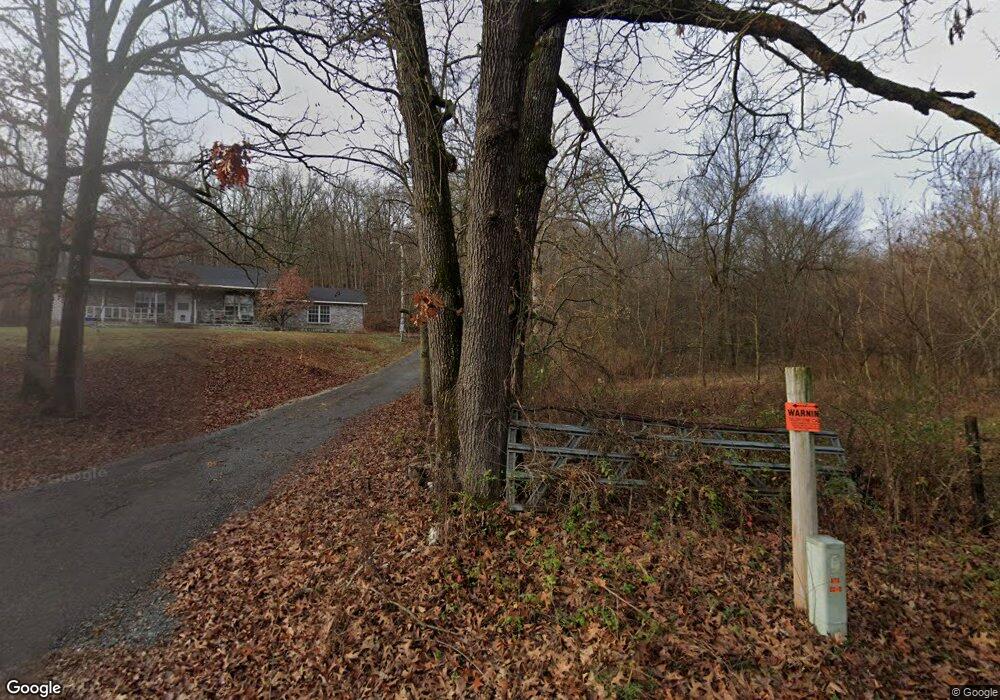
Estimated Value: $172,000 - $321,000
3
Beds
2
Baths
1,200
Sq Ft
$206/Sq Ft
Est. Value
About This Home
This home is located at 59496 S 4720 Rd, Watts, OK 74964 and is currently estimated at $246,682, approximately $205 per square foot. 59496 S 4720 Rd is a home located in Adair County with nearby schools including Watts Elementary School and Watts High School.
Ownership History
Date
Name
Owned For
Owner Type
Purchase Details
Closed on
Jul 11, 2012
Sold by
Blaine Mary
Bought by
Raimer Lonnie
Current Estimated Value
Home Financials for this Owner
Home Financials are based on the most recent Mortgage that was taken out on this home.
Original Mortgage
$87,755
Outstanding Balance
$60,703
Interest Rate
3.79%
Mortgage Type
New Conventional
Estimated Equity
$185,979
Purchase Details
Closed on
May 12, 1997
Sold by
Luttrell James and Luttrell Jean
Bought by
Blaine Mary
Create a Home Valuation Report for This Property
The Home Valuation Report is an in-depth analysis detailing your home's value as well as a comparison with similar homes in the area
Home Values in the Area
Average Home Value in this Area
Purchase History
| Date | Buyer | Sale Price | Title Company |
|---|---|---|---|
| Raimer Lonnie | $85,000 | None Available | |
| Blaine Mary | $20,000 | -- |
Source: Public Records
Mortgage History
| Date | Status | Borrower | Loan Amount |
|---|---|---|---|
| Open | Raimer Lonnie | $87,755 |
Source: Public Records
Tax History Compared to Growth
Tax History
| Year | Tax Paid | Tax Assessment Tax Assessment Total Assessment is a certain percentage of the fair market value that is determined by local assessors to be the total taxable value of land and additions on the property. | Land | Improvement |
|---|---|---|---|---|
| 2025 | $757 | $11,369 | $1,438 | $9,931 |
| 2024 | $733 | $11,037 | $1,396 | $9,641 |
| 2023 | $733 | $10,716 | $1,361 | $9,355 |
| 2022 | $687 | $10,404 | $1,321 | $9,083 |
| 2021 | $686 | $10,404 | $1,321 | $9,083 |
| 2020 | $702 | $10,616 | $1,321 | $9,295 |
| 2019 | $710 | $10,724 | $1,321 | $9,403 |
| 2018 | $693 | $10,832 | $1,321 | $9,511 |
| 2017 | $672 | $10,528 | $1,259 | $9,269 |
| 2016 | $650 | $10,221 | $1,081 | $9,140 |
| 2015 | $700 | $9,923 | $1,081 | $8,842 |
| 2014 | $700 | $9,934 | $1,081 | $8,853 |
Source: Public Records
Map
Nearby Homes
- 5773 Cedar Dr
- 306 N Moseley Rd
- 5978 Cedar Dr
- Tract A Highway 412 (10 Ac Mol)
- TRACT B
- 369 S Cherry St
- 20724 E 578 Rd
- 840 N Moseley Rd
- 59879 S 4700 Rd
- 0 W 412 Hwy Unit 1308057
- 847 Snyder Springs Loop
- 880 Snyder Springs Loop
- 8302 Covenant Cove
- 975 Snyder Springs Loop
- 939 Snyder Springs Loop
- 991 Snyder Springs Loop
- 934 Snyder Springs Loop
- 944 Snyder Springs Loop
- 58 Snyder Springs Cir
- 56826 County Road 710
- 59222 S 4726 Rd
- 0 4720 Rd Unit 19-225
- 0 4720 Rd Unit 1101729
- 518 N4710
- 21698 E 590 Rd
- 471496 E 590 Rd
- 21622 E 590 (Off South Mosley Road) Rd
- 21622 E 590 Rd
- 59151 S 4726 Rd
- 312 Rr 2
- 472573 E 591 Rd
- 58823 County Road 717
- 0 Rr 2 Unit 1023759
- 842 Rr 2
- 1094 S White Oak Rd
- 58869 S 705 Rd
- 21252 E 590 Rd
- 471149 E 600 Rd
- 58737 S 705 Rd
- 58710 County Road 717
