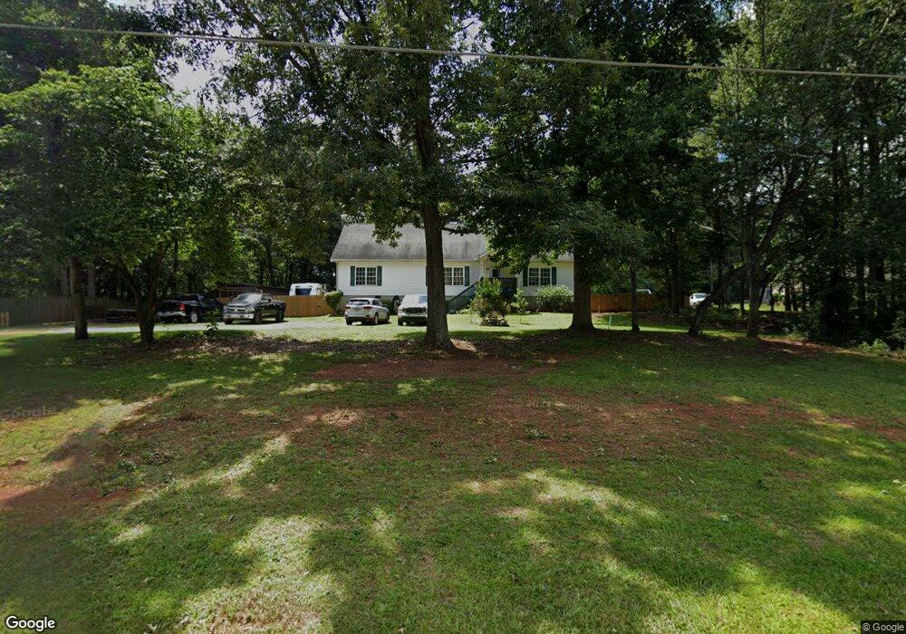
595 Jim David Rd Nicholson, GA 30565
Estimated Value: $218,000 - $320,000
3
Beds
2
Baths
1,764
Sq Ft
$160/Sq Ft
Est. Value
About This Home
This home is located at 595 Jim David Rd, Nicholson, GA 30565 and is currently estimated at $281,430, approximately $159 per square foot. 595 Jim David Rd is a home located in Jackson County with nearby schools including East Jackson Elementary School, East Jackson Middle School, and East Jackson Comprehensive High School.
Ownership History
Date
Name
Owned For
Owner Type
Purchase Details
Closed on
Oct 7, 2025
Sold by
Reynolds William
Bought by
Reynolds William G and Reynolds Deneika
Current Estimated Value
Purchase Details
Closed on
Jul 27, 2018
Sold by
Williams Donald S
Bought by
Reynolds William
Home Financials for this Owner
Home Financials are based on the most recent Mortgage that was taken out on this home.
Original Mortgage
$123,226
Interest Rate
5.12%
Mortgage Type
FHA
Purchase Details
Closed on
Sep 27, 2007
Sold by
Not Provided
Bought by
Williams Donald S
Purchase Details
Closed on
Feb 6, 2007
Sold by
Not Provided
Bought by
Williams Donald S
Purchase Details
Closed on
Nov 27, 2002
Sold by
Nicholson Development Inc
Bought by
Veal Ronald
Create a Home Valuation Report for This Property
The Home Valuation Report is an in-depth analysis detailing your home's value as well as a comparison with similar homes in the area
Purchase History
| Date | Buyer | Sale Price | Title Company |
|---|---|---|---|
| Reynolds William G | -- | -- | |
| Reynolds William | $125,500 | -- | |
| Williams Donald S | -- | -- | |
| Williams Donald S | -- | -- | |
| Williams Donald S | -- | -- | |
| Veal Ronald | $13,300 | -- |
Source: Public Records
Mortgage History
| Date | Status | Borrower | Loan Amount |
|---|---|---|---|
| Previous Owner | Reynolds William | $123,226 |
Source: Public Records
Tax History
| Year | Tax Paid | Tax Assessment Tax Assessment Total Assessment is a certain percentage of the fair market value that is determined by local assessors to be the total taxable value of land and additions on the property. | Land | Improvement |
|---|---|---|---|---|
| 2025 | $2,256 | $84,600 | $20,000 | $64,600 |
| 2024 | $2,256 | $84,600 | $20,000 | $64,600 |
| 2023 | $2,279 | $77,800 | $20,000 | $57,800 |
| 2022 | $2,039 | $67,040 | $20,000 | $47,040 |
| 2021 | $1,711 | $56,640 | $9,600 | $47,040 |
| 2020 | $1,485 | $44,960 | $6,000 | $38,960 |
| 2019 | $1,514 | $44,960 | $6,000 | $38,960 |
| 2018 | $1,464 | $43,080 | $6,000 | $37,080 |
| 2017 | $1,424 | $41,556 | $6,000 | $35,556 |
| 2016 | $1,431 | $41,556 | $6,000 | $35,556 |
| 2015 | $1,437 | $41,556 | $6,000 | $35,556 |
| 2014 | $1,389 | $40,478 | $6,000 | $34,478 |
| 2013 | -- | $40,477 | $6,000 | $34,477 |
Source: Public Records
Map
Nearby Homes
- 0 G W Wilson & Christian Rd
- 3460 Sanford Rd
- 0 Berea Rd Unit 10622565
- 393 Harmony Gates Dr
- 742 Harmony Gates Dr
- 305 Harmony Gates Dr
- 5246 Us-441 S
- 8541 Georgia 334
- 620 Ivy Creek Dr
- 227 Autumn Dr
- 698 Ivy Creek Dr
- 883 Harris Lord Cemetery Rd
- 778 Ivy Creek Dr
- 141 Rabbit Run Rd
- 0 Jefferson Dr Unit 7635823
- 0 Jefferson Dr Unit 10588928
- 520 Old Athens Dr
- 2883 Highway 441 S
- 151 J S Williamson Ct
- 7 Red Rose Rd
- 617 Jim David Rd
- 592 Jim David Rd
- 86 Steeple Chase Rd
- 110 Steeple Chase Rd
- 69 Steeplechase Rd
- 550 Jim David Rd
- 69 Steeple Chase Rd
- 673 Jim David Rd
- 160 Hunters Ridge Ln
- 141 Steeple Chase Rd
- 146 Steeple Chase Rd
- 68 Blackthorne Rd
- 136 Hunter's Ridge Ln
- 199 Hunters Ridge Ln
- Lot 44 Hunter's Ridge Ln
- 98 Jim's Ln
- 695 Jim David Rd
- 167 Hunters Ridge Ln
- 80 Hunters Ridge Ln
- 179 Steeple Chase Rd
Your Personal Tour Guide
Ask me questions while you tour the home.