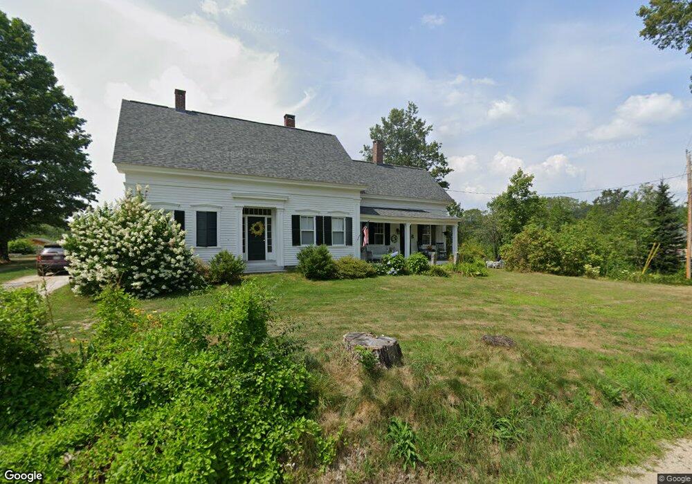
595 Maplewood Rd West Newfield, ME 04095
Newfield NeighborhoodEstimated Value: $451,000 - $561,000
4
Beds
1
Bath
2,100
Sq Ft
$246/Sq Ft
Est. Value
About This Home
This home is located at 595 Maplewood Rd, West Newfield, ME 04095 and is currently estimated at $516,069, approximately $245 per square foot. 595 Maplewood Rd is a home located in York County with nearby schools including Massabesic High School.
Ownership History
Date
Name
Owned For
Owner Type
Purchase Details
Closed on
Sep 2, 2025
Sold by
St Peter Gail and St Peter Donald
Bought by
Gail E St Peter Lt and St Peter
Current Estimated Value
Purchase Details
Closed on
Aug 16, 2006
Sold by
Adams Alice M Est and Wert
Bought by
Saint Peter G and Stpeter Donald
Create a Home Valuation Report for This Property
The Home Valuation Report is an in-depth analysis detailing your home's value as well as a comparison with similar homes in the area
Home Values in the Area
Average Home Value in this Area
Purchase History
| Date | Buyer | Sale Price | Title Company |
|---|---|---|---|
| Gail E St Peter Lt | -- | -- | |
| Saint Peter G | -- | -- | |
| Saint Peter G | -- | -- | |
| Saint Peter G | -- | -- |
Source: Public Records
Mortgage History
| Date | Status | Borrower | Loan Amount |
|---|---|---|---|
| Previous Owner | Saint Peter G | $237,000 | |
| Previous Owner | Saint Peter G | $240,000 |
Source: Public Records
Tax History Compared to Growth
Tax History
| Year | Tax Paid | Tax Assessment Tax Assessment Total Assessment is a certain percentage of the fair market value that is determined by local assessors to be the total taxable value of land and additions on the property. | Land | Improvement |
|---|---|---|---|---|
| 2025 | $5,696 | $461,600 | $185,000 | $276,600 |
| 2024 | $5,352 | $453,600 | $185,000 | $268,600 |
| 2023 | $4,937 | $452,100 | $183,500 | $268,600 |
| 2022 | $4,412 | $452,100 | $183,500 | $268,600 |
| 2021 | $4,117 | $361,800 | $146,900 | $214,900 |
| 2020 | $4,117 | $361,800 | $146,900 | $214,900 |
| 2019 | $4,030 | $361,800 | $146,900 | $214,900 |
| 2018 | $2,379 | $361,800 | $146,900 | $214,900 |
| 2017 | $4,579 | $324,000 | $146,900 | $177,100 |
| 2016 | $3,405 | $324,000 | $146,900 | $177,100 |
| 2015 | $3,156 | $324,000 | $146,900 | $177,100 |
| 2014 | $2,970 | $319,400 | $167,400 | $152,000 |
| 2013 | $2,875 | $319,400 | $167,400 | $152,000 |
Source: Public Records
Map
Nearby Homes
- 570 Maplewood Rd
- 511 South Rd
- 174 Wakefield Rd
- 209 Lost Mile Rd
- 27 Wakefield Rd Unit 27
- 11 Symmes Dr
- 00 Libby Rd Unit Lot 9
- 154 Staples Rd
- Lot#33 Shore Acres Rd
- Lot 4 Emery Rd
- Lot 1 Moulton Hill Rd
- 48 Elm St
- 220 Bond Spring Rd
- 199 Stagecoach Rd
- 339 Stevens Corner Rd
- 360 Bridge St
- 367 Shady Nook Rd
- 0 Province Lake Rd Unit 22854991
- Parcel #1 Sanborn Rd
- 424 Maplecrest Rd
- Lot 5 Maplewood Rd
- Lot10 Maplewood
- Lot 24-2 Maplewood Rd
- 590 Maplewood Rd
- 585 Maplewood Rd
- 1050 Maplewood Rd
- 578 Maplewood Rd
- 794 Mountain Rd
- 13 Reed Ln
- 780 Mountain Rd
- 776 Mountain Rd
- 685 Spring Rd
- 44 Reed Ln
- 675 Spring Rd
- 26 Reed Ln
- 547 Maplewood Rd
- 748 Mountain Rd
- 745 Mountain Rd
- 732 Mountain Rd
- 635 Spring Rd