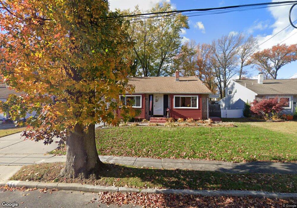
595 Shields Ave West Deptford, NJ 08096
West Deptford Township NeighborhoodEstimated Value: $315,899 - $349,000
--
Bed
--
Bath
1,464
Sq Ft
$227/Sq Ft
Est. Value
About This Home
This home is located at 595 Shields Ave, West Deptford, NJ 08096 and is currently estimated at $331,975, approximately $226 per square foot. 595 Shields Ave is a home located in Gloucester County with nearby schools including Oakview Elementary School, Red Bank Elementary School, and Green-Fields Elementary School.
Ownership History
Date
Name
Owned For
Owner Type
Purchase Details
Closed on
Sep 29, 2017
Sold by
Eachus William M and Eachus Nina M
Bought by
Jones Robert K
Current Estimated Value
Home Financials for this Owner
Home Financials are based on the most recent Mortgage that was taken out on this home.
Original Mortgage
$101,250
Outstanding Balance
$84,663
Interest Rate
3.86%
Mortgage Type
New Conventional
Estimated Equity
$247,312
Purchase Details
Closed on
Jul 13, 2001
Sold by
Kaehler Frederick J and Kaehler Anna G
Bought by
Eachus Christopher J
Home Financials for this Owner
Home Financials are based on the most recent Mortgage that was taken out on this home.
Original Mortgage
$127,492
Interest Rate
7.2%
Mortgage Type
FHA
Create a Home Valuation Report for This Property
The Home Valuation Report is an in-depth analysis detailing your home's value as well as a comparison with similar homes in the area
Home Values in the Area
Average Home Value in this Area
Purchase History
| Date | Buyer | Sale Price | Title Company |
|---|---|---|---|
| Jones Robert K | $135,000 | National Title Agency | |
| Eachus Christopher J | $128,500 | -- |
Source: Public Records
Mortgage History
| Date | Status | Borrower | Loan Amount |
|---|---|---|---|
| Open | Jones Robert K | $101,250 | |
| Previous Owner | Eachus Christopher J | $127,492 |
Source: Public Records
Tax History Compared to Growth
Tax History
| Year | Tax Paid | Tax Assessment Tax Assessment Total Assessment is a certain percentage of the fair market value that is determined by local assessors to be the total taxable value of land and additions on the property. | Land | Improvement |
|---|---|---|---|---|
| 2025 | $5,734 | $164,200 | $57,200 | $107,000 |
| 2024 | $5,660 | $164,200 | $57,200 | $107,000 |
| 2023 | $5,660 | $164,200 | $57,200 | $107,000 |
| 2022 | $5,634 | $164,200 | $57,200 | $107,000 |
| 2021 | $5,614 | $164,200 | $57,200 | $107,000 |
| 2020 | $5,601 | $164,200 | $57,200 | $107,000 |
| 2019 | $5,445 | $164,200 | $57,200 | $107,000 |
| 2018 | $5,297 | $164,200 | $57,200 | $107,000 |
| 2017 | $5,174 | $164,200 | $57,200 | $107,000 |
| 2016 | $5,029 | $164,200 | $57,200 | $107,000 |
| 2015 | $4,791 | $164,200 | $57,200 | $107,000 |
| 2014 | $4,553 | $164,200 | $57,200 | $107,000 |
Source: Public Records
Map
Nearby Homes
- 302 W Red Bank Ave
- 654 Frances Ave
- 46 Lynn Dr
- 193 Dubois Ave
- 7 Victorian Way
- 3 Victorian Way
- 2 Victorian Way
- 83 Lynn Dr
- 210 Lawnton Ave
- 131 Watkins Ave
- 815 Harker Ave
- 121 Crescent Ave
- 626 Green St
- 38 Watkins Ave
- 17 Watkins Ave
- 70 Crescent Ave
- 41 Crescent Ave
- 1029 Tatum St
- 120 Progress Ave
- 112 Progress Ave
- 587 Shields Ave
- 603 Shields Ave
- 579 Shields Ave
- 613 Shields Ave
- 596 Carter Ave
- 602 Carter Ave
- 586 Carter Ave
- 569 Shields Ave
- 623 Shields Ave
- 612 Carter Ave
- 594 Shields Ave
- 572 Carter Ave
- 602 Shields Ave
- 588 Shields Ave
- 207 Walnut St
- 622 Carter Ave
- 578 Shields Ave
- 612 Shields Ave
- 229 Walnut St
- 568 Shields Ave