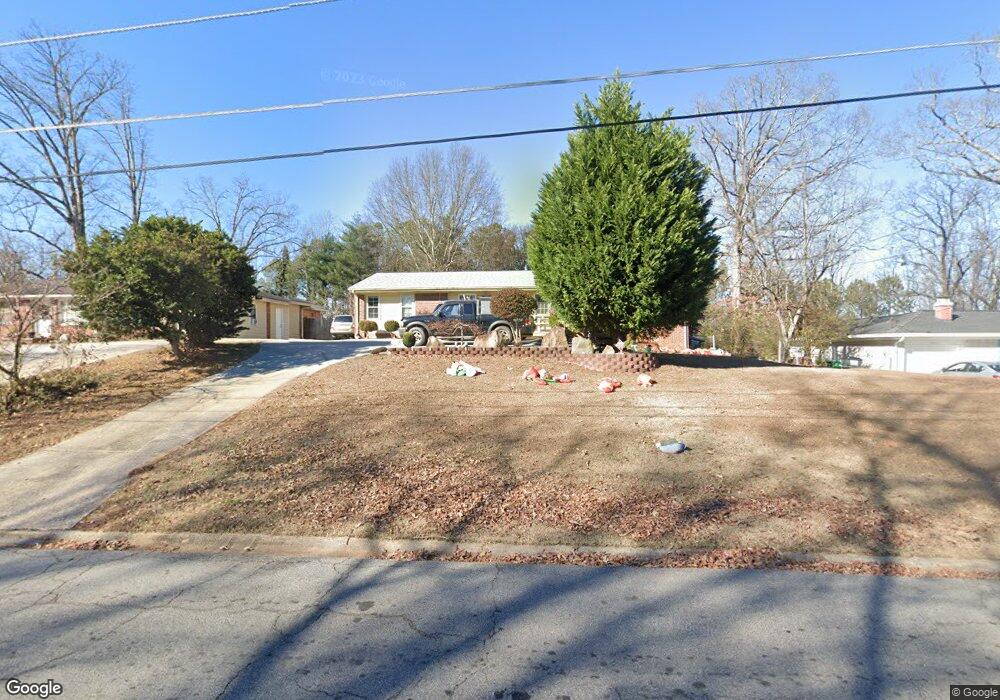
5951 Kay Dr Unit 3 Norcross, GA 30093
Estimated Value: $309,405 - $364,000
3
Beds
2
Baths
1,569
Sq Ft
$211/Sq Ft
Est. Value
About This Home
This home is located at 5951 Kay Dr Unit 3, Norcross, GA 30093 and is currently estimated at $331,601, approximately $211 per square foot. 5951 Kay Dr Unit 3 is a home located in Gwinnett County with nearby schools including Meadowcreek Elementary School, Louise Radloff Middle School, and Meadowcreek High School.
Ownership History
Date
Name
Owned For
Owner Type
Purchase Details
Closed on
Apr 25, 2025
Sold by
Korinkova Andrea
Bought by
Nejedlik Rene
Current Estimated Value
Purchase Details
Closed on
Jan 29, 2025
Sold by
Pounds Claud Augustus
Bought by
Pounds King Jan
Purchase Details
Closed on
Dec 24, 2003
Sold by
Nejedlik Rene
Bought by
Nejedlik Rene
Home Financials for this Owner
Home Financials are based on the most recent Mortgage that was taken out on this home.
Original Mortgage
$84,000
Interest Rate
7.75%
Mortgage Type
New Conventional
Create a Home Valuation Report for This Property
The Home Valuation Report is an in-depth analysis detailing your home's value as well as a comparison with similar homes in the area
Home Values in the Area
Average Home Value in this Area
Purchase History
| Date | Buyer | Sale Price | Title Company |
|---|---|---|---|
| Nejedlik Rene | -- | -- | |
| Pounds King Jan | -- | -- | |
| Nejedlik Rene | -- | -- | |
| Nejedlik Rene | $105,000 | -- |
Source: Public Records
Mortgage History
| Date | Status | Borrower | Loan Amount |
|---|---|---|---|
| Previous Owner | Nejedlik Rene | $84,000 | |
| Previous Owner | Nejedlik Rene | $15,750 |
Source: Public Records
Tax History Compared to Growth
Tax History
| Year | Tax Paid | Tax Assessment Tax Assessment Total Assessment is a certain percentage of the fair market value that is determined by local assessors to be the total taxable value of land and additions on the property. | Land | Improvement |
|---|---|---|---|---|
| 2025 | $3,137 | $118,040 | $21,120 | $96,920 |
| 2024 | $3,144 | $112,520 | $21,120 | $91,400 |
| 2023 | $3,144 | $109,080 | $24,800 | $84,280 |
| 2022 | $2,702 | $93,320 | $22,400 | $70,920 |
| 2021 | $2,229 | $68,960 | $16,000 | $52,960 |
| 2020 | $2,243 | $68,960 | $16,000 | $52,960 |
| 2019 | $1,870 | $53,840 | $13,600 | $40,240 |
| 2018 | $1,866 | $53,840 | $13,600 | $40,240 |
| 2016 | $1,475 | $38,240 | $10,400 | $27,840 |
| 2015 | $1,247 | $31,400 | $8,000 | $23,400 |
| 2014 | $1,251 | $31,400 | $8,000 | $23,400 |
Source: Public Records
Map
Nearby Homes
- 1665 Oakbrook Lake Dr
- 5719 Singlebriar Ct
- 1353 Harbins Ridge Dr Unit 36
- 5590 Stonewood Ct
- 1281 Rockfield Cir
- 1368 Breezy Cir
- 1415 Commercial Ct
- 1561 Danbury Dr
- 1002 Rockbridge Rd
- 5665 Terremont Cir
- 1258 Roman Point Dr
- 1576 Village Dr
- 1596 Village Dr
- 1637 Roman Point Dr
- 5952 Robin Hood Ln
- 5670 Hollow Ridge Ln
- 5775 Dekalb Ln
- 936 Six Oaks Cir Unit B
- 897 Six Oaks Cir Unit B
- 5605 Rock Place Ct
- 5961 Kay Dr
- 5941 Kay Dr Unit 3
- 5971 Kay Dr Unit 3
- 5931 Kay Dr Unit 2
- 5931 Kay Dr Unit B
- 5931 Kay Dr Unit A
- 5931 Kay Dr Unit C
- 5931 Kay Dr
- 5952 Kay Dr
- 5933 Brookside Oak Cir
- 5935 Brookside Oak Cir
- 5935 Brookside Oak Cir
- 5931 Brookside Oak Cir
- 5937 Brookside Oak Cir Unit 38
- 5939 Brookside Oak Cir Unit 37
- 5939 Brookside Oak Cir Unit 5939
- 5929 Brookside Oak Cir
- 5927 Brookside Oak Cir
- 5932 Kay Dr
- 5925 Brookside Oak Cir Unit 44