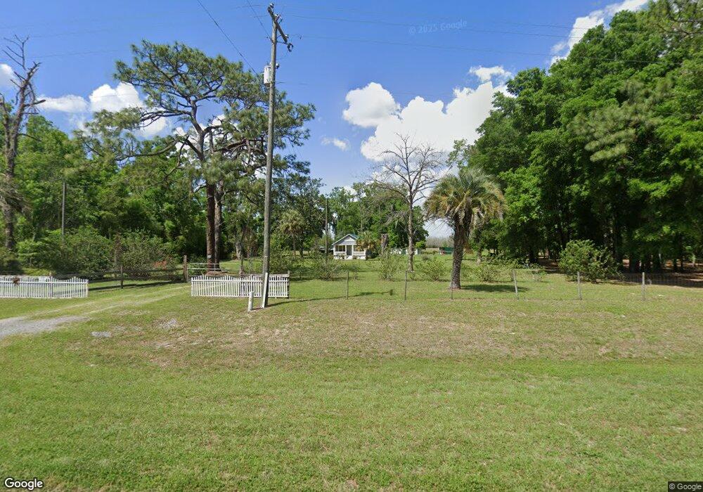
5953 Us Highway 27 Branford, FL 32008
Estimated Value: $107,000 - $197,000
--
Bed
--
Bath
1,259
Sq Ft
$126/Sq Ft
Est. Value
About This Home
This home is located at 5953 Us Highway 27, Branford, FL 32008 and is currently estimated at $158,085, approximately $125 per square foot. 5953 Us Highway 27 is a home located in Suwannee County with nearby schools including Branford Elementary School and Branford High School.
Ownership History
Date
Name
Owned For
Owner Type
Purchase Details
Closed on
Oct 15, 2008
Sold by
Bradley James David and Bradley Tricia Ann
Bought by
Carr Paul
Current Estimated Value
Home Financials for this Owner
Home Financials are based on the most recent Mortgage that was taken out on this home.
Original Mortgage
$34,500
Interest Rate
5.96%
Mortgage Type
Unknown
Purchase Details
Closed on
Mar 24, 2008
Sold by
Gay Kirly Robert Kenneth and Gay Kirly Edwina
Bought by
Bradley Dames David and Bradley Tricia Ann
Purchase Details
Closed on
May 12, 2006
Sold by
Kirby Edwina Gay
Bought by
Kirby Robert and Kirby Edwina
Home Financials for this Owner
Home Financials are based on the most recent Mortgage that was taken out on this home.
Original Mortgage
$29,000
Interest Rate
11.99%
Mortgage Type
Stand Alone First
Create a Home Valuation Report for This Property
The Home Valuation Report is an in-depth analysis detailing your home's value as well as a comparison with similar homes in the area
Home Values in the Area
Average Home Value in this Area
Purchase History
| Date | Buyer | Sale Price | Title Company |
|---|---|---|---|
| Carr Paul | $46,000 | Title Offices Llc | |
| Bradley Dames David | -- | None Available | |
| Kirby Robert | $14,500 | Signature Title & Recording |
Source: Public Records
Mortgage History
| Date | Status | Borrower | Loan Amount |
|---|---|---|---|
| Closed | Carr Paul | $34,500 | |
| Previous Owner | Kirby Robert | $29,000 |
Source: Public Records
Tax History Compared to Growth
Tax History
| Year | Tax Paid | Tax Assessment Tax Assessment Total Assessment is a certain percentage of the fair market value that is determined by local assessors to be the total taxable value of land and additions on the property. | Land | Improvement |
|---|---|---|---|---|
| 2024 | $707 | $92,414 | $49,130 | $43,284 |
| 2023 | $707 | $47,218 | $0 | $0 |
| 2022 | $679 | $71,487 | $39,882 | $31,605 |
| 2021 | $668 | $55,330 | $27,166 | $28,164 |
| 2020 | $521 | $43,893 | $0 | $0 |
| 2019 | $482 | $41,217 | $0 | $0 |
| 2018 | $470 | $40,448 | $0 | $0 |
| 2017 | $474 | $40,448 | $0 | $0 |
| 2016 | $480 | $40,448 | $0 | $0 |
| 2015 | $483 | $40,448 | $0 | $0 |
| 2014 | -- | $40,448 | $0 | $0 |
Source: Public Records
Map
Nearby Homes
- 0 65th Rd Unit 129009
- 28209 Us Hwy 129
- 3782 284th St
- 6766 264th St
- 6523 260th Place
- LT 20 288th St
- 4183 276th Terrace
- 0 280th Terrace Unit MFRGC532778
- 4341 284th Terrace
- 4354 284th Terrace
- 4109 282nd Terrace
- 7944 264th St
- 3914 280th St
- TBD 288th St
- 27441 37th Dr
- 27441 37th Rd
- 27090 37th Rd
- 3964 288th St
- 4135 290th Terrace
- LOT 14/15 292nd St
- 5953 U S 27
- 5919 Us Highway 27
- 5983 Us Highway 27
- TBD 61st Rd
- 27416 61st Rd
- 27429 61st Rd
- 0 61st Rd
- TBD Us Hwy 27 129 49
- 129 Us Highway 27
- 27037 County Road 49
- 4989 Us Highway 27
- 27093 61st Rd
- 27206 County Road 49
- 27075 County Road 49
- 27490 65th Rd
- 27618 65th Rd
- 27676 Us Highway 129
- 5338 Us Highway 27
- 27471 65th Rd
- Lot 4 65th Rd