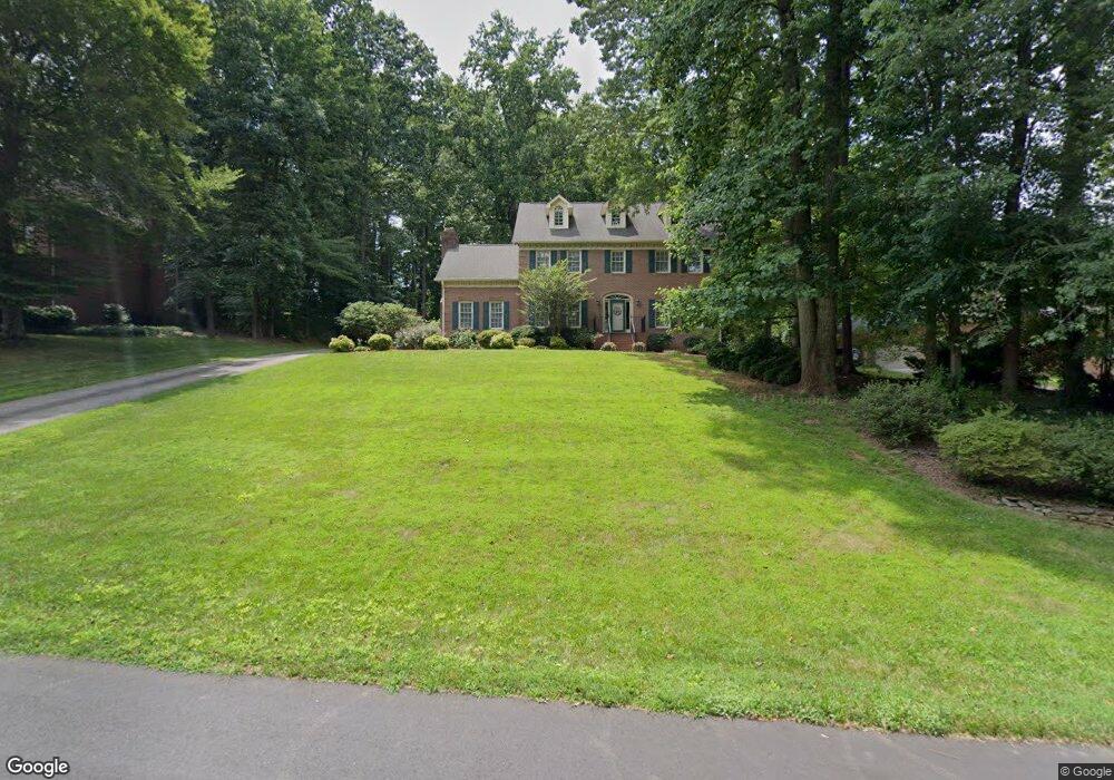
596 Doe Run Dr Kernersville, NC 27284
Woodbridge NeighborhoodEstimated Value: $515,301 - $642,000
4
Beds
3
Baths
4,330
Sq Ft
$134/Sq Ft
Est. Value
About This Home
This home is located at 596 Doe Run Dr, Kernersville, NC 27284 and is currently estimated at $581,325, approximately $134 per square foot. 596 Doe Run Dr is a home located in Forsyth County with nearby schools including Cash Elementary, East Forsyth Middle, and East Forsyth High School.
Ownership History
Date
Name
Owned For
Owner Type
Purchase Details
Closed on
Oct 14, 2009
Sold by
Jarman Harry L and Jarman Vicki L
Bought by
Aitken Andrew T and Aitken Colleen C
Current Estimated Value
Home Financials for this Owner
Home Financials are based on the most recent Mortgage that was taken out on this home.
Original Mortgage
$256,000
Outstanding Balance
$166,822
Interest Rate
5.04%
Mortgage Type
New Conventional
Estimated Equity
$414,503
Create a Home Valuation Report for This Property
The Home Valuation Report is an in-depth analysis detailing your home's value as well as a comparison with similar homes in the area
Home Values in the Area
Average Home Value in this Area
Purchase History
| Date | Buyer | Sale Price | Title Company |
|---|---|---|---|
| Aitken Andrew T | $320,000 | None Available |
Source: Public Records
Mortgage History
| Date | Status | Borrower | Loan Amount |
|---|---|---|---|
| Open | Aitken Andrew T | $256,000 |
Source: Public Records
Tax History Compared to Growth
Tax History
| Year | Tax Paid | Tax Assessment Tax Assessment Total Assessment is a certain percentage of the fair market value that is determined by local assessors to be the total taxable value of land and additions on the property. | Land | Improvement |
|---|---|---|---|---|
| 2025 | $4,867 | $565,900 | $70,000 | $495,900 |
| 2024 | $4,772 | $377,600 | $57,000 | $320,600 |
| 2023 | $4,772 | $377,600 | $57,000 | $320,600 |
| 2022 | $4,762 | $377,600 | $57,000 | $320,600 |
| 2021 | $4,762 | $377,600 | $57,000 | $320,600 |
| 2020 | $4,450 | $331,800 | $51,000 | $280,800 |
| 2019 | $4,483 | $331,800 | $51,000 | $280,800 |
| 2018 | $4,383 | $331,800 | $51,000 | $280,800 |
| 2016 | $4,171 | $315,136 | $51,000 | $264,136 |
| 2015 | $4,085 | $315,136 | $51,000 | $264,136 |
| 2014 | $4,040 | $315,136 | $51,000 | $264,136 |
Source: Public Records
Map
Nearby Homes
- 0 Doe Run Dr
- 2337 Willow Bend Dr
- 501 Buck Run Dr
- 0 Hastings Hill Ln
- 170 Gerry Dr
- 215 Gerry Dr
- 305 Hastings Hill Rd
- 306 Hastings Hill Rd
- 310 Hastings Hill Rd
- 487 Raven Ridge Dr
- 4445 Old Wood Ct
- 5572 Long Walk Dr Unit 1041
- 5642 Regents Park Rd
- 425 Rockbridge Dr
- Mayfair Plan at Pisgah Park
- Canton Plan at Pisgah Park
- Ellerbe Plan at Pisgah Park
- Raleigh Plan at Pisgah Park
- Drexel Plan at Pisgah Park
- Davidson Plan at Pisgah Park
- 600 Doe Run Dr
- 544 Buck Run Dr
- 593 Doe Run Dr
- 2401 Bambi Ln
- 2405 Bambi Ln
- 540 Buck Run Dr
- 548 Buck Run Dr
- 604 Doe Run Dr
- 536 Buck Run Dr
- 589 Doe Run Dr
- 597 Doe Run Dr
- 550 Buck Run Dr
- 585 Doe Run Dr
- 2409 Bambi Ln
- 608 Doe Run Dr
- 601 Doe Run Dr
- 521 Buck Run Dr
- 581 Doe Run Dr
- 525 Buck Run Dr
- 2400 Bambi Ln