Estimated Value: $666,000 - $814,000
4
Beds
3
Baths
2,812
Sq Ft
$269/Sq Ft
Est. Value
About This Home
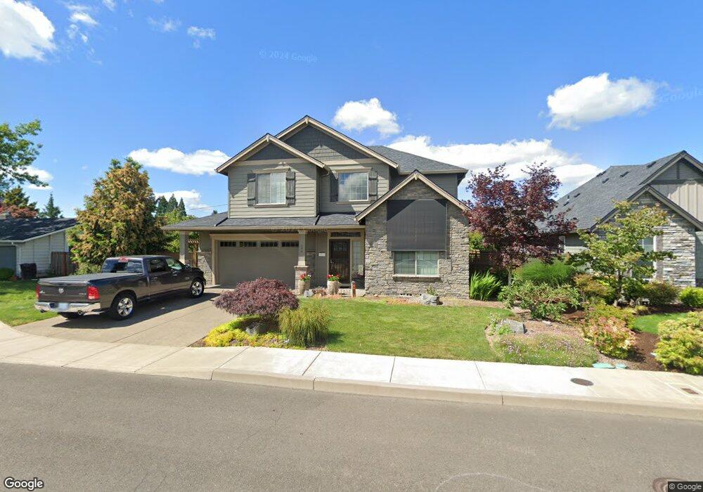
This home is located at 596 NW 12th Ave, Canby, OR 97013 and is currently estimated at $755,180, approximately $268 per square foot. 596 NW 12th Ave is a home located in Clackamas County with nearby schools including Josefa L. Sambrano Elementary School, Baker Prairie Middle School, and Canby High School.
Ownership History
Date
Name
Owned For
Owner Type
Purchase Details
Closed on
Aug 27, 2024
Sold by
Tutmark Cathy and Tutmark Peter
Bought by
Tutmark
Current Estimated Value
Purchase Details
Closed on
Nov 29, 2016
Sold by
Frontier Homes Llc
Bought by
Tutmark Peter and Tutmark Cathy
Home Financials for this Owner
Home Financials are based on the most recent Mortgage that was taken out on this home.
Original Mortgage
$417,000
Interest Rate
3.52%
Mortgage Type
New Conventional
Purchase Details
Closed on
Dec 31, 2014
Sold by
2Krmt Inc
Bought by
Frontier Homes Llc
Create a Home Valuation Report for This Property
The Home Valuation Report is an in-depth analysis detailing your home's value as well as a comparison with similar homes in the area
Home Values in the Area
Average Home Value in this Area
Purchase History
| Date | Buyer | Sale Price | Title Company |
|---|---|---|---|
| Tutmark | -- | None Listed On Document | |
| Tutmark Peter | $529,500 | Chicago Title | |
| Frontier Homes Llc | $136,000 | Chicago Title Company Of Or |
Source: Public Records
Mortgage History
| Date | Status | Borrower | Loan Amount |
|---|---|---|---|
| Previous Owner | Tutmark Peter | $417,000 |
Source: Public Records
Tax History Compared to Growth
Tax History
| Year | Tax Paid | Tax Assessment Tax Assessment Total Assessment is a certain percentage of the fair market value that is determined by local assessors to be the total taxable value of land and additions on the property. | Land | Improvement |
|---|---|---|---|---|
| 2025 | $7,976 | $450,224 | -- | -- |
| 2024 | $7,753 | $437,111 | -- | -- |
| 2023 | $7,753 | $424,380 | $0 | $0 |
| 2022 | $7,131 | $412,020 | $0 | $0 |
| 2021 | $6,867 | $400,020 | $0 | $0 |
| 2020 | $6,744 | $388,369 | $0 | $0 |
| 2019 | $6,422 | $377,058 | $0 | $0 |
| 2018 | $6,279 | $366,076 | $0 | $0 |
| 2017 | $6,120 | $355,414 | $0 | $0 |
| 2016 | $1,698 | $99,072 | $0 | $0 |
| 2015 | $1,640 | $96,186 | $0 | $0 |
Source: Public Records
Map
Nearby Homes
- 0 NW 10th Ave
- 960 N Aspen Ct
- 1614 NW 16th Ave
- 184 NE 10th Ave
- 187 NE 14th Ave
- 1721 N Hyssop St
- 580 N Grant St
- 318 NE 9th Ave
- 312 NE 14th Ave
- 442 NW 4th Ave
- 1751 N Laurelwood Loop
- 589 NW 3rd Ave
- 812 NW 3rd Ave
- 850 NW 3rd Ave
- 1165 NW 22nd Ave
- 1199 NW 22nd Ave
- 1151 NW 22nd Ave
- 2152 N Laurelwood St
- 860 NE 14th Ave
- 660 NE 20th Ave
- 564 NW 12th Ave
- 604 NW 12th Ave
- 597 NW 13th Ave
- 573 NW 13th Ave
- 603 NW 13th Ave
- 565 NW 12th Ave
- 597 NW 12th Ave
- 646 NW 12th Ave
- 607 NW 12th Ave
- 1175 N Elm St
- 539 NW 13th Ave
- 1295 N Elm St
- 1297 N Elm St
- 615 NW 12th Ave
- 570 NW 11th Ave
- 590 NW 11th Ave
- 620 NW 11th Ave
- 668 NW 12th Ave
- 1165 N Elm St
- 600 NW 13th Ave