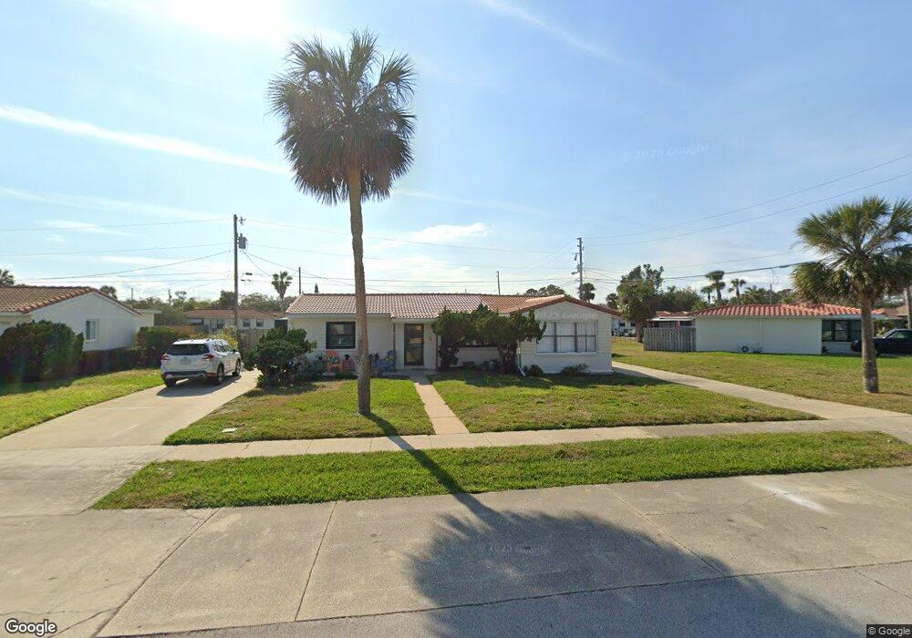
596 Robin Rd Unit A Ormond Beach, FL 32176
Estimated Value: $230,000 - $272,000
2
Beds
1
Bath
1,208
Sq Ft
$208/Sq Ft
Est. Value
About This Home
This home is located at 596 Robin Rd Unit A, Ormond Beach, FL 32176 and is currently estimated at $251,317, approximately $208 per square foot. 596 Robin Rd Unit A is a home located in Volusia County with nearby schools including Ormond Beach Middle School, Seabreeze High School, and Lourdes Academy.
Ownership History
Date
Name
Owned For
Owner Type
Purchase Details
Closed on
Jun 30, 2000
Sold by
Newbold Anthony E and Newbold Monine C
Bought by
Mcgrath Alessandra F and Murbach Jonathan F
Current Estimated Value
Home Financials for this Owner
Home Financials are based on the most recent Mortgage that was taken out on this home.
Original Mortgage
$56,000
Outstanding Balance
$19,737
Interest Rate
8.63%
Mortgage Type
Purchase Money Mortgage
Estimated Equity
$231,580
Purchase Details
Closed on
Dec 15, 1990
Bought by
Mcgrath Alessandra F
Create a Home Valuation Report for This Property
The Home Valuation Report is an in-depth analysis detailing your home's value as well as a comparison with similar homes in the area
Home Values in the Area
Average Home Value in this Area
Purchase History
| Date | Buyer | Sale Price | Title Company |
|---|---|---|---|
| Mcgrath Alessandra F | $70,000 | -- | |
| Mcgrath Alessandra F | $50,900 | -- |
Source: Public Records
Mortgage History
| Date | Status | Borrower | Loan Amount |
|---|---|---|---|
| Open | Mcgrath Alessandra F | $56,000 |
Source: Public Records
Tax History
| Year | Tax Paid | Tax Assessment Tax Assessment Total Assessment is a certain percentage of the fair market value that is determined by local assessors to be the total taxable value of land and additions on the property. | Land | Improvement |
|---|---|---|---|---|
| 2026 | $860 | $97,555 | -- | -- |
| 2025 | $860 | $94,991 | -- | -- |
| 2024 | $782 | $92,315 | -- | -- |
| 2023 | $782 | $89,626 | $0 | $0 |
| 2022 | $744 | $87,016 | $0 | $0 |
| 2021 | $752 | $84,482 | $0 | $0 |
| 2020 | $734 | $83,316 | $0 | $0 |
| 2019 | $710 | $81,443 | $0 | $0 |
| 2018 | $703 | $79,924 | $0 | $0 |
| 2017 | $702 | $78,280 | $0 | $0 |
| 2016 | $699 | $76,670 | $0 | $0 |
| 2015 | $718 | $76,137 | $0 | $0 |
| 2014 | $711 | $75,533 | $0 | $0 |
Source: Public Records
Map
Nearby Homes
- 601 Robin Rd Unit A
- 3 Oriole Cir Unit B
- 11 Oriole Cir Unit A
- 106 Cardinal Dr Unit B
- 47 Chippingwood Ln
- 67 Ormond Shores Dr
- 46 Chippingwood Ln
- 150 Benjamin Dr
- 159 Ponce de Leon Dr
- 2 Cypress Cir
- 482 Riverside Dr
- 46 Marvin Rd
- 45 Loyola Dr
- 246 Ponce de Leon Dr
- 792 Marvin Rd
- 395 S Atlantic Ave Unit 305
- 395 S Atlantic Ave Unit 701
- 395 S Atlantic Ave Unit 301
- 395 S Atlantic Ave Unit 102
- 395 S Atlantic Ave Unit 402
- 596 Robin Rd Unit B
- 584 Robin Rd Unit B
- 584 Robin Rd Unit A
- 593 Flamingo Dr Unit A
- 593 Flamingo Dr Unit B
- 604 Robin Rd Unit B
- 604 Robin Rd Unit A
- 583 Flamingo Dr Unit A
- 583 Flamingo Dr Unit B
- 583 Flamingo Dr
- 601 Flamingo Dr Unit B
- 601 Flamingo Dr Unit A
- 601 Robin Rd Unit C
- 595 Robin Rd Unit B
- 595 Robin Rd Unit A
- 583 Robin Rd
- 614 Robin Rd Unit B
- 547 Pinewood St
- 613 Robin Rd Unit 613B
- 613 Robin Rd Unit B
Your Personal Tour Guide
Ask me questions while you tour the home.