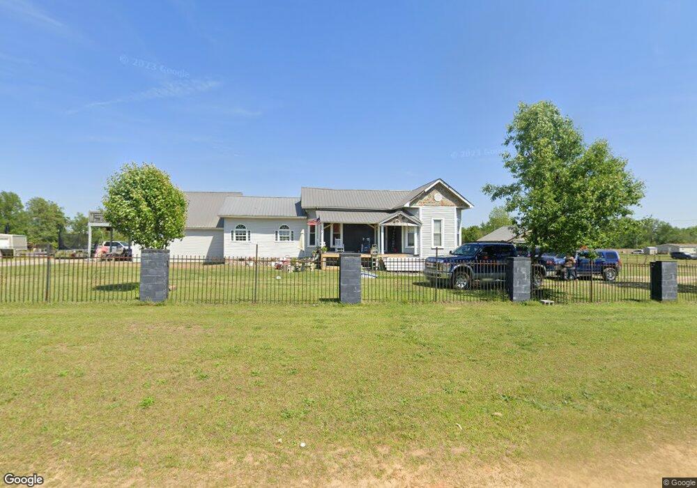
596 Thomas Dr Raeford, NC 28376
Estimated Value: $256,000 - $298,000
Studio
--
Bath
2,503
Sq Ft
$112/Sq Ft
Est. Value
About This Home
This home is located at 596 Thomas Dr, Raeford, NC 28376 and is currently estimated at $279,586, approximately $111 per square foot. 596 Thomas Dr is a home with nearby schools including West Hoke Elementary School, West Hoke Middle, and Hoke County High.
Ownership History
Date
Name
Owned For
Owner Type
Purchase Details
Closed on
Jan 8, 2007
Sold by
Thompson Mark Stephen and Thompson Demetrice
Bought by
Grace Vincent
Current Estimated Value
Home Financials for this Owner
Home Financials are based on the most recent Mortgage that was taken out on this home.
Original Mortgage
$78,400
Outstanding Balance
$46,195
Interest Rate
6.05%
Mortgage Type
New Conventional
Estimated Equity
$233,391
Create a Home Valuation Report for This Property
The Home Valuation Report is an in-depth analysis detailing your home's value as well as a comparison with similar homes in the area
Home Values in the Area
Average Home Value in this Area
Purchase History
| Date | Buyer | Sale Price | Title Company |
|---|---|---|---|
| Grace Vincent | $112,000 | None Available |
Source: Public Records
Mortgage History
| Date | Status | Borrower | Loan Amount |
|---|---|---|---|
| Open | Grace Vincent | $78,400 |
Source: Public Records
Tax History
| Year | Tax Paid | Tax Assessment Tax Assessment Total Assessment is a certain percentage of the fair market value that is determined by local assessors to be the total taxable value of land and additions on the property. | Land | Improvement |
|---|---|---|---|---|
| 2025 | $1,575 | $174,060 | $10,000 | $164,060 |
| 2024 | $1,575 | $174,060 | $10,000 | $164,060 |
| 2023 | $1,575 | $174,060 | $10,000 | $164,060 |
| 2022 | $1,546 | $174,060 | $10,000 | $164,060 |
| 2021 | $1,423 | $155,190 | $10,000 | $145,190 |
| 2020 | $1,447 | $155,190 | $10,000 | $145,190 |
| 2019 | $1,447 | $155,190 | $10,000 | $145,190 |
| 2018 | $1,447 | $155,190 | $10,000 | $145,190 |
| 2017 | $1,447 | $155,190 | $10,000 | $145,190 |
| 2016 | $1,421 | $155,190 | $10,000 | $145,190 |
| 2015 | $1,421 | $155,190 | $10,000 | $145,190 |
| 2014 | $1,147 | $124,940 | $10,000 | $114,940 |
| 2013 | -- | $109,880 | $8,000 | $101,880 |
Source: Public Records
Map
Nearby Homes
- 555 Lemont Dr
- 100 L McMillian Rd
- 486 Gable Dr
- 408 Old Farm Rd
- TBD Skimmer Bay Dr
- 261 W Palmer St
- 0 Mockingbird Hill (Lot 1) Rd Unit 746301
- 0 Mockingbird Hill (Lot 2) Rd
- 5745 Turnpike Rd
- 648 Ashley Heights (Lot 95) Dr
- 560 Ashley Heights (Lot 90) Dr
- 129 Traveller Way
- 114 Seaford (Lot 9) Ln
- 574 Ashley Heights (Lot 91) Dr
- 176 Seaford (Lot 5) Ln
- 499 Ashley Heights (Lot 21) Dr
- 485 Ashley Heights (Lot 22) Dr
- 415 Traveller Way
- 259 Palomo Place
- 206 Palomo Place
- 431 Lemont Dr
- 592 Thomas Dr
- 551 Lemont Dr
- 130 L McMillian Rd
- 420 Lemont Dr
- 593 Thomas Dr
- 550 Thomas Dr
- 162 L McMillian Rd
- 533 Thomas Dr
- 347 Lemont Dr
- 1039 Edgewater Dr
- 0 Thomas Dr Unit 395373
- 223 L McMillian Rd
- 287 Mayor Ct
- 250 L McMillian Rd
- 279 Mayor Ct
- 977 Lemont Dr
- 263 Mayor Ct
- 284 Mayor Ct
- 249 Mayor Ct
Your Personal Tour Guide
Ask me questions while you tour the home.