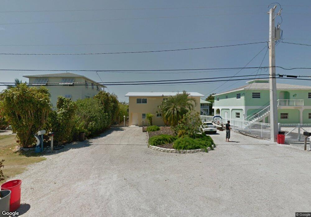
596 W Shore Dr Summerland Key, FL 33042
Estimated Value: $812,056 - $1,198,000
3
Beds
3
Baths
2,832
Sq Ft
$379/Sq Ft
Est. Value
About This Home
This home is located at 596 W Shore Dr, Summerland Key, FL 33042 and is currently estimated at $1,074,264, approximately $379 per square foot. 596 W Shore Dr is a home located in Monroe County with nearby schools including Sugarloaf School and Key West High School.
Ownership History
Date
Name
Owned For
Owner Type
Purchase Details
Closed on
Aug 31, 2020
Sold by
Mensch Shirley
Bought by
Mensch Shirley and Shirley Mensch Trust
Current Estimated Value
Purchase Details
Closed on
Jul 20, 2018
Sold by
Wright James W
Bought by
Wright James W and Mensch Shirley
Purchase Details
Closed on
Dec 3, 1996
Sold by
Grant Michael C and Grant Anna
Bought by
Wright James W
Purchase Details
Closed on
Jun 1, 1987
Bought by
Wright James W
Create a Home Valuation Report for This Property
The Home Valuation Report is an in-depth analysis detailing your home's value as well as a comparison with similar homes in the area
Home Values in the Area
Average Home Value in this Area
Purchase History
| Date | Buyer | Sale Price | Title Company |
|---|---|---|---|
| Mensch Shirley | -- | Attorney | |
| Wright James W | $100 | None Listed On Document | |
| Wright James W | $100 | None Listed On Document | |
| Wright James W | $208,700 | -- | |
| Wright James W | $140,000 | -- |
Source: Public Records
Tax History Compared to Growth
Tax History
| Year | Tax Paid | Tax Assessment Tax Assessment Total Assessment is a certain percentage of the fair market value that is determined by local assessors to be the total taxable value of land and additions on the property. | Land | Improvement |
|---|---|---|---|---|
| 2024 | $7,087 | $792,514 | $404,505 | $388,009 |
| 2023 | $7,087 | $783,338 | $404,505 | $378,833 |
| 2022 | $6,273 | $607,093 | $228,765 | $378,328 |
| 2021 | $5,900 | $489,960 | $175,740 | $314,220 |
| 2020 | $5,880 | $483,924 | $169,680 | $314,244 |
| 2019 | $5,889 | $483,664 | $165,135 | $318,529 |
| 2018 | $6,013 | $484,234 | $165,135 | $319,099 |
| 2017 | $5,937 | $484,259 | $0 | $0 |
| 2016 | $5,638 | $436,836 | $0 | $0 |
| 2015 | $5,891 | $448,327 | $0 | $0 |
| 2014 | $5,642 | $400,213 | $0 | $0 |
Source: Public Records
Map
Nearby Homes
- 554 W Shore Dr
- 466 W Shore Dr
- 937 Gulf Dr
- 948 Gulf Dr
- 876 Gulf Dr
- 835 Gulf Dr
- 951 Lagoon Dr
- 680 Cruikshank Island
- 1082 Bay Dr
- 860 Lagoon Dr
- 655 E Shore Dr
- 231 E Shore Dr Unit 7
- 231 E Shore Dr Unit 6
- 231 E Shore Dr Unit 4
- 231 E Shore Dr Unit 2
- 231 E Shore Dr Unit 5
- 231 E Shore Dr Unit 1
- 231 E Shore Dr Unit 3
- 974 Flagship Dr
- 1147 Flagship Dr
- 616 W Shore Dr
- 584 W Shore Dr
- 626 W Shore Dr
- 574 W Shore Dr
- 989 Caribbean Dr E
- 969 Caribbean Dr E
- 564 W Shore Dr
- 636 W Shore Dr
- 959 Caribbean Dr E
- 1011 Caribbean Dr E
- 615 W Shore Dr
- 949 Caribbean Dr E
- 2705 Lt 14 East Caribbean Dr
- 1031 Caribbean Dr E
- 656 W Shore Dr
- 939 Caribbean Dr E
- 2705 Lt 15 East Caribbean Dr
- 980 Caribbean Dr E
- 970 Caribbean Dr E
- 544 W Shore Dr