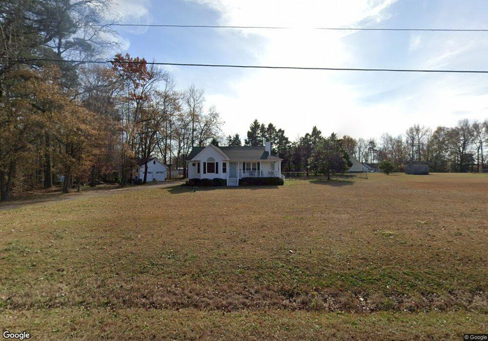
5960 Covered Bridge Rd Clayton, NC 27527
Estimated Value: $320,228 - $349,000
3
Beds
2
Baths
1,410
Sq Ft
$236/Sq Ft
Est. Value
About This Home
This home is located at 5960 Covered Bridge Rd, Clayton, NC 27527 and is currently estimated at $332,557, approximately $235 per square foot. 5960 Covered Bridge Rd is a home located in Johnston County with nearby schools including River Dell Elementary School, Archer Lodge Middle School, and Corinth Holders High School.
Ownership History
Date
Name
Owned For
Owner Type
Purchase Details
Closed on
Oct 8, 2021
Sold by
Apanovich and Marleliza
Bought by
State Of North Carolina
Current Estimated Value
Purchase Details
Closed on
Nov 20, 2020
Sold by
Brier Walter J and Brier Cheryl L
Bought by
Apanovich Michael and Apanovich Marieliza
Home Financials for this Owner
Home Financials are based on the most recent Mortgage that was taken out on this home.
Original Mortgage
$170,250
Interest Rate
2.8%
Mortgage Type
New Conventional
Create a Home Valuation Report for This Property
The Home Valuation Report is an in-depth analysis detailing your home's value as well as a comparison with similar homes in the area
Home Values in the Area
Average Home Value in this Area
Purchase History
| Date | Buyer | Sale Price | Title Company |
|---|---|---|---|
| State Of North Carolina | $15,000 | None Listed On Document | |
| Apanovich Michael | $232,000 | None Available |
Source: Public Records
Mortgage History
| Date | Status | Borrower | Loan Amount |
|---|---|---|---|
| Previous Owner | Apanovich Michael | $170,250 |
Source: Public Records
Tax History
| Year | Tax Paid | Tax Assessment Tax Assessment Total Assessment is a certain percentage of the fair market value that is determined by local assessors to be the total taxable value of land and additions on the property. | Land | Improvement |
|---|---|---|---|---|
| 2025 | $2,264 | $276,120 | $51,940 | $224,180 |
| 2024 | $1,722 | $173,950 | $46,000 | $127,950 |
| 2023 | $1,722 | $173,950 | $46,000 | $127,950 |
| 2022 | $1,740 | $173,950 | $46,000 | $127,950 |
| 2021 | $1,653 | $173,950 | $46,000 | $127,950 |
| 2020 | $1,705 | $173,950 | $46,000 | $127,950 |
| 2019 | $1,705 | $173,950 | $46,000 | $127,950 |
| 2018 | $1,381 | $138,110 | $30,900 | $107,210 |
| 2017 | $1,353 | $138,110 | $30,900 | $107,210 |
| 2016 | $1,353 | $138,110 | $30,900 | $107,210 |
| 2015 | $1,295 | $138,110 | $30,900 | $107,210 |
| 2014 | $1,295 | $138,110 | $30,900 | $107,210 |
Source: Public Records
Map
Nearby Homes
- 1998 Woodstone Dr
- 131 Nashville Dr
- 150 Summerlin Dr
- 160 Summerlin Dr
- 174 Summerlin Dr
- 2276 Castleberry Rd
- 207 Wendell Rd
- 153 Sanidine Ln
- 112 Radcliffe Ct
- 68 Radcliffe Ct
- 54 Denby Cir
- 128 Wembley Dr
- 211 Wheeler Ct
- 93 Denby Cir
- 155 Millwood Dr
- 115 Denby Cir
- 1000 Deerfield Trail
- 365 N Farm Dr
- 69 Cedar Grove Ct
- 39 Anderby Dr
- 105 S Woodstone Dr
- 1998 Woodstone Dr Unit 1700
- 109 S Woodstone Dr
- 113 S Woodstone Dr
- 101 S Woodstone Dr
- 3197 Castleberry Rd
- 3219 Castleberry Rd
- 2000 Woodstone Dr
- 100 S Woodstone Dr
- 104 S Woodstone Dr
- 3175 Castleberry Rd
- 2002 Woodstone Dr
- 3155 Castleberry Rd
- 6081 Covered Bridge Rd
- 1999 Woodstone Dr
- 108 S Woodstone Dr
- 5870 Covered Bridge Rd
- 121 S Woodstone Dr
- 2004 Woodstone Dr
- 2001 Woodstone Dr
Your Personal Tour Guide
Ask me questions while you tour the home.