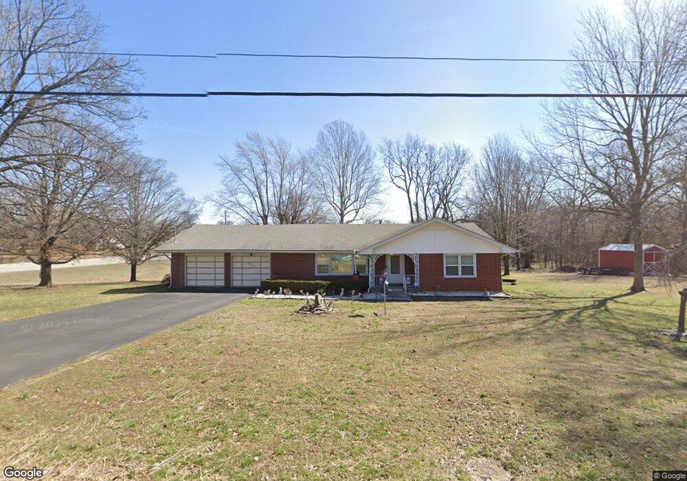
5960 Elm St Webb City, MO 64870
Estimated Value: $204,000 - $267,000
3
Beds
2
Baths
1,800
Sq Ft
$127/Sq Ft
Est. Value
About This Home
This home is located at 5960 Elm St, Webb City, MO 64870 and is currently estimated at $228,558, approximately $126 per square foot. 5960 Elm St is a home located in Jasper County with nearby schools including Webb City High School.
Ownership History
Date
Name
Owned For
Owner Type
Purchase Details
Closed on
Oct 29, 2013
Sold by
Vorse Ronald L and Vorse Wilma L
Bought by
Vorse Ronald L and Vorse Wilma L
Current Estimated Value
Purchase Details
Closed on
Oct 15, 2009
Sold by
Green Nellie P
Bought by
Vorse Ronald L and Vorse Wilma L
Home Financials for this Owner
Home Financials are based on the most recent Mortgage that was taken out on this home.
Original Mortgage
$94,000
Outstanding Balance
$61,194
Interest Rate
5.1%
Mortgage Type
New Conventional
Estimated Equity
$167,364
Create a Home Valuation Report for This Property
The Home Valuation Report is an in-depth analysis detailing your home's value as well as a comparison with similar homes in the area
Purchase History
We collect this data history from publicly available records. To have your information removed, we recommend requesting removal directly through your county’s website.
| Date | Buyer | Sale Price | Title Company |
|---|---|---|---|
| Vorse Ronald L | -- | None Available | |
| Vorse Ronald L | -- | Abbey |
Source: Public Records
Mortgage History
We collect this data history from publicly available records. To have your information removed, we recommend requesting removal directly through your county’s website.
| Date | Status | Borrower | Loan Amount |
|---|---|---|---|
| Open | Vorse Ronald L | $94,000 |
Source: Public Records
Tax History
| Year | Tax Paid | Tax Assessment Tax Assessment Total Assessment is a certain percentage of the fair market value that is determined by local assessors to be the total taxable value of land and additions on the property. | Land | Improvement |
|---|---|---|---|---|
| 2025 | $910 | $25,900 | $3,800 | $22,100 |
| 2024 | $910 | $23,080 | $3,800 | $19,280 |
| 2023 | $910 | $23,080 | $3,800 | $19,280 |
| 2022 | $888 | $22,610 | $3,800 | $18,810 |
| 2021 | $882 | $22,610 | $3,800 | $18,810 |
| 2020 | $828 | $20,950 | $3,800 | $17,150 |
| 2019 | $830 | $20,950 | $3,800 | $17,150 |
| 2018 | $809 | $20,480 | $0 | $0 |
| 2017 | $812 | $20,480 | $0 | $0 |
| 2016 | $785 | $19,890 | $0 | $0 |
| 2015 | $785 | $19,890 | $0 | $0 |
| 2014 | $785 | $19,890 | $0 | $0 |
Source: Public Records
Map
Nearby Homes
- 5825 Joplin St
- Xxx Wall St
- TBD Wall St
- 25XXX Central Ave
- 6576 Park Cir
- Lot 1A Hwy 171 & Fir Rd
- Lot 1 Hwy 171 & Fir Rd
- 25327 Central Ave
- Lot 1B Hwy 171 & Fir Rd
- TBD N Main Street Rd
- XXX N Main Street Rd
- 25636 Fir Rd
- LOT 4C Hwy 171 & Fir Rd Unit 4C
- 25122 Gum Rd
- 5189 Evergreen Rd
- 6548 Mo-171
- 407 Dogwood Trails Loop
- 25949 Paper Loop
- 917 Dogwood Trails Loop
- 1104 Lakeview Dr
Your Personal Tour Guide
Ask me questions while you tour the home.