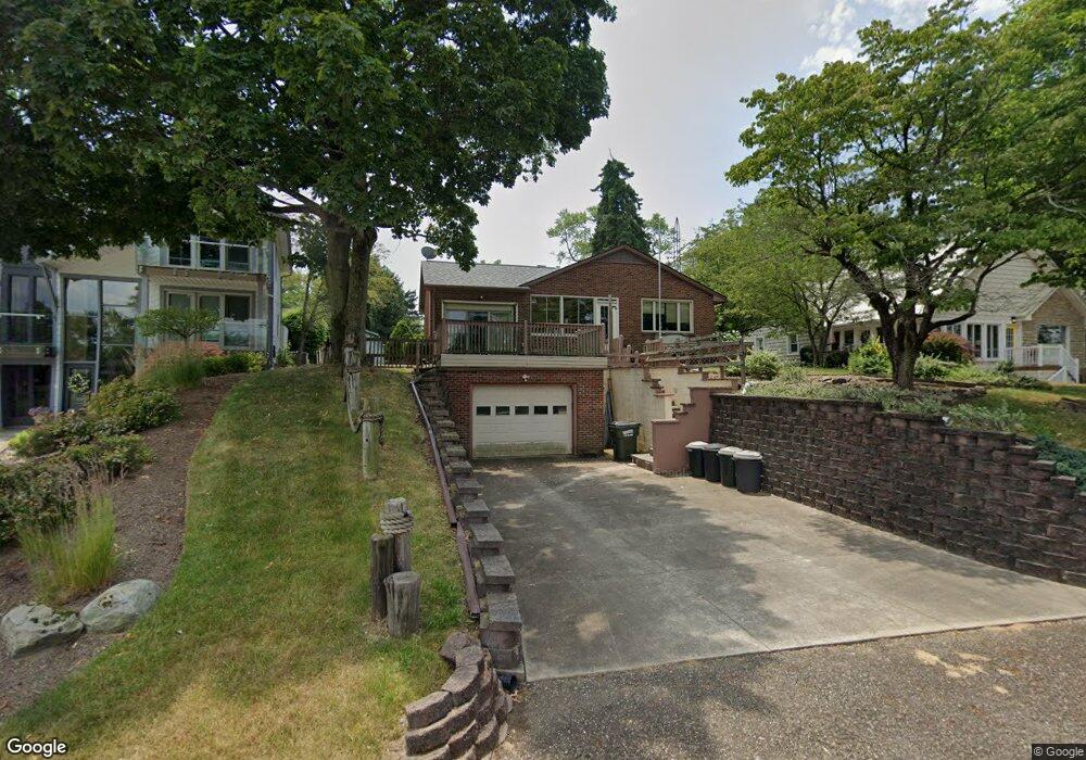
5961 W Shore Dr NW Canton, OH 44718
Lake Cable NeighborhoodEstimated Value: $364,000 - $477,000
5
Beds
2
Baths
1,866
Sq Ft
$220/Sq Ft
Est. Value
About This Home
This home is located at 5961 W Shore Dr NW, Canton, OH 44718 and is currently estimated at $409,719, approximately $219 per square foot. 5961 W Shore Dr NW is a home located in Stark County with nearby schools including Lake Cable Elementary School, Jackson Memorial Middle School, and Jackson High School.
Ownership History
Date
Name
Owned For
Owner Type
Purchase Details
Closed on
Apr 24, 2013
Sold by
Mountford John A and Mountford John A
Bought by
Mountford John A
Current Estimated Value
Create a Home Valuation Report for This Property
The Home Valuation Report is an in-depth analysis detailing your home's value as well as a comparison with similar homes in the area
Home Values in the Area
Average Home Value in this Area
Purchase History
| Date | Buyer | Sale Price | Title Company |
|---|---|---|---|
| Mountford John A | -- | None Available |
Source: Public Records
Tax History Compared to Growth
Tax History
| Year | Tax Paid | Tax Assessment Tax Assessment Total Assessment is a certain percentage of the fair market value that is determined by local assessors to be the total taxable value of land and additions on the property. | Land | Improvement |
|---|---|---|---|---|
| 2025 | -- | $118,620 | $39,100 | $79,520 |
| 2024 | -- | $118,620 | $39,100 | $79,520 |
| 2023 | $4,764 | $104,900 | $36,370 | $68,530 |
| 2022 | $2,381 | $104,900 | $36,370 | $68,530 |
| 2021 | $4,780 | $104,900 | $36,370 | $68,530 |
| 2020 | $4,405 | $90,200 | $31,360 | $58,840 |
| 2019 | $4,243 | $90,200 | $31,360 | $58,840 |
| 2018 | $4,265 | $90,200 | $31,360 | $58,840 |
| 2017 | $4,020 | $81,800 | $26,180 | $55,620 |
| 2016 | $4,047 | $81,800 | $26,180 | $55,620 |
| 2015 | $4,097 | $81,800 | $26,180 | $55,620 |
| 2014 | $1,741 | $72,530 | $23,210 | $49,320 |
| 2013 | $1,841 | $72,530 | $23,210 | $49,320 |
Source: Public Records
Map
Nearby Homes
- 5055 West Blvd NW
- 5011 West Blvd NW
- 5433 Fleetwood Ave NW
- 5155 Fleetwood Ave NW
- 5550 West Blvd NW
- 0 Hollyhock Ave NW
- 5309 S Island Dr NW
- 6422 Pebble Beach Dr NW
- 5691 Governors Ave NW
- 4710 Brunnerdale Ave NW
- 0 Stoneywood Cir NW Unit 5051952
- 5636 Gray Fox Dr NW
- 0 Armandale Ave NW Unit 5051954
- 0 Armandale Ave NW Unit 5052422
- 0 Armandale Ave NW Unit 5052421
- 6422 Stoneywood Cir NW
- 5412 Downingsgate Cir NW
- 6446 Tallwood Cir NW
- 6257 Island Dr NW
- 5764 Oak Dr NW
- 5957 W Shore Dr NW
- 5965 W Shore Dr NW
- 5969 W Shore Dr NW
- 5955 W Shore Dr NW
- 5066 West Blvd NW
- 5943 W Shore Dr NW
- 5060 West Blvd NW
- 5939 W Shore Dr NW
- 5933 W Shore Dr NW
- 5052 West Blvd NW
- 5923 W Shore Dr NW
- 5105 West Blvd NW
- 5073 West Blvd NW
- 5083 West Blvd NW
- 5905 W Shore Dr NW
- 5911 W Shore Dr NW
- 5093 West Blvd NW
- 5269 Brunnerdale Ave NW
- 5043 West Blvd NW
- 5226 Pinedrive Cir NW