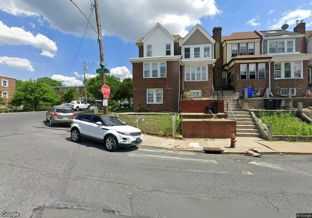
5965 Reach St Unit 3 Philadelphia, PA 19120
Lawncrest NeighborhoodEstimated Value: $232,000 - $264,000
1
Bed
1
Bath
850
Sq Ft
$292/Sq Ft
Est. Value
About This Home
This home is located at 5965 Reach St Unit 3, Philadelphia, PA 19120 and is currently estimated at $248,000, approximately $291 per square foot. 5965 Reach St Unit 3 is a home located in Philadelphia County with nearby schools including Benjamin Franklin Elementary School, Samuel Fels High School, and Mast Community Charter Ii.
Ownership History
Date
Name
Owned For
Owner Type
Purchase Details
Closed on
Mar 28, 2014
Sold by
Fannie Mae
Bought by
Gallelli Pasquale and Medero Angie
Current Estimated Value
Purchase Details
Closed on
May 24, 2010
Sold by
Fong Edward C
Bought by
Federal National Mortgage Association
Purchase Details
Closed on
Mar 5, 2002
Sold by
Jackson William G
Bought by
Fong Edward C
Home Financials for this Owner
Home Financials are based on the most recent Mortgage that was taken out on this home.
Original Mortgage
$89,040
Interest Rate
6.91%
Mortgage Type
Commercial
Create a Home Valuation Report for This Property
The Home Valuation Report is an in-depth analysis detailing your home's value as well as a comparison with similar homes in the area
Home Values in the Area
Average Home Value in this Area
Purchase History
| Date | Buyer | Sale Price | Title Company |
|---|---|---|---|
| Gallelli Pasquale | $67,000 | First American Title Ins | |
| Federal National Mortgage Association | $8,200 | None Available | |
| Fong Edward C | $111,300 | -- |
Source: Public Records
Mortgage History
| Date | Status | Borrower | Loan Amount |
|---|---|---|---|
| Previous Owner | Fong Edward C | $89,040 | |
| Closed | Fong Edward C | $15,000 |
Source: Public Records
Tax History Compared to Growth
Tax History
| Year | Tax Paid | Tax Assessment Tax Assessment Total Assessment is a certain percentage of the fair market value that is determined by local assessors to be the total taxable value of land and additions on the property. | Land | Improvement |
|---|---|---|---|---|
| 2025 | $3,162 | $301,100 | $60,220 | $240,880 |
| 2024 | $3,162 | $301,100 | $60,220 | $240,880 |
| 2023 | $3,162 | $225,900 | $45,180 | $180,720 |
| 2022 | $2,014 | $225,900 | $45,180 | $180,720 |
| 2021 | $2,014 | $0 | $0 | $0 |
| 2020 | $2,014 | $143,900 | $26,910 | $116,990 |
| 2019 | $1,933 | $0 | $0 | $0 |
| 2018 | $1,769 | $0 | $0 | $0 |
| 2017 | $1,769 | $0 | $0 | $0 |
| 2016 | $1,769 | $0 | $0 | $0 |
| 2015 | $1,694 | $0 | $0 | $0 |
| 2014 | -- | $126,400 | $36,881 | $89,519 |
| 2012 | -- | $22,912 | $3,614 | $19,298 |
Source: Public Records
Map
Nearby Homes
- 6046 Hasbrook Ave
- 344 Van Kirk St
- 252 Benner St
- 441 Van Kirk St
- 223 Stearly St
- 307 E Cheltenham Ave
- 209 Stearly St
- 5815 Newtown Ave
- 6143 Reach St
- 6162 Hasbrook Ave
- 318 Devereaux Ave
- 354 Devereaux Ave
- 517 E Cheltenham Ave
- 407 E Sanger St Unit 9
- 6101 Colgate St
- 539 Van Kirk St
- 454 Devereaux Ave
- 5943 Malta St
- 5939 Malta St
- 330-32 Sanger St
- 5965 Reach St
- 5963 Reach St
- 5961 Reach St
- 5959 Reach St
- 5957 Reach St
- 5955 Reach St
- 5953 Reach St
- 5958 Hasbrook Ave
- 6001 Reach St
- 5956 Hasbrook Ave
- 5951 Reach St
- 5954 Hasbrook Ave
- 6000 Hasbrook Ave
- 5952 Hasbrook Ave
- 5950 Hasbrook Ave
- 6002 Hasbrook Ave
- 6003 Reach St
- 5948 Hasbrook Ave
- 316 E Howell St
- 5945 Reach St