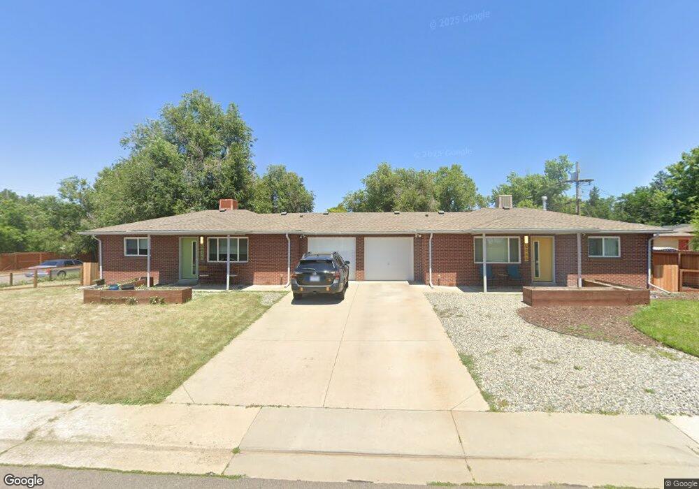
5965 W 30th Ave Wheat Ridge, CO 80214
East Wheat Ridge NeighborhoodEstimated Value: $643,000 - $746,000
4
Beds
2
Baths
1,568
Sq Ft
$443/Sq Ft
Est. Value
About This Home
This home is located at 5965 W 30th Ave, Wheat Ridge, CO 80214 and is currently estimated at $694,291, approximately $442 per square foot. 5965 W 30th Ave is a home located in Jefferson County with nearby schools including Lumberg Elementary School and Early College of Arvada.
Ownership History
Date
Name
Owned For
Owner Type
Purchase Details
Closed on
Jul 9, 2021
Sold by
Baker Barbara J and Baker William H
Bought by
Baker Family Trust
Current Estimated Value
Purchase Details
Closed on
May 20, 2020
Sold by
Rawson Robert Jobs
Bought by
Baker Wilson H and Baker Barbara J
Home Financials for this Owner
Home Financials are based on the most recent Mortgage that was taken out on this home.
Original Mortgage
$550,000
Interest Rate
2.9%
Mortgage Type
Commercial
Purchase Details
Closed on
Jan 27, 2014
Sold by
Rawson Robert John
Bought by
Rawson Robert John
Purchase Details
Closed on
Jun 13, 2013
Sold by
Diedrichs Isabel P
Bought by
Rawson Laura Posso
Purchase Details
Closed on
Oct 3, 1997
Sold by
Posso Laura C
Bought by
Rawson Laura Posso and Diedrichs Isabel P
Create a Home Valuation Report for This Property
The Home Valuation Report is an in-depth analysis detailing your home's value as well as a comparison with similar homes in the area
Home Values in the Area
Average Home Value in this Area
Purchase History
| Date | Buyer | Sale Price | Title Company |
|---|---|---|---|
| Baker Family Trust | -- | None Available | |
| Baker Wilson H | $550,000 | Chicago Title | |
| Rawson Robert John | -- | None Available | |
| Rawson Laura Posso | -- | None Available | |
| Rawson Laura Posso | -- | -- |
Source: Public Records
Mortgage History
| Date | Status | Borrower | Loan Amount |
|---|---|---|---|
| Previous Owner | Baker Wilson H | $550,000 |
Source: Public Records
Tax History Compared to Growth
Tax History
| Year | Tax Paid | Tax Assessment Tax Assessment Total Assessment is a certain percentage of the fair market value that is determined by local assessors to be the total taxable value of land and additions on the property. | Land | Improvement |
|---|---|---|---|---|
| 2024 | $4,168 | $47,667 | $21,429 | $26,238 |
| 2023 | $4,168 | $47,667 | $21,429 | $26,238 |
| 2022 | $3,227 | $36,251 | $16,348 | $19,903 |
| 2021 | $3,344 | $38,116 | $17,189 | $20,927 |
| 2020 | $2,892 | $33,133 | $18,242 | $14,891 |
| 2019 | $2,854 | $33,133 | $18,242 | $14,891 |
| 2018 | $2,666 | $29,916 | $9,209 | $20,707 |
| 2017 | $2,407 | $29,916 | $9,209 | $20,707 |
| 2016 | $3,267 | $22,264 | $6,280 | $15,984 |
| 2015 | $1,277 | $22,264 | $6,280 | $15,984 |
| 2014 | $1,277 | $13,930 | $5,731 | $8,199 |
Source: Public Records
Map
Nearby Homes
- 3022 Fenton St
- 6000 W 29th Ave
- 2890 N Harlan St Unit 102
- 3019 Chase St
- 6500 W 32nd Ave
- 2777 Kendall St
- 2933 Benton St
- 3342 Marshall St
- 3515 Gray St
- 2598 Harlan St Unit 1
- 2590 Gray St
- 3530 Fenton St
- 2834 Benton St
- 3100 Ames St
- 2570 Jay St
- 2577 Depew St
- 2568 Eaton St
- 3280 Ames St
- 3450 Benton St
- 6795 W 31st Ave
- 5901 W 30th Ave
- 3015 Gray St Unit 3025
- 3050 Harlan St
- 3000 Ingalls St
- 3020 Ingalls St
- 3045 Gray St
- 3035 Gray St
- 2990 Ingalls St
- 3095 Gray St
- 3100 Harlan St
- 2980 Ingalls St
- 3030 Ingalls St
- 3101 Gray St
- 3105 Harlan St
- 2970 Ingalls St
- 3150 Harlan St Unit 8
- 3155 Gray St
- 3050 Ingalls St
- 6115 W 30th Ave
- 3135 Harlan St