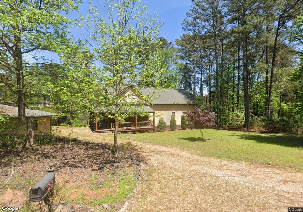
5967 Blackberry Ln Buford, GA 30518
Estimated Value: $598,000 - $904,000
3
Beds
3
Baths
2,080
Sq Ft
$363/Sq Ft
Est. Value
About This Home
This home is located at 5967 Blackberry Ln, Buford, GA 30518 and is currently estimated at $755,029, approximately $362 per square foot. 5967 Blackberry Ln is a home located in Hall County with nearby schools including Flowery Branch Elementary School, West Hall Middle School, and West Hall High School.
Ownership History
Date
Name
Owned For
Owner Type
Purchase Details
Closed on
Jun 7, 2007
Sold by
Slotin Steve B and Slotin Amy N
Bought by
Dimaggio Patrick James and Dimaggio Heather Nicole
Current Estimated Value
Home Financials for this Owner
Home Financials are based on the most recent Mortgage that was taken out on this home.
Original Mortgage
$293,600
Outstanding Balance
$179,753
Interest Rate
6.38%
Mortgage Type
New Conventional
Estimated Equity
$575,276
Purchase Details
Closed on
Aug 31, 1995
Sold by
Nationsbanc Mtgcorp
Bought by
Slotin Steve B Amy N
Purchase Details
Closed on
Aug 1, 1995
Create a Home Valuation Report for This Property
The Home Valuation Report is an in-depth analysis detailing your home's value as well as a comparison with similar homes in the area
Home Values in the Area
Average Home Value in this Area
Purchase History
| Date | Buyer | Sale Price | Title Company |
|---|---|---|---|
| Dimaggio Patrick James | $367,000 | -- | |
| Slotin Steve B Amy N | $16,500 | -- | |
| -- | $165,000 | -- |
Source: Public Records
Mortgage History
| Date | Status | Borrower | Loan Amount |
|---|---|---|---|
| Open | Dimaggio Patrick James | $293,600 | |
| Closed | Slotin Steve B Amy N | $0 |
Source: Public Records
Tax History Compared to Growth
Tax History
| Year | Tax Paid | Tax Assessment Tax Assessment Total Assessment is a certain percentage of the fair market value that is determined by local assessors to be the total taxable value of land and additions on the property. | Land | Improvement |
|---|---|---|---|---|
| 2025 | $4,788 | $224,720 | $107,440 | $117,280 |
| 2024 | $5,089 | $205,160 | $99,880 | $105,280 |
| 2023 | $4,540 | $198,760 | $99,880 | $98,880 |
| 2022 | $4,752 | $183,760 | $99,880 | $83,880 |
| 2021 | $4,815 | $182,800 | $99,880 | $82,920 |
| 2020 | $4,864 | $179,400 | $99,880 | $79,520 |
| 2019 | $4,784 | $174,880 | $99,880 | $75,000 |
| 2018 | $4,579 | $162,000 | $91,600 | $70,400 |
| 2017 | $3,547 | $172,880 | $107,800 | $65,080 |
| 2016 | $3,462 | $126,680 | $61,600 | $65,080 |
| 2015 | $2,424 | $126,680 | $61,600 | $65,080 |
| 2014 | $2,424 | $165,320 | $94,760 | $70,560 |
Source: Public Records
Map
Nearby Homes
- 6095 Blackberry Ln
- 6111 Blackberry Ln
- 6398 Snelling Mill Rd
- 6604 Windbrook Way
- 6397 Snelling Mill Rd
- 6708 Thornwood Ct
- 6465 Yacht Club Rd
- 6732 Willowbrook Trail
- 6313 Shoreland Cir
- 3394 Lee Dr
- 3374 Lee Dr
- 6446 Winter Harbor Dr
- 6181 Shoreland Cir
- 6509 Snug Harbor Ct
- 6120 Hutchins Dr
- 6132 Hutchins Dr
- 3907 Rustic Pine Ln
- 6500 Gaines Ferry Rd Unit A2
- 6500 Gaines Ferry Rd Unit G2
- 6500 Gaines Ferry Rd Unit I4
- 5971 Blackberry Ln
- 5969 Blackberry Ln
- 5959 Blackberry Ln
- 5947 Blackberry Ln Unit 16181618
- 5943 Blackberry Ln
- 5953 Blackberry Ln
- 5973 Blackberry Ln
- 5963 Blackberry Ln
- 5939 Blackberry Ln
- 5939 Blackberry Ln Unit 1
- 5053 Blackberry Ln
- 5051 Blackberry Ln
- 5039 Blackberry Ln
- 5975 Blackberry Ln
- 5071 Blackberry Ln
- 5977 Blackberry Ln
- 5043 Blackberry Ln Unit C
- 5043 Blackberry Ln
- 5979 Blackberry Ln Unit 2
- 5979 Blackberry Ln