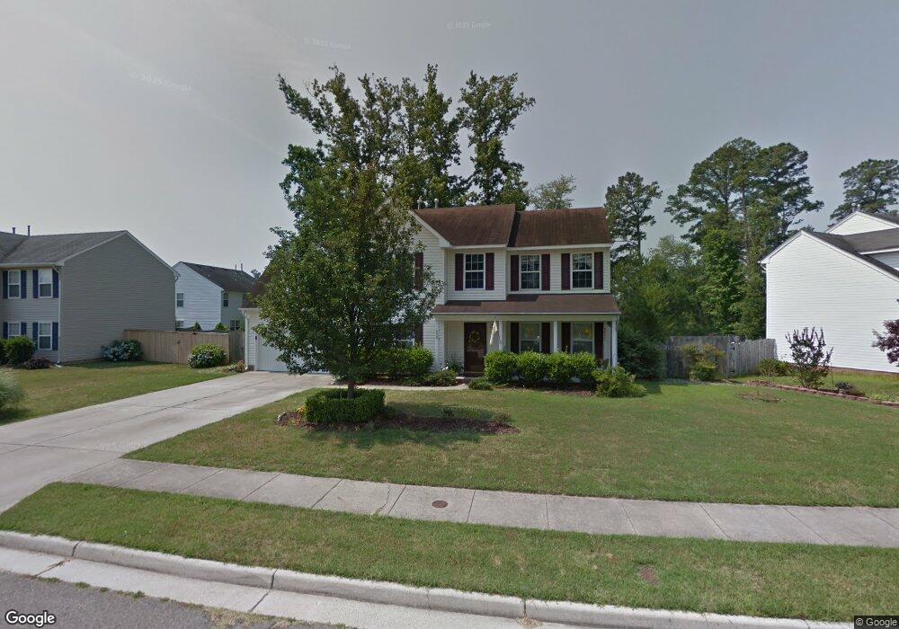
5967 Eagle Point Portsmouth, VA 23703
Churchland NeighborhoodEstimated Value: $402,629 - $433,000
4
Beds
3
Baths
2,203
Sq Ft
$187/Sq Ft
Est. Value
About This Home
This home is located at 5967 Eagle Point, Portsmouth, VA 23703 and is currently estimated at $411,657, approximately $186 per square foot. 5967 Eagle Point is a home located in Portsmouth City with nearby schools including Churchland Primary/Intermediate School, Churchland Middle School, and Churchland High School.
Ownership History
Date
Name
Owned For
Owner Type
Purchase Details
Closed on
Apr 7, 2000
Sold by
Bishops Green L L C
Bought by
Mcdonald Joseph A
Current Estimated Value
Home Financials for this Owner
Home Financials are based on the most recent Mortgage that was taken out on this home.
Original Mortgage
$134,119
Outstanding Balance
$45,356
Interest Rate
8.26%
Estimated Equity
$366,301
Create a Home Valuation Report for This Property
The Home Valuation Report is an in-depth analysis detailing your home's value as well as a comparison with similar homes in the area
Home Values in the Area
Average Home Value in this Area
Purchase History
| Date | Buyer | Sale Price | Title Company |
|---|---|---|---|
| Mcdonald Joseph A | $136,000 | -- |
Source: Public Records
Mortgage History
| Date | Status | Borrower | Loan Amount |
|---|---|---|---|
| Open | Mcdonald Joseph A | $134,119 |
Source: Public Records
Tax History Compared to Growth
Tax History
| Year | Tax Paid | Tax Assessment Tax Assessment Total Assessment is a certain percentage of the fair market value that is determined by local assessors to be the total taxable value of land and additions on the property. | Land | Improvement |
|---|---|---|---|---|
| 2025 | $4,615 | $374,810 | $113,810 | $261,000 |
| 2024 | $4,615 | $361,280 | $113,810 | $247,470 |
| 2023 | $4,129 | $330,340 | $113,810 | $216,530 |
| 2022 | $3,947 | $303,640 | $94,840 | $208,800 |
| 2021 | $3,426 | $263,570 | $74,100 | $189,470 |
| 2020 | $3,255 | $250,370 | $70,570 | $179,800 |
| 2019 | $3,230 | $248,440 | $70,570 | $177,870 |
| 2018 | $3,230 | $248,440 | $70,570 | $177,870 |
| 2017 | $3,230 | $248,440 | $70,570 | $177,870 |
| 2016 | $3,129 | $240,700 | $70,570 | $170,130 |
| 2015 | $3,054 | $234,900 | $70,570 | $164,330 |
| 2014 | $2,983 | $234,900 | $70,570 | $164,330 |
Source: Public Records
Map
Nearby Homes
- 21 Windy Pines Crescent
- 8 Compass Ct
- 5833 Hawthorne Ln
- 17 Shoal Ct
- 4071 Long Point Blvd
- 4444 Southampton Arch
- 4100 Mayfair Way
- 4224 Burnham Dr
- 4200 Quince Rd
- 4726 River Shore Rd
- 5728 Hawthorne Ln
- 4619 River Shore Rd
- 4232 Summerset Dr
- 5807 Dunkin St
- 6750 Burbage Landing Cir
- 6446 Olde Bullocks Cir
- 3866 Augustine Cir
- 3877 Peachtree Ln W
- 3818 Peach Orchard Cir
- 3860 Sugar Creek Cir
- 5971 Eagle Point
- 5963 Eagle Point
- 4306 Golden Eagle Point
- 5975 Eagle Point
- 4310 Golden Eagle Point
- 5978 Eagle Point
- 5974 Eagle Point
- 1 Bald Eagle Ct
- 5972 Eagle Point
- 5979 Eagle Point
- 4314 Golden Eagle Point
- 5986 Eagle Point
- 3 Bald Eagle Ct
- 5968 Eagle Point
- 5959 Eagle Point
- 4305 Golden Eagle Point
- 4318 Golden Eagle Point
- 4 Bald Eagle Ct
- 5 Bald Eagle Ct
- 5990 Eagle Point