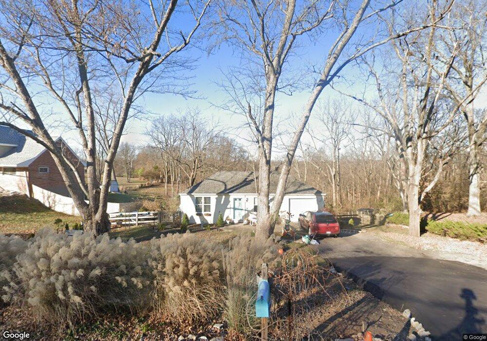
5968 Jessup Rd Cincinnati, OH 45247
Estimated Value: $144,000 - $224,000
2
Beds
1
Bath
775
Sq Ft
$238/Sq Ft
Est. Value
About This Home
This home is located at 5968 Jessup Rd, Cincinnati, OH 45247 and is currently estimated at $184,670, approximately $238 per square foot. 5968 Jessup Rd is a home located in Hamilton County with nearby schools including Monfort Heights Elementary School, White Oak Middle School, and Colerain High School.
Ownership History
Date
Name
Owned For
Owner Type
Purchase Details
Closed on
Mar 1, 1993
Sold by
Baer Ted A
Bought by
Baer Diane
Current Estimated Value
Create a Home Valuation Report for This Property
The Home Valuation Report is an in-depth analysis detailing your home's value as well as a comparison with similar homes in the area
Home Values in the Area
Average Home Value in this Area
Purchase History
| Date | Buyer | Sale Price | Title Company |
|---|---|---|---|
| Baer Diane | -- | -- |
Source: Public Records
Tax History Compared to Growth
Tax History
| Year | Tax Paid | Tax Assessment Tax Assessment Total Assessment is a certain percentage of the fair market value that is determined by local assessors to be the total taxable value of land and additions on the property. | Land | Improvement |
|---|---|---|---|---|
| 2024 | $2,050 | $43,456 | $16,800 | $26,656 |
| 2023 | $2,293 | $43,456 | $16,800 | $26,656 |
| 2022 | $1,745 | $33,275 | $17,640 | $15,635 |
| 2021 | $1,454 | $33,275 | $17,640 | $15,635 |
| 2020 | $1,481 | $33,275 | $17,640 | $15,635 |
| 2019 | $1,526 | $31,689 | $16,800 | $14,889 |
| 2018 | $1,360 | $31,689 | $16,800 | $14,889 |
| 2017 | $1,279 | $31,689 | $16,800 | $14,889 |
| 2016 | $1,155 | $29,267 | $16,632 | $12,635 |
| 2015 | $1,173 | $29,267 | $16,632 | $12,635 |
| 2014 | $1,766 | $29,267 | $16,632 | $12,635 |
| 2013 | $1,672 | $29,561 | $16,800 | $12,761 |
Source: Public Records
Map
Nearby Homes
- 5998 Brierly Ridge Dr
- 6169 Sheed Rd
- 5980 Brierly Creek Rd
- 5991 Gaines Rd
- 5984 W Fork Rd
- 6230 Castle Stone Ln
- 5819 Gaines Rd
- 6129 Rose Petal Dr
- 6130 W Fork Rd
- 6044 Eden Roc Place
- 6676 Daleview Rd
- 6761 Schweitzerhoff Rd
- 5591 Squirrel Run
- 6306 W Fork Rd
- 6303 W Fork Rd
- 5545 Squirrel Run
- 6384 Conifer Ln
- 5555 Anna Marie Ln
- 7555 Squirrel Creek Dr
- 5509 Bluepine Dr
- 5972 Jessup Rd
- 5950 Jessup Rd
- 5965 Jessup Rd
- 5973 Jessup Rd
- 5955 Jessup Rd
- 5936 Jessup Rd
- 5990 Jessup Rd
- 5945 Jessup Rd
- 5983 Jessup Rd
- 5993 Jessup Rd
- 6097 Peachview Dr
- 5928 Jessup Rd
- 6091 Peachview Dr
- 6005 Jessup Rd
- 5920 Jessup Rd
- 6083 Peachview Dr
- 6014 Jessup Rd
- 6077 Peachview Dr
- 5910 Jessup Rd
- 6096 Peachview Dr