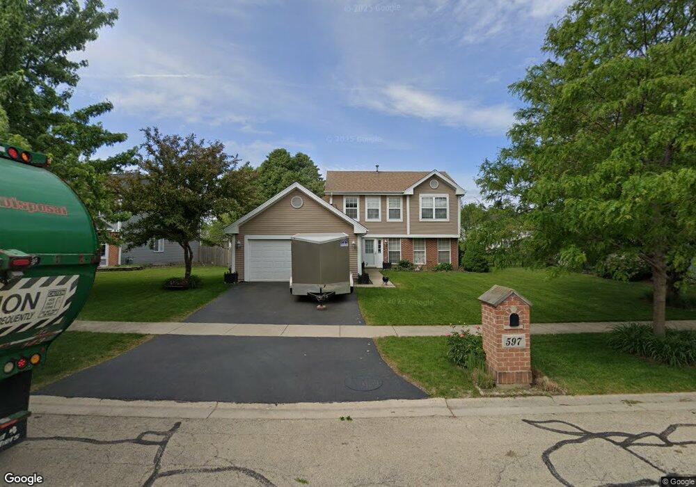
597 Buckboard Rd Bolingbrook, IL 60490
Lily Cache NeighborhoodEstimated Value: $360,434 - $385,000
--
Bed
1
Bath
1,742
Sq Ft
$217/Sq Ft
Est. Value
About This Home
This home is located at 597 Buckboard Rd, Bolingbrook, IL 60490 and is currently estimated at $378,109, approximately $217 per square foot. 597 Buckboard Rd is a home located in Will County with nearby schools including Pioneer Elementary School, Brooks Middle School, and Bolingbrook High School.
Ownership History
Date
Name
Owned For
Owner Type
Purchase Details
Closed on
Jun 30, 2003
Sold by
Diaz David and Diaz Delia M
Bought by
Zermeno Martin G and Zermeno Sonia P
Current Estimated Value
Home Financials for this Owner
Home Financials are based on the most recent Mortgage that was taken out on this home.
Original Mortgage
$160,000
Outstanding Balance
$68,588
Interest Rate
5.37%
Mortgage Type
Stand Alone First
Estimated Equity
$309,521
Purchase Details
Closed on
Jul 9, 1999
Sold by
Meyers Ronald A and Meyers Patricia D
Bought by
Diaz David and Diaz Delia M
Home Financials for this Owner
Home Financials are based on the most recent Mortgage that was taken out on this home.
Original Mortgage
$145,302
Interest Rate
7.54%
Mortgage Type
FHA
Create a Home Valuation Report for This Property
The Home Valuation Report is an in-depth analysis detailing your home's value as well as a comparison with similar homes in the area
Home Values in the Area
Average Home Value in this Area
Purchase History
| Date | Buyer | Sale Price | Title Company |
|---|---|---|---|
| Zermeno Martin G | $200,000 | -- | |
| Diaz David | $146,500 | -- |
Source: Public Records
Mortgage History
| Date | Status | Borrower | Loan Amount |
|---|---|---|---|
| Open | Zermeno Martin G | $160,000 | |
| Previous Owner | Diaz David | $145,302 |
Source: Public Records
Tax History Compared to Growth
Tax History
| Year | Tax Paid | Tax Assessment Tax Assessment Total Assessment is a certain percentage of the fair market value that is determined by local assessors to be the total taxable value of land and additions on the property. | Land | Improvement |
|---|---|---|---|---|
| 2024 | $9,288 | $108,567 | $18,729 | $89,838 |
| 2023 | $9,288 | $97,685 | $16,852 | $80,833 |
| 2022 | $8,112 | $88,068 | $15,193 | $72,875 |
| 2021 | $7,686 | $82,345 | $14,206 | $68,139 |
| 2020 | $7,448 | $79,637 | $13,739 | $65,898 |
| 2019 | $7,206 | $75,845 | $13,085 | $62,760 |
| 2018 | $6,917 | $72,593 | $12,524 | $60,069 |
| 2017 | $6,583 | $68,808 | $11,871 | $56,937 |
| 2016 | $6,390 | $65,500 | $11,300 | $54,200 |
| 2015 | $6,322 | $62,800 | $10,800 | $52,000 |
| 2014 | $6,322 | $64,700 | $11,100 | $53,600 |
| 2013 | $6,322 | $64,700 | $11,100 | $53,600 |
Source: Public Records
Map
Nearby Homes
- 584 Lakewood Farms Dr
- 1437 Sage Dr
- 652 Timberline Dr
- 1424 Sage Dr
- 1433 White Pine Ln
- 545 Pinebrook Dr
- 558 Pinebrook Dr
- 1126 Mandalay Ln Unit 1126
- 856 Fieldcrest Dr
- 1488 Schoenherr Ave
- 1409 Aster Ln
- 402 S Palmer Dr Unit 2B
- 1536 Trails End Ln Unit 5A
- 333 Inner Circle Dr
- 1152 Partridge Ave
- 1544 Suncrest Ln
- 402 Marshall Ash St Unit 3
- 309 Inner Circle Dr
- 1132 Partridge Ave
- 377 Blackfoot Dr
- 603 Buckboard Rd
- 656 Harvest Dr
- 585 Buckboard Rd
- 650 Harvest Dr
- 662 Harvest Dr
- 609 Buckboard Rd
- 6 Buckboard Ct
- 644 Harvest Dr
- 579 Buckboard Rd
- 602 Buckboard Rd
- 615 Buckboard Rd
- 608 Buckboard Rd
- 5 Buckboard Ct
- 638 Harvest Dr
- 573 Buckboard Rd
- 621 Buckboard Rd
- 614 Buckboard Rd
- 1 Buckboard Ct
- 1 Harvest Ct
- 667 Harvest Dr