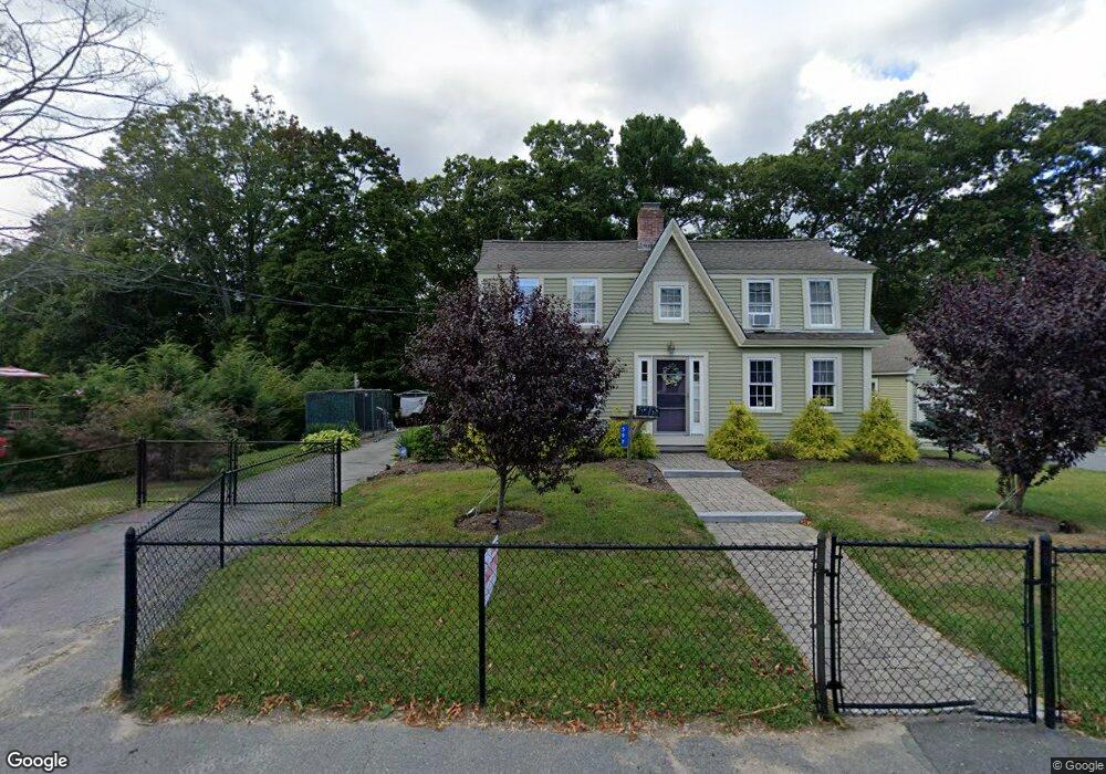
597 Cohannet St Taunton, MA 02780
Estimated Value: $511,000 - $596,000
3
Beds
2
Baths
1,740
Sq Ft
$318/Sq Ft
Est. Value
About This Home
This home is located at 597 Cohannet St, Taunton, MA 02780 and is currently estimated at $553,590, approximately $318 per square foot. 597 Cohannet St is a home located in Bristol County with nearby schools including Mulcahey Elementary School, Taunton High School, and John F. Parker Middle School.
Ownership History
Date
Name
Owned For
Owner Type
Purchase Details
Closed on
Mar 29, 2024
Sold by
Boiros John F and Boiros Maureen F
Bought by
597 Cohannet St Rt and Boiros
Current Estimated Value
Create a Home Valuation Report for This Property
The Home Valuation Report is an in-depth analysis detailing your home's value as well as a comparison with similar homes in the area
Home Values in the Area
Average Home Value in this Area
Purchase History
| Date | Buyer | Sale Price | Title Company |
|---|---|---|---|
| 597 Cohannet St Rt | -- | None Available | |
| 597 Cohannet St Rt | -- | None Available |
Source: Public Records
Tax History Compared to Growth
Tax History
| Year | Tax Paid | Tax Assessment Tax Assessment Total Assessment is a certain percentage of the fair market value that is determined by local assessors to be the total taxable value of land and additions on the property. | Land | Improvement |
|---|---|---|---|---|
| 2025 | $5,833 | $533,200 | $144,800 | $388,400 |
| 2024 | $5,060 | $452,200 | $144,800 | $307,400 |
| 2023 | $5,086 | $422,100 | $151,300 | $270,800 |
| 2022 | $4,770 | $361,900 | $117,300 | $244,600 |
| 2021 | $4,618 | $325,200 | $106,700 | $218,500 |
| 2020 | $4,468 | $300,700 | $106,700 | $194,000 |
| 2019 | $4,403 | $279,400 | $111,500 | $167,900 |
| 2018 | $4,350 | $276,700 | $112,600 | $164,100 |
| 2017 | $3,962 | $252,200 | $107,200 | $145,000 |
| 2016 | $3,849 | $245,500 | $104,000 | $141,500 |
| 2015 | $3,781 | $251,900 | $104,500 | $147,400 |
| 2014 | $3,723 | $254,800 | $104,500 | $150,300 |
Source: Public Records
Map
Nearby Homes
- 24 Highland Terrace
- 193 Winthrop St
- 125 Highland St Unit 103
- 56 Silver St
- 170 Highland St Unit 320
- 132 Winthrop St
- 22 Everett St
- 72 Barnum St
- 39 Myrtle St
- 98 Winthrop St
- 278 Cohannet St
- 26 Kilmer Ave
- 55 Highland Ave
- 63 Kilmer Ave
- 16 Clinton St
- 19 Mason St
- 48 Oak St
- 16 Kilton St
- 46 Harrison St Unit 4
- 321 Winthrop St Unit 111
- 609 Cohannet St
- 611 Cohannet St
- 590 Cohannet St
- 619 Cohannet St
- 617 Cohannet St
- 617 Cohannet St Unit 617
- 617 Cohannet St
- 598 Cohannet St Unit 1B
- 598 Cohannet St Unit 3
- 598 Cohannet St
- 581 Cohannet St
- 582 Cohannet St
- 620 Cohannet St
- 620 Cohannet St Unit 5
- 620 Cohannet St Unit 6
- 574 Cohannet St
- 194 Winthrop St
- 192 Winthrop St
- 627 Cohannet St
- 629 Cohannet St