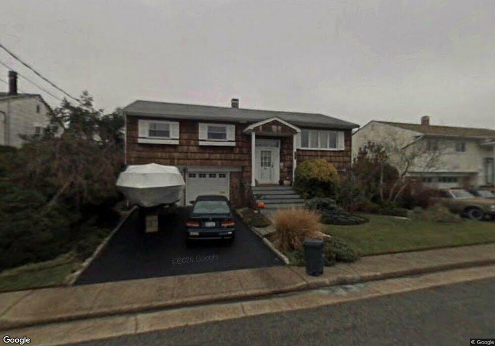
597 Nassau Ave Freeport, NY 11520
Estimated Value: $520,000 - $591,117
--
Bed
2
Baths
1,174
Sq Ft
$473/Sq Ft
Est. Value
About This Home
This home is located at 597 Nassau Ave, Freeport, NY 11520 and is currently estimated at $555,559, approximately $473 per square foot. 597 Nassau Ave is a home located in Nassau County with nearby schools including Columbus Avenue School, Caroline G. Atkinson Intermediate School, and John W Dodd Middle School.
Ownership History
Date
Name
Owned For
Owner Type
Purchase Details
Closed on
Jan 27, 2023
Sold by
Jurist Michael and The Jurist Family 2014 Irrevocable Trust
Bought by
Atsalas Vivian and Weeks Adam
Current Estimated Value
Home Financials for this Owner
Home Financials are based on the most recent Mortgage that was taken out on this home.
Original Mortgage
$388,278
Outstanding Balance
$375,649
Interest Rate
6.13%
Mortgage Type
FHA
Estimated Equity
$179,910
Purchase Details
Closed on
Jul 11, 2014
Sold by
Jurist Herbert H and Jurist Linda
Bought by
Jurist Family 2014 Irrevocable Trust and Jurist Michael
Create a Home Valuation Report for This Property
The Home Valuation Report is an in-depth analysis detailing your home's value as well as a comparison with similar homes in the area
Home Values in the Area
Average Home Value in this Area
Purchase History
| Date | Buyer | Sale Price | Title Company |
|---|---|---|---|
| Atsalas Vivian | $424,000 | Stewart Title Insurance Co | |
| Jurist Family 2014 Irrevocable Trust | -- | -- |
Source: Public Records
Mortgage History
| Date | Status | Borrower | Loan Amount |
|---|---|---|---|
| Open | Atsalas Vivian | $388,278 |
Source: Public Records
Tax History Compared to Growth
Tax History
| Year | Tax Paid | Tax Assessment Tax Assessment Total Assessment is a certain percentage of the fair market value that is determined by local assessors to be the total taxable value of land and additions on the property. | Land | Improvement |
|---|---|---|---|---|
| 2025 | $9,617 | $446 | $165 | $281 |
| 2024 | $923 | $428 | $158 | $270 |
| 2023 | $7,777 | $446 | $165 | $281 |
| 2022 | $7,777 | $446 | $165 | $281 |
| 2021 | $10,962 | $427 | $158 | $269 |
| 2020 | $7,098 | $502 | $501 | $1 |
| 2019 | $6,049 | $502 | $501 | $1 |
| 2018 | $5,832 | $535 | $0 | $0 |
| 2017 | $5,508 | $574 | $476 | $98 |
| 2016 | $6,369 | $750 | $572 | $178 |
| 2015 | $1,144 | $792 | $604 | $188 |
| 2014 | $1,144 | $792 | $604 | $188 |
| 2013 | $1,176 | $862 | $657 | $205 |
Source: Public Records
Map
Nearby Homes
- 929 S Long Beach Ave
- 894 S Long Beach Ave
- 883 S Long Beach Ave
- 725 Miller Ave Unit 111
- 725 Miller Ave Unit 133
- 725 Miller Ave Unit 137
- 503 Nassau Ave
- 497 Nassau Ave
- 829 S Long Beach Ave
- 465 Nassau Ave
- 7 Howard Ave
- 744 S Long Beach Ave
- 57 Hubbard Ave
- 44 Tyler St
- 68 Tyler St
- 525 Miller Ave
- 74 Tyler St
- 3505 Bay Front Dr
- 1 Anchorage Way Unit 301
- 3496 Bay Front Dr
- 603 Nassau Ave
- 591 Nassau Ave
- 598 Nassau Ave
- 609 Nassau Ave
- 762 Miller Ave
- 766 Miller Ave
- 592 Nassau Ave
- 604 Nassau Ave
- 758 Miller Ave
- 770 Miller Ave
- 586 Nassau Ave
- 610 Nassau Ave
- 615 Nassau Ave
- 577 Nassau Ave
- 780 Miller Ave
- 725 Miller Ave Unit 113
- 725 Miller Ave Unit 423
- 725 Miller Ave Unit 307
- 725 Miller Ave Unit 108
- 725 Miller Ave Unit 205