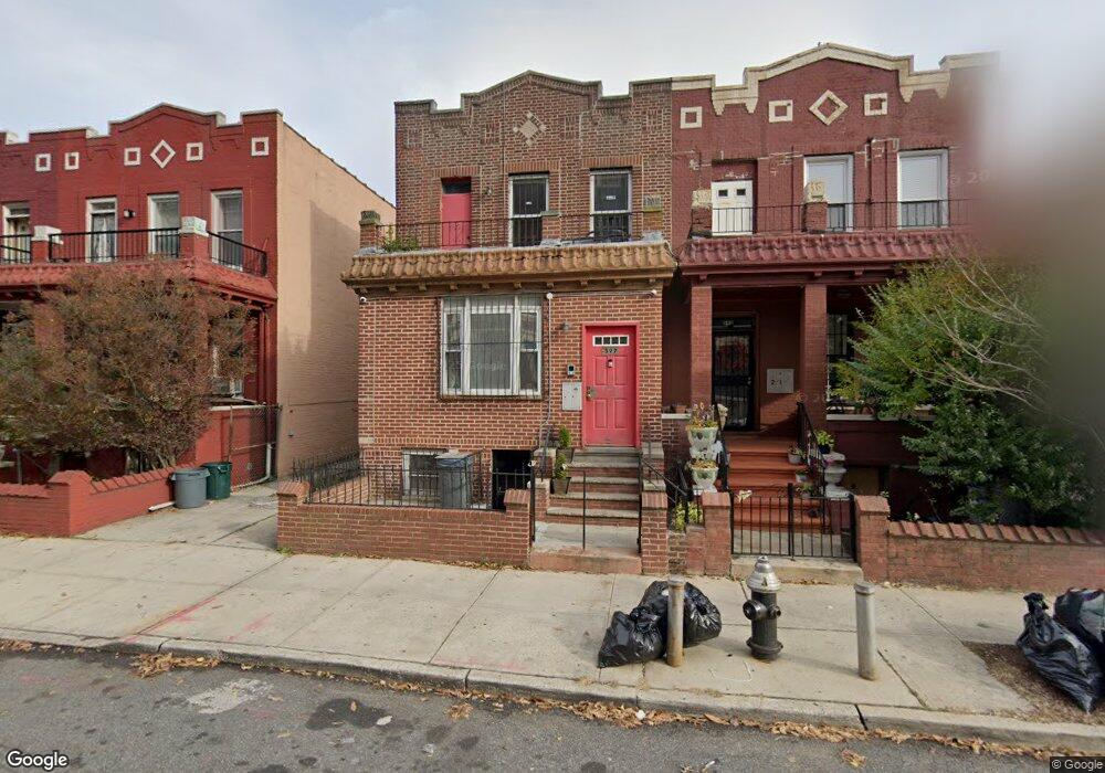
597 Sheffield Ave Brooklyn, NY 11207
Brownsville NeighborhoodEstimated Value: $766,000 - $956,000
3
Beds
2
Baths
2,200
Sq Ft
$396/Sq Ft
Est. Value
About This Home
This home is located at 597 Sheffield Ave, Brooklyn, NY 11207 and is currently estimated at $871,166, approximately $395 per square foot. 597 Sheffield Ave is a home located in Kings County with nearby schools including P.S. 190 - Sheffield, Achievement First - East New York School, and Grace Christian Educational.
Ownership History
Date
Name
Owned For
Owner Type
Purchase Details
Closed on
Jan 24, 2017
Sold by
Leroy Gilead Austin
Bought by
Fabien Willand and Lewin Gale
Current Estimated Value
Home Financials for this Owner
Home Financials are based on the most recent Mortgage that was taken out on this home.
Original Mortgage
$559,675
Outstanding Balance
$453,805
Interest Rate
4.16%
Mortgage Type
Purchase Money Mortgage
Estimated Equity
$417,361
Create a Home Valuation Report for This Property
The Home Valuation Report is an in-depth analysis detailing your home's value as well as a comparison with similar homes in the area
Home Values in the Area
Average Home Value in this Area
Purchase History
| Date | Buyer | Sale Price | Title Company |
|---|---|---|---|
| Fabien Willand | $570,000 | -- |
Source: Public Records
Mortgage History
| Date | Status | Borrower | Loan Amount |
|---|---|---|---|
| Open | Fabien Willand | $559,675 |
Source: Public Records
Tax History
| Year | Tax Paid | Tax Assessment Tax Assessment Total Assessment is a certain percentage of the fair market value that is determined by local assessors to be the total taxable value of land and additions on the property. | Land | Improvement |
|---|---|---|---|---|
| 2026 | $1,367 | $46,020 | $20,280 | $25,740 |
| 2025 | $1,295 | $49,800 | $20,280 | $29,520 |
| 2024 | $1,295 | $55,080 | $20,280 | $34,800 |
| 2023 | $1,236 | $56,160 | $20,280 | $35,880 |
| 2022 | $1,215 | $45,180 | $20,280 | $24,900 |
| 2021 | $1,264 | $34,860 | $20,280 | $14,580 |
| 2019 | $1,124 | $35,580 | $20,280 | $15,300 |
| 2018 | $1,034 | $5,073 | $2,622 | $2,451 |
| 2017 | $1,034 | $5,073 | $2,634 | $2,439 |
| 2016 | $1,001 | $5,007 | $3,151 | $1,856 |
| 2015 | -- | $4,726 | $2,496 | $2,230 |
| 2014 | -- | $4,478 | $2,838 | $1,640 |
Source: Public Records
Map
Nearby Homes
- 605 Sheffield Ave
- 591 Sheffield Ave
- 548 Sheffield Ave
- 738 New Jersey Ave
- 606 Alabama Ave
- 610 Alabama Ave
- 525 Alabama Ave
- 644 Vermont St
- 697 Sheffield Ave
- 578 Williams Ave
- 750 Vermont St
- 596 Wyona St
- 494 Hegeman Ave
- 589 Hinsdale St
- 650 Williams Ave
- 660 Williams Ave
- 719 Alabama Ave
- 584 Hinsdale St
- 806 New Jersey Ave
- 749 Pennsylvania Ave
- 593 Sheffield Ave
- 593 Sheffield Ave Unit 2
- 599 Sheffield Ave
- 603 Sheffield Ave
- 587 Sheffield Ave
- 610 Pennsylvania Ave
- 608 Pennsylvania Ave
- 585 Sheffield Ave
- 611 Sheffield Ave
- 612 Pennsylvania Ave
- 604 Pennsylvania Ave
- 616 Pennsylvania Ave
- 602 Pennsylvania Ave
- 613 Sheffield Ave
- 581 Sheffield Ave
- 598 Pennsylvania Ave
- 596 Pennsylvania Ave
- 596 Pennsylvania Ave Unit 2B
- 596 Pennsylvania Ave
- 579 Sheffield Ave
Your Personal Tour Guide
Ask me questions while you tour the home.