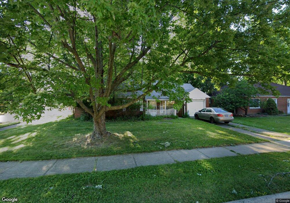
597 Walnut Dr Euclid, OH 44132
Estimated Value: $162,405 - $186,000
3
Beds
2
Baths
1,401
Sq Ft
$123/Sq Ft
Est. Value
About This Home
This home is located at 597 Walnut Dr, Euclid, OH 44132 and is currently estimated at $172,601, approximately $123 per square foot. 597 Walnut Dr is a home located in Cuyahoga County with nearby schools including Shoreview Elementary School, Euclid High School, and Mater Dei Academy.
Ownership History
Date
Name
Owned For
Owner Type
Purchase Details
Closed on
Jul 31, 2002
Sold by
Vazzana Karen Erb
Bought by
Erb Mary Susan
Current Estimated Value
Purchase Details
Closed on
Feb 24, 2002
Sold by
Erb Mary Susan and Erb Linda
Bought by
Vazzana Karen Erb
Purchase Details
Closed on
Sep 27, 1979
Sold by
Shafer Chas T and Shafer Rita M
Bought by
Erb Gene F
Purchase Details
Closed on
Jan 1, 1975
Bought by
Shafer Chas T and Shafer Rita M
Create a Home Valuation Report for This Property
The Home Valuation Report is an in-depth analysis detailing your home's value as well as a comparison with similar homes in the area
Home Values in the Area
Average Home Value in this Area
Purchase History
We collect this data history from publicly available records. To have your information removed, we recommend requesting removal directly through your county’s website.
| Date | Buyer | Sale Price | Title Company |
|---|---|---|---|
| Erb Mary Susan | -- | -- | |
| Vazzana Karen Erb | -- | -- | |
| Erb Gene F | $50,000 | -- | |
| Shafer Chas T | -- | -- |
Source: Public Records
Tax History
| Year | Tax Paid | Tax Assessment Tax Assessment Total Assessment is a certain percentage of the fair market value that is determined by local assessors to be the total taxable value of land and additions on the property. | Land | Improvement |
|---|---|---|---|---|
| 2025 | $2,861 | $51,415 | $10,185 | $41,230 |
| 2024 | $2,887 | $51,415 | $10,185 | $41,230 |
| 2023 | $2,268 | $34,870 | $9,000 | $25,870 |
| 2022 | $2,251 | $34,860 | $9,000 | $25,870 |
| 2021 | $2,495 | $34,860 | $9,000 | $25,870 |
| 2020 | $1,896 | $26,430 | $6,830 | $19,600 |
| 2019 | $1,702 | $75,500 | $19,500 | $56,000 |
| 2018 | $2,182 | $26,430 | $6,830 | $19,600 |
| 2017 | $1,933 | $25,480 | $5,460 | $20,020 |
| 2016 | $2,873 | $25,480 | $5,460 | $20,020 |
| 2015 | $2,615 | $25,480 | $5,460 | $20,020 |
| 2014 | $2,615 | $25,480 | $5,460 | $20,020 |
Source: Public Records
Map
Nearby Homes
- 29023 Weber Ave
- 29107 Fuller Ave
- 670 Walnut Dr
- 754 Hemlock Dr
- 27182 Oriole Ave
- 29234 Grand Blvd
- 26831 Shoreview Ave
- 434 E 272nd St
- 610 E 266th St
- 406 E 274th St
- 26530 Shoreview Ave
- 746 N Elmwood Ave
- 29616 Grand Blvd
- 26361 Elinore Ave
- 571 E 260th St
- 311 E 262nd St
- 257 E 270th St
- 295 E 276th St
- 355 E 257th St
- 26288 Aaron Dr
- 603 Walnut Dr
- 29016 Fuller Ave
- 585 Walnut Dr
- 29020 Fuller Ave
- 607 Walnut Dr
- 596 Walnut Dr
- 590 Walnut Dr
- 29024 Fuller Ave
- 29021 Fuller Ave
- 600 Walnut Dr
- 579 Walnut Dr
- 29009 Norman Ave
- 29017 Norman Ave
- 586 Walnut Dr
- 611 Walnut Dr
- 29028 Fuller Ave
- 29019 Norman Ave
- 606 Walnut Dr
- 29029 Fuller Ave
- 29023 Norman Ave
Your Personal Tour Guide
Ask me questions while you tour the home.