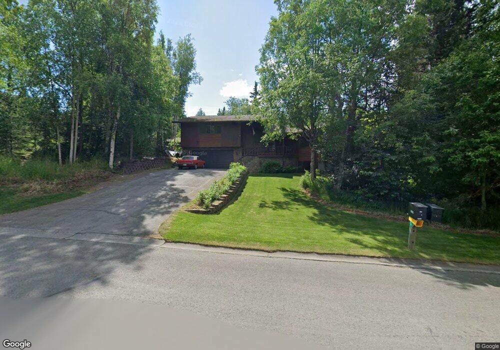
5970 Yukon Rd Anchorage, AK 99507
Mid-Hillside NeighborhoodEstimated Value: $572,000 - $773,000
3
Beds
3
Baths
3,441
Sq Ft
$192/Sq Ft
Est. Value
About This Home
This home is located at 5970 Yukon Rd, Anchorage, AK 99507 and is currently estimated at $659,492, approximately $191 per square foot. 5970 Yukon Rd is a home located in Anchorage Municipality with nearby schools including O'Malley Elementary School, Hanshew Middle School, and Service High School.
Ownership History
Date
Name
Owned For
Owner Type
Purchase Details
Closed on
Mar 17, 2022
Sold by
Johnson David C and Johnson Jane C
Bought by
David And Jane Johnson Alaska Community Prope
Current Estimated Value
Create a Home Valuation Report for This Property
The Home Valuation Report is an in-depth analysis detailing your home's value as well as a comparison with similar homes in the area
Home Values in the Area
Average Home Value in this Area
Purchase History
| Date | Buyer | Sale Price | Title Company |
|---|---|---|---|
| David And Jane Johnson Alaska Community Prope | -- | None Listed On Document |
Source: Public Records
Tax History
| Year | Tax Paid | Tax Assessment Tax Assessment Total Assessment is a certain percentage of the fair market value that is determined by local assessors to be the total taxable value of land and additions on the property. | Land | Improvement |
|---|---|---|---|---|
| 2025 | $4,012 | $582,100 | $119,400 | $462,700 |
| 2024 | $4,012 | $520,300 | $114,000 | $406,300 |
| 2023 | $6,849 | $484,000 | $109,700 | $374,300 |
| 2022 | $5,963 | $467,000 | $109,700 | $357,300 |
| 2021 | $6,920 | $447,300 | $109,700 | $337,600 |
| 2020 | $5,405 | $438,100 | $109,700 | $328,400 |
| 2019 | $5,264 | $432,800 | $109,700 | $323,100 |
| 2018 | $4,582 | $383,500 | $97,700 | $285,800 |
| 2017 | $5,111 | $400,300 | $94,000 | $306,300 |
| 2016 | -- | $415,800 | $94,000 | $321,800 |
| 2015 | $4,773 | $401,200 | $88,800 | $312,400 |
| 2014 | $4,773 | $392,800 | $84,600 | $308,200 |
Source: Public Records
Map
Nearby Homes
- 6130 Summit St
- 000 Valley View Dr
- 6324 Red Tree Cir
- 112 Chelsea St
- 9400 Spring Hill Dr
- 4738 Egret Rock Cir
- 6770 Round Tree Dr
- 6815 Double Tree Ct
- L5 Panorama Dr
- L7 Panorama Dr
- L13 Panorama Dr
- L3 Panorama Dr
- L1 Panorama Dr
- L9 Panorama Dr
- L6 Panorama Dr
- L2 Panorama Dr
- 7509 Beacon Hill Dr
- Lt 87 Carlson Rd
- L82 Carlson Rd
- 0 Rd
Your Personal Tour Guide
Ask me questions while you tour the home.