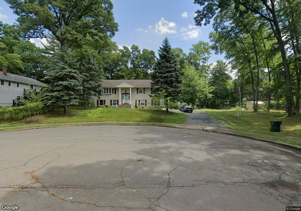
598 Bryn Mawr Ct Paramus, NJ 07652
Estimated Value: $919,000 - $1,149,000
--
Bed
--
Bath
2,040
Sq Ft
$510/Sq Ft
Est. Value
About This Home
This home is located at 598 Bryn Mawr Ct, Paramus, NJ 07652 and is currently estimated at $1,040,818, approximately $510 per square foot. 598 Bryn Mawr Ct is a home located in Bergen County with nearby schools including Paramus High School and Bergen Catholic High School.
Ownership History
Date
Name
Owned For
Owner Type
Purchase Details
Closed on
Oct 14, 2014
Sold by
Woehr John M
Bought by
Khoury Joseph
Current Estimated Value
Home Financials for this Owner
Home Financials are based on the most recent Mortgage that was taken out on this home.
Original Mortgage
$417,000
Outstanding Balance
$320,630
Interest Rate
4.18%
Mortgage Type
New Conventional
Estimated Equity
$720,188
Create a Home Valuation Report for This Property
The Home Valuation Report is an in-depth analysis detailing your home's value as well as a comparison with similar homes in the area
Home Values in the Area
Average Home Value in this Area
Purchase History
| Date | Buyer | Sale Price | Title Company |
|---|---|---|---|
| Khoury Joseph | $548,650 | Old Republic National Title |
Source: Public Records
Mortgage History
| Date | Status | Borrower | Loan Amount |
|---|---|---|---|
| Open | Khoury Joseph | $417,000 |
Source: Public Records
Tax History Compared to Growth
Tax History
| Year | Tax Paid | Tax Assessment Tax Assessment Total Assessment is a certain percentage of the fair market value that is determined by local assessors to be the total taxable value of land and additions on the property. | Land | Improvement |
|---|---|---|---|---|
| 2025 | $11,089 | $781,000 | $437,400 | $343,600 |
| 2024 | $10,769 | $732,400 | $405,400 | $327,000 |
| 2023 | $10,217 | $702,000 | $386,700 | $315,300 |
| 2022 | $10,217 | $658,300 | $361,500 | $296,800 |
| 2021 | $9,564 | $607,500 | $334,500 | $273,000 |
| 2020 | $9,551 | $598,800 | $329,500 | $269,300 |
| 2019 | $9,564 | $515,300 | $290,900 | $224,400 |
| 2018 | $9,445 | $515,300 | $290,900 | $224,400 |
| 2017 | $9,281 | $515,300 | $290,900 | $224,400 |
| 2016 | $9,028 | $515,300 | $290,900 | $224,400 |
| 2015 | $8,935 | $515,300 | $290,900 | $224,400 |
| 2014 | $8,858 | $515,300 | $290,900 | $224,400 |
Source: Public Records
Map
Nearby Homes
- 623 Alberta Dr
- 557 Forest Ave
- 314 Ross Rd
- 517 Marion Ln
- 160 Jerome Ave
- 517 Fordham Place
- 229 Standish Rd
- 645 Cambridge Rd
- 890 Oradell Ave
- 552 Burlington St
- 14 Congress Rd
- 812 Ridgewood Ave
- 59 Colonial Rd
- 216 E Midland Ave
- 391 Harrison St
- 817 Riverdell Rd
- 784 Austin Ave
- 415 Bailey Rd
- 729 Schaefer Ave
- 11 Patrick Ave
- 324 Briarcliff Ln
- 328 Briarcliff Ln
- 597 Bryn Mawr Ct
- 318 Briarcliff Ln
- 327 Briarcliff Ln
- 321 Briarcliff Ln
- 332 Briarcliff Ln
- 317 Briarcliff Ln
- 336 Briarcliff Ln
- 326 South Dr
- 339 Briarcliff Ln
- 322 South Dr
- 369 Veronica Ct
- 373 Veronica Ct
- 320 South Dr
- 316 South Dr
- 377 Veronica Ct
- 340 Briarcliff Ln
- 314 South Dr
- 338 South Dr