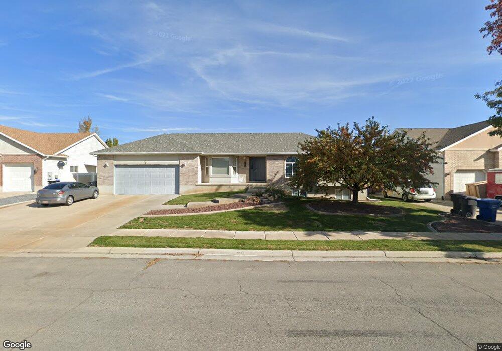
598 N 1775 W Clearfield, UT 84015
Estimated Value: $515,000 - $561,000
6
Beds
3
Baths
2,644
Sq Ft
$205/Sq Ft
Est. Value
About This Home
This home is located at 598 N 1775 W, Clearfield, UT 84015 and is currently estimated at $540,807, approximately $204 per square foot. 598 N 1775 W is a home located in Davis County with nearby schools including Lakeside School, West Point Junior High School, and Syracuse High School.
Ownership History
Date
Name
Owned For
Owner Type
Purchase Details
Closed on
Jul 26, 2021
Sold by
Patrick John D and Patrick Kiyomi T
Bought by
Grusendorf Peggy and Grusendorf Patrick John
Current Estimated Value
Home Financials for this Owner
Home Financials are based on the most recent Mortgage that was taken out on this home.
Original Mortgage
$239,000
Outstanding Balance
$217,054
Interest Rate
2.96%
Mortgage Type
New Conventional
Estimated Equity
$323,753
Purchase Details
Closed on
Jan 3, 1900
Sold by
Vankomen Robert H
Bought by
Hoye Jeffrey J and Hoye Lani R
Home Financials for this Owner
Home Financials are based on the most recent Mortgage that was taken out on this home.
Original Mortgage
$130,950
Interest Rate
7.25%
Create a Home Valuation Report for This Property
The Home Valuation Report is an in-depth analysis detailing your home's value as well as a comparison with similar homes in the area
Home Values in the Area
Average Home Value in this Area
Purchase History
| Date | Buyer | Sale Price | Title Company |
|---|---|---|---|
| Grusendorf Peggy | -- | Cottonwood Title Ins Agenc | |
| Hoye Jeffrey J | -- | Inwest Title Services Inc |
Source: Public Records
Mortgage History
| Date | Status | Borrower | Loan Amount |
|---|---|---|---|
| Open | Grusendorf Peggy | $239,000 | |
| Previous Owner | Hoye Jeffrey J | $130,950 |
Source: Public Records
Tax History Compared to Growth
Tax History
| Year | Tax Paid | Tax Assessment Tax Assessment Total Assessment is a certain percentage of the fair market value that is determined by local assessors to be the total taxable value of land and additions on the property. | Land | Improvement |
|---|---|---|---|---|
| 2025 | $2,970 | $278,300 | $101,834 | $176,466 |
| 2024 | $2,805 | $263,999 | $91,734 | $172,265 |
| 2023 | $2,593 | $246,950 | $61,120 | $185,829 |
| 2022 | $2,803 | $483,000 | $103,506 | $379,494 |
| 2021 | $2,560 | $363,000 | $92,388 | $270,612 |
| 2020 | $2,223 | $311,000 | $76,978 | $234,022 |
| 2019 | $2,153 | $297,000 | $74,872 | $222,128 |
| 2018 | $1,949 | $265,000 | $76,283 | $188,717 |
| 2016 | $1,712 | $122,485 | $29,454 | $93,031 |
| 2015 | $1,642 | $111,320 | $29,454 | $81,866 |
| 2014 | $1,487 | $102,242 | $29,454 | $72,788 |
| 2013 | -- | $100,288 | $32,175 | $68,113 |
Source: Public Records
Map
Nearby Homes
- 1805 W 675 N
- 1774 W 400 N
- 1652 W 560 N
- 1832 W 725 N
- 1827 W 775 N
- 607 N 2000 W
- 575 N 1350 W Unit 137
- 1350 W 300 N Unit 49
- 1350 W 300 N Unit 38
- 1350 W 300 N Unit 29
- 563 N 1350 W Unit 139
- 2132 W 800 N
- 1337 W 550 N Unit 195
- 2283 W 470 N
- 47 N 1750 W
- 423 N 1250 W Unit 118
- 12 N 2000 W Unit 1
- 2348 W 800 N
- 1122 N 1500 W
- 417 N 1200 W Unit 84