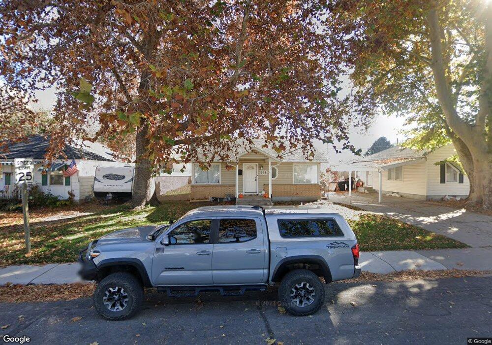
598 S Brookside Dr Springville, UT 84663
East Hobble Creek NeighborhoodEstimated Value: $414,923 - $541,000
2
Beds
1
Bath
1,560
Sq Ft
$291/Sq Ft
Est. Value
About This Home
This home is located at 598 S Brookside Dr, Springville, UT 84663 and is currently estimated at $453,981, approximately $291 per square foot. 598 S Brookside Dr is a home located in Utah County with nearby schools including Brookside School, Springville Junior High School, and Springville High School.
Ownership History
Date
Name
Owned For
Owner Type
Purchase Details
Closed on
Oct 1, 2025
Sold by
Andlauer Rebecca and Baarda Vance
Bought by
Andlauer Rebecca
Current Estimated Value
Home Financials for this Owner
Home Financials are based on the most recent Mortgage that was taken out on this home.
Original Mortgage
$396,000
Outstanding Balance
$396,000
Interest Rate
6.58%
Mortgage Type
New Conventional
Estimated Equity
$57,981
Purchase Details
Closed on
Jan 28, 2021
Sold by
Passalacqua Anthony and Robison Bertha
Bought by
Mower Kaden
Purchase Details
Closed on
Apr 19, 2018
Sold by
Cooper Steven
Bought by
Passalcqa Anthony and Robison Bertah
Home Financials for this Owner
Home Financials are based on the most recent Mortgage that was taken out on this home.
Original Mortgage
$237,125
Interest Rate
5.87%
Mortgage Type
FHA
Purchase Details
Closed on
Apr 12, 2016
Sold by
Hintze Eric N and Hintze Tosha A
Bought by
Cooper Steven
Purchase Details
Closed on
Oct 23, 2008
Sold by
Hintze Eric
Bought by
Hintze Eric N and Hintze Tosha A
Purchase Details
Closed on
Jul 3, 2001
Sold by
Webb Travis K and Webb Kristy S
Bought by
Wild Carrie A
Purchase Details
Closed on
Oct 15, 1998
Sold by
Mortenson Myrl T and Mortenson Gayle J
Bought by
Webb Travis K and Webb Kristy S
Purchase Details
Closed on
Jul 31, 1996
Sold by
Holland D Berniece H
Bought by
Mortenson Myrl T and Mortenson Gayle J
Create a Home Valuation Report for This Property
The Home Valuation Report is an in-depth analysis detailing your home's value as well as a comparison with similar homes in the area
Home Values in the Area
Average Home Value in this Area
Purchase History
| Date | Buyer | Sale Price | Title Company |
|---|---|---|---|
| Andlauer Rebecca | -- | Cottonwood Title | |
| Andlauer Rebecca | -- | Protitle | |
| Andlauer Rebecca | -- | Cottonwood Title | |
| Andlauer Rebecca | -- | Protitle | |
| Mower Kaden | -- | Stewart Ttile Ins Agcy Of Ut | |
| Mower Kaden | -- | Stewart Ttile Ins Agcy Of Ut | |
| Passalcqa Anthony | -- | Backman Title Services Ltd | |
| Passalcqa Anthony | -- | Backman Title Services Ltd | |
| Cooper Steven | -- | None Available | |
| Cooper Steven | -- | None Available | |
| Hintze Eric N | -- | Accommodation | |
| Hintze Eric | -- | Sundance Title Insurance Ag | |
| Hintze Eric N | -- | Accommodation | |
| Hintze Eric | -- | Sundance Title Insurance Ag | |
| Wild Carrie A | -- | Title West Title Co | |
| Wild Carrie A | -- | Title West Title Co | |
| Webb Travis K | -- | Old Republic Title Co Of Uta | |
| Webb Travis K | -- | Old Republic Title Co Of Uta | |
| Mortenson Myrl T | -- | -- | |
| Mortenson Myrl T | -- | -- |
Source: Public Records
Mortgage History
| Date | Status | Borrower | Loan Amount |
|---|---|---|---|
| Open | Andlauer Rebecca | $396,000 | |
| Previous Owner | Passalcqa Anthony | $237,125 |
Source: Public Records
Tax History
| Year | Tax Paid | Tax Assessment Tax Assessment Total Assessment is a certain percentage of the fair market value that is determined by local assessors to be the total taxable value of land and additions on the property. | Land | Improvement |
|---|---|---|---|---|
| 2025 | $1,683 | $190,355 | -- | -- |
| 2024 | $1,683 | $172,370 | $0 | $0 |
| 2023 | $1,607 | $164,835 | $0 | $0 |
| 2022 | $1,729 | $174,185 | $0 | $0 |
| 2021 | $1,554 | $243,600 | $85,400 | $158,200 |
| 2020 | $1,430 | $217,300 | $71,200 | $146,100 |
| 2019 | $1,339 | $207,200 | $71,200 | $136,000 |
| 2018 | $1,262 | $186,300 | $68,000 | $118,300 |
| 2017 | $1,117 | $87,560 | $0 | $0 |
| 2016 | $1,000 | $76,890 | $0 | $0 |
| 2015 | $924 | $72,600 | $0 | $0 |
| 2014 | $921 | $71,885 | $0 | $0 |
Source: Public Records
Map
Nearby Homes
- 883 E 700 S
- 802 S Brookside Dr
- 805 E 400 S
- 1062 E 350 S
- 645 Swenson Ave Unit 5
- 645 Swenson Ave Unit 3
- 647 Swenson Ave Unit 3
- 1130 Hillcrest Dr
- 677 E 800 South St
- 949 S 1060 E
- 1185 Hillcrest Dr
- 445 E 535 S
- 1361 E 400 S
- 585 S 400 E
- 579 E 800 St S
- 629 E 800 St S
- 557 S 1470 E
- 616 E Aaron Ave
- 511 S 300 E Unit 2
- 66 E 750 S Unit 23
- 610 Brookside Dr
- 586 Brookside Dr
- 624 Brookside Dr
- 572 Brookside Dr
- 591 Brookside Dr
- 611 Brookside Dr
- 638 Brookside Dr
- 558 Brookside Dr
- 629 Brookside Dr
- 665 S Weight Ave
- 561 Brookside Dr
- 155 C St
- 652 Brookside Dr
- 635 S Weight Ave
- 685 S Weight Ave
- 146 B St
- 605 S Weight Ave
- 154 C St
- 666 Brookside Dr
- 541 Brookside Dr
Your Personal Tour Guide
Ask me questions while you tour the home.