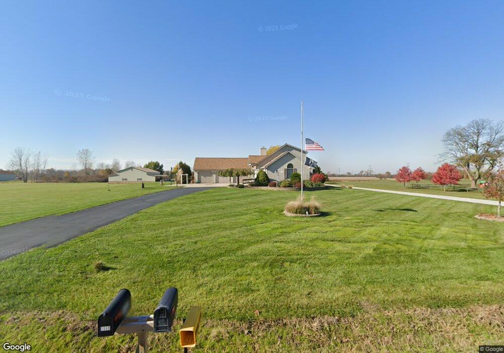
5981 Newport South Rd Newport, MI 48166
Estimated Value: $488,000 - $623,727
3
Beds
4
Baths
2,750
Sq Ft
$205/Sq Ft
Est. Value
About This Home
This home is located at 5981 Newport South Rd, Newport, MI 48166 and is currently estimated at $563,682, approximately $204 per square foot. 5981 Newport South Rd is a home located in Monroe County with nearby schools including Jefferson High School.
Ownership History
Date
Name
Owned For
Owner Type
Purchase Details
Closed on
Jun 24, 2010
Sold by
Balk Robert
Bought by
Smallwood Michael W and Smallwood Heidi E
Current Estimated Value
Purchase Details
Closed on
Mar 21, 1997
Sold by
Robinson Lyle B
Bought by
Balk Robert L and Balk Joanne M
Home Financials for this Owner
Home Financials are based on the most recent Mortgage that was taken out on this home.
Original Mortgage
$224,000
Interest Rate
7.73%
Mortgage Type
New Conventional
Create a Home Valuation Report for This Property
The Home Valuation Report is an in-depth analysis detailing your home's value as well as a comparison with similar homes in the area
Home Values in the Area
Average Home Value in this Area
Purchase History
| Date | Buyer | Sale Price | Title Company |
|---|---|---|---|
| Smallwood Michael W | $210,000 | -- | |
| Balk Robert L | $375,000 | -- |
Source: Public Records
Mortgage History
| Date | Status | Borrower | Loan Amount |
|---|---|---|---|
| Previous Owner | Balk Robert L | $224,000 |
Source: Public Records
Tax History Compared to Growth
Tax History
| Year | Tax Paid | Tax Assessment Tax Assessment Total Assessment is a certain percentage of the fair market value that is determined by local assessors to be the total taxable value of land and additions on the property. | Land | Improvement |
|---|---|---|---|---|
| 2025 | $6,888 | $298,800 | $298,800 | $0 |
| 2024 | $2,508 | $287,200 | $0 | $0 |
| 2023 | $2,388 | $259,800 | $0 | $0 |
| 2022 | $6,305 | $259,800 | $0 | $0 |
| 2021 | $6,061 | $225,700 | $0 | $0 |
| 2020 | $6,180 | $197,400 | $0 | $0 |
| 2019 | $6,246 | $197,400 | $0 | $0 |
| 2018 | $6,195 | $211,700 | $0 | $0 |
| 2017 | $2,075 | $211,700 | $0 | $0 |
| 2016 | $5,669 | $211,300 | $0 | $0 |
| 2015 | $5,484 | $194,400 | $0 | $0 |
| 2014 | $5,411 | $194,400 | $0 | $0 |
| 2013 | -- | $184,000 | $0 | $0 |
Source: Public Records
Map
Nearby Homes
- 0 Williams Rd Unit 50112219
- 0 Nadeau Rd
- 2831 Nadeau Rd
- 5022 N Stoney Creek Rd
- 7393 Newport Rd S
- 5437 Mustang Dr
- 000 N Dixie
- 3469 Clairmont St
- 0 N Stoney Creek Rd Unit 50188927
- 3181 Glendale St
- 3087 N Dixie Hwy
- 4077 Brest Rd
- 3124 Beechwood St
- 4261 Brest Rd
- 4040 W Shore Ct
- 6470 S Stony Creek Rd
- 6700 N Stony Creek Rd
- 0 Mentel Rd Unit 4 50168313
- 0 Mentel Rd Unit 3 50168312
- 0 Mentel Rd Unit 2 50168311
- 5981 Newport South Rd
- 5995 Newport Rd S
- 5995 Newport South Rd
- 5995 Newport South Rd
- 5980 Newport South Rd
- 6000 Newport South Rd
- 5885 Newport South Rd
- 5950 Newport South Rd
- 6036 Newport South Rd
- 6036 Newport South Rd
- 6036 Newport South Rd
- 5890 Newport South Rd
- 5922 Newport Rd S
- 6121 Newport South Rd
- 6121 Newport South Rd
- 5833 Newport South Rd
- 6090 Newport South Rd
- 5805 Newport South Rd
- 5818 Newport South Rd
- 5818 Newport South Rd