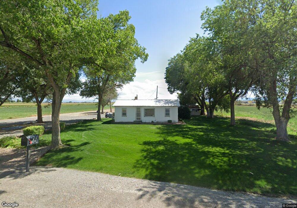
59812 David Rd Olathe, CO 81425
Estimated Value: $253,098 - $361,000
--
Bed
1
Bath
612
Sq Ft
$463/Sq Ft
Est. Value
About This Home
This home is located at 59812 David Rd, Olathe, CO 81425 and is currently estimated at $283,275, approximately $462 per square foot. 59812 David Rd is a home located in Montrose County with nearby schools including Olathe Elementary School, Olathe Middle and High School, and Olathe Middle School.
Ownership History
Date
Name
Owned For
Owner Type
Purchase Details
Closed on
Jun 19, 2017
Sold by
Slade Charlori A and Cotter Jason T
Bought by
Stutzman Paul E and Stutzman Leah B
Current Estimated Value
Purchase Details
Closed on
May 20, 2015
Sold by
Liming Charlotte A and Slade Charlori A
Bought by
Cotter Jason T
Purchase Details
Closed on
May 1, 2015
Sold by
Slade Charlori and Cotter Jason
Bought by
Liming Charlotte A
Purchase Details
Closed on
Mar 26, 2001
Sold by
Liming Charlotte A
Bought by
Liming Charlotte A and Cotter Betty G
Purchase Details
Closed on
Mar 23, 1953
Sold by
Patton Hazle and Patton Walter Scott
Bought by
Liming Charlotte A and Liming Loren C
Create a Home Valuation Report for This Property
The Home Valuation Report is an in-depth analysis detailing your home's value as well as a comparison with similar homes in the area
Home Values in the Area
Average Home Value in this Area
Purchase History
| Date | Buyer | Sale Price | Title Company |
|---|---|---|---|
| Stutzman Paul E | $130,000 | Land Title Guarantee Co | |
| Cotter Jason T | -- | None Available | |
| Liming Charlotte A | -- | None Available | |
| Liming Charlotte A | -- | -- | |
| Liming Charlotte A | $2,800 | -- |
Source: Public Records
Tax History Compared to Growth
Tax History
| Year | Tax Paid | Tax Assessment Tax Assessment Total Assessment is a certain percentage of the fair market value that is determined by local assessors to be the total taxable value of land and additions on the property. | Land | Improvement |
|---|---|---|---|---|
| 2024 | $979 | $13,970 | $6,800 | $7,170 |
| 2023 | $979 | $18,030 | $8,900 | $9,130 |
| 2022 | $806 | $12,800 | $6,010 | $6,790 |
| 2021 | $860 | $13,600 | $6,410 | $7,190 |
| 2020 | $734 | $11,850 | $5,350 | $6,500 |
| 2019 | $739 | $11,850 | $5,350 | $6,500 |
| 2018 | $769 | $11,990 | $6,030 | $5,960 |
| 2017 | $767 | $11,990 | $6,030 | $5,960 |
| 2016 | $533 | $10,980 | $4,970 | $6,010 |
| 2015 | $636 | $10,980 | $4,970 | $6,010 |
| 2014 | -- | $9,600 | $4,260 | $5,340 |
Source: Public Records
Map
Nearby Homes
- Lot 2(TBD) Wilson Ave
- 103 N Grand Ave
- 400 6th St
- 320 6th St
- 612 S Church Ave
- 615 S Church Ave
- 60433 Falcon Rd
- TBD N River Rd
- 6910 High Mesa Rd
- 7655 6075 Rd
- 7062 6150 Rd
- 61537 Grand View Ct
- 60799 Goodieville Ct
- 7773 High Mesa Rd
- 58286 Blossom Rd
- TBD (Lot 2) Gunnison Rd
- TBD (Lot 1) Gunnison Rd
- TBD (Lot 3) Gunnison Rd
- 6617 5700 Rd
- 3847 5725 Rd
- 1001 Industrial Ave
- 59400 Highway 50
- 0 Melanie Ln Unit 714007
- 0 Melanie Ln Unit 733529
- 2001 Melanie Ln
- 19-20 N 2nd St
- 300 Industrial Ave
- 0 Industrial Ave Unit 757121
- 300 Industrial Blvd
- 17-18 N 2nd St
- 12-16 N 2nd St
- S Wilson Ave
- 0 U S 50 Unit 763900
- 0 U S 50 Unit 762846
- 0 U S 50 Unit 760781
- 0 U S 50 Unit 759926
- 0 U S 50 Unit 755672
- 0 U S 50 Unit 754976
- 0 U S 50 Unit 747835
- 0 U S 50 Unit 746214