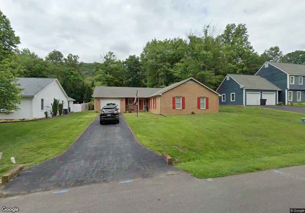
5986 Buckland Mill Rd Roanoke, VA 24019
Estimated Value: $276,000 - $358,000
3
Beds
2
Baths
1,657
Sq Ft
$195/Sq Ft
Est. Value
About This Home
This home is located at 5986 Buckland Mill Rd, Roanoke, VA 24019 and is currently estimated at $323,162, approximately $195 per square foot. 5986 Buckland Mill Rd is a home located in Roanoke County with nearby schools including Burlington Elementary School, Northside Middle School, and Northside High School.
Ownership History
Date
Name
Owned For
Owner Type
Purchase Details
Closed on
Feb 18, 2015
Sold by
Rock Betty H
Bought by
Rock Richard L and Rock Robin L
Current Estimated Value
Home Financials for this Owner
Home Financials are based on the most recent Mortgage that was taken out on this home.
Original Mortgage
$180,175
Outstanding Balance
$137,899
Interest Rate
3.74%
Mortgage Type
New Conventional
Estimated Equity
$185,263
Create a Home Valuation Report for This Property
The Home Valuation Report is an in-depth analysis detailing your home's value as well as a comparison with similar homes in the area
Home Values in the Area
Average Home Value in this Area
Purchase History
| Date | Buyer | Sale Price | Title Company |
|---|---|---|---|
| Rock Richard L | $175,000 | None Available |
Source: Public Records
Mortgage History
| Date | Status | Borrower | Loan Amount |
|---|---|---|---|
| Open | Rock Richard L | $180,175 |
Source: Public Records
Tax History Compared to Growth
Tax History
| Year | Tax Paid | Tax Assessment Tax Assessment Total Assessment is a certain percentage of the fair market value that is determined by local assessors to be the total taxable value of land and additions on the property. | Land | Improvement |
|---|---|---|---|---|
| 2025 | $2,741 | $266,100 | $65,000 | $201,100 |
| 2024 | $2,520 | $242,300 | $65,000 | $177,300 |
| 2023 | $2,379 | $224,400 | $60,000 | $164,400 |
| 2022 | $2,245 | $206,000 | $55,000 | $151,000 |
| 2021 | $2,072 | $190,100 | $50,000 | $140,100 |
| 2020 | $2,059 | $188,900 | $50,000 | $138,900 |
| 2019 | $1,988 | $182,400 | $42,000 | $140,400 |
| 2018 | $1,963 | $182,400 | $42,000 | $140,400 |
| 2017 | $1,963 | $180,100 | $42,000 | $138,100 |
| 2016 | $1,941 | $178,100 | $42,000 | $136,100 |
| 2015 | $1,909 | $175,100 | $45,000 | $130,100 |
| 2014 | $1,853 | $170,000 | $40,000 | $130,000 |
Source: Public Records
Map
Nearby Homes
- 7044 Irondale Cir
- 5921 Buckland Mill Rd
- 8355 Leighburn Dr
- 5877 Buckland Mill Rd
- 8356 Leighburn Dr
- 8212 Loman Dr
- 3190 Loch Haven Dr
- 7009 Tinkerdale Rd
- 6510 Brookfield Rd
- 1141 Starmount Ave
- 7522 New Barrens Ct
- 8216 Strathmore Ln
- 1121 Nover Ave
- 7192 Red Cedar Cir
- 252 Knoll Rd
- 7204 Snowberry Cir
- 210 Post Rd
- 7171 Wild Cherry Ct
- 6928 Scotch Pine Ln
- 6825 Woodcreeper Dr
- 5980 Buckland Mill Rd
- 5992 Buckland Mill Rd
- 5972 Buckland Mill Rd
- 6000 Buckland Mill Rd
- 5981 Buckland Mill Rd
- 7001 Irondale Cir
- 5973 Buckland Mill Rd
- 5964 Buckland Mill Rd
- 6008 Buckland Mill Rd
- 5967 Buckland Mill Rd
- 6007 Buckland Mill Rd
- 7009 Irondale Cir
- 5956 Buckland Mill Rd
- 6011 Buckland Mill Rd
- 4014 Drake Cir
- 6016 Buckland Mill Rd
- 7015 Irondale Cir
- 7008 Irondale Cir
- 6017 Buckland Mill Rd
- 4022 Drake Cir