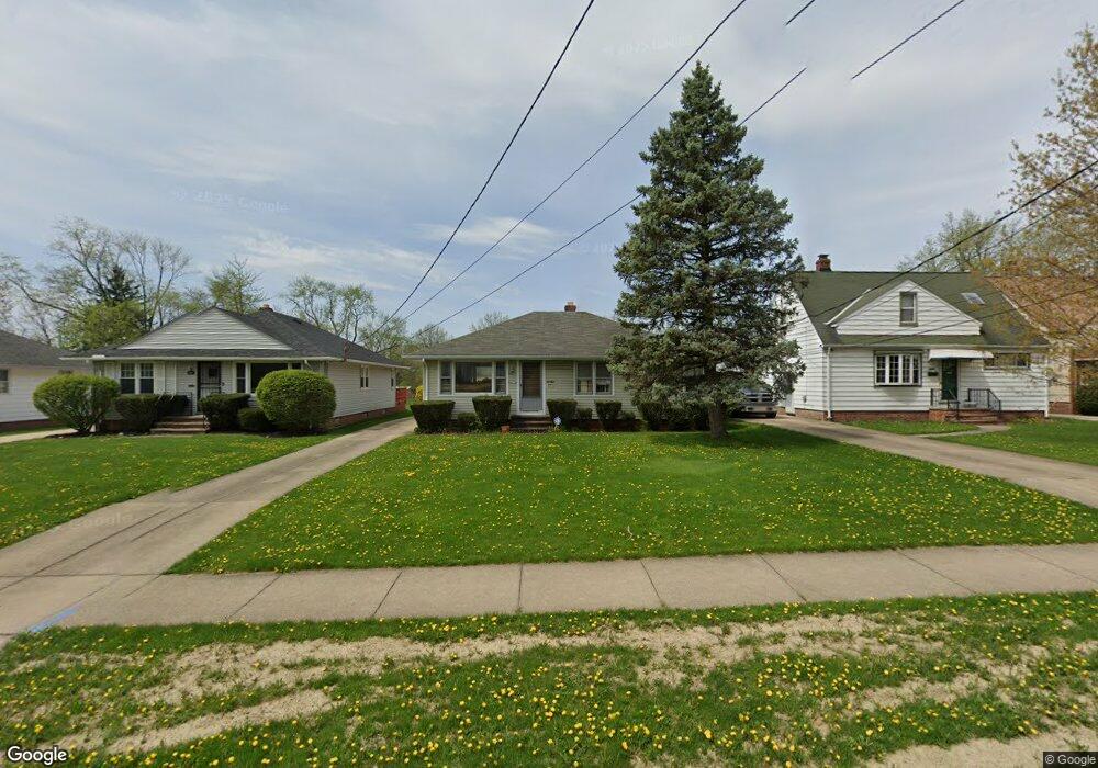
5986 Dunham Rd Maple Heights, OH 44137
Estimated Value: $149,008 - $156,000
3
Beds
1
Bath
1,160
Sq Ft
$131/Sq Ft
Est. Value
About This Home
This home is located at 5986 Dunham Rd, Maple Heights, OH 44137 and is currently estimated at $152,502, approximately $131 per square foot. 5986 Dunham Rd is a home located in Cuyahoga County with nearby schools including Abraham Lincoln Elementary School, Rockside/ J.F. Kennedy School, and Barack Obama School.
Ownership History
Date
Name
Owned For
Owner Type
Purchase Details
Closed on
Jun 4, 2014
Sold by
Moccia Dominic Anthony
Bought by
Moccia Romeo Anthony
Current Estimated Value
Purchase Details
Closed on
Apr 11, 1999
Sold by
Moccia Alberto
Bought by
Moccia Alberto and The Moccia Family Trust
Purchase Details
Closed on
Feb 21, 1991
Sold by
Moccia Annina
Bought by
Moccia Alberto
Purchase Details
Closed on
Jun 13, 1988
Sold by
Moccia Alberto and Moccia Annina
Bought by
Moccia Annina
Purchase Details
Closed on
Jan 1, 1975
Bought by
Moccia Alberto and Moccia Annina
Create a Home Valuation Report for This Property
The Home Valuation Report is an in-depth analysis detailing your home's value as well as a comparison with similar homes in the area
Home Values in the Area
Average Home Value in this Area
Purchase History
| Date | Buyer | Sale Price | Title Company |
|---|---|---|---|
| Moccia Romeo Anthony | $40,000 | Attorney | |
| Moccia Alberto | -- | -- | |
| Moccia Alberto | -- | -- | |
| Moccia Annina | -- | -- | |
| Moccia Alberto | -- | -- |
Source: Public Records
Tax History
| Year | Tax Paid | Tax Assessment Tax Assessment Total Assessment is a certain percentage of the fair market value that is determined by local assessors to be the total taxable value of land and additions on the property. | Land | Improvement |
|---|---|---|---|---|
| 2025 | $2,924 | $47,320 | $9,065 | $38,255 |
| 2024 | $3,287 | $47,320 | $9,065 | $38,255 |
| 2023 | $2,426 | $31,610 | $6,930 | $24,680 |
| 2022 | $2,455 | $31,610 | $6,930 | $24,680 |
| 2021 | $3,463 | $31,610 | $6,930 | $24,680 |
| 2020 | $3,148 | $25,900 | $5,670 | $20,230 |
| 2019 | $3,020 | $74,000 | $16,200 | $57,800 |
| 2018 | $2,916 | $25,900 | $5,670 | $20,230 |
| 2017 | $3,012 | $24,330 | $5,010 | $19,320 |
| 2016 | $2,913 | $24,330 | $5,010 | $19,320 |
| 2015 | $1,827 | $24,330 | $5,010 | $19,320 |
| 2014 | $1,827 | $25,100 | $5,150 | $19,950 |
Source: Public Records
Map
Nearby Homes
- 6045 Dunham Rd
- 5948 Dunham Rd
- 6089 Dunham Rd
- 14956 Carol Dr
- 15401 Walvern Blvd
- 15513 Walvern Blvd
- 14808 James Ave
- 15405 Turney Rd
- 15701 Walvern Blvd
- 14357 Turney Rd
- 15522 Turney Rd
- 14320 Janice Dr
- SL15 Rocky Top Ct
- 15 Rockytop Ct
- 15712 Mendota Ave
- 15521 Corkhill Rd
- 13810 Martin Dr
- 16014 Turney Rd
- 14012 Wheeler Rd
- 13741 Grove Dr
- 5982 Dunham Rd
- 5990 Dunham Rd
- 5978 Dunham Rd
- 5994 Dunham Rd
- 5970 Dunham Rd
- 6000 Dunham Rd
- 15096 Rochelle Dr
- 15080 Rochelle Dr
- 5989 Dunham Rd
- 15066 Rochelle Dr
- 5956 Dunham Rd
- 5981 Dunham Rd
- 5995 Dunham Rd
- 6020 Dunham Rd
- 15105 Summit Ave
- 5971 Dunham Rd
- 15085 Summit Ave
- 15052 Rochelle Dr
- 15095 Rochelle Dr
- 15075 Summit Ave
Your Personal Tour Guide
Ask me questions while you tour the home.