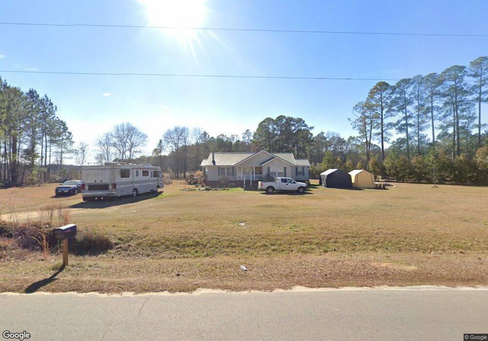
5989 Campground Rd Claxton, GA 30417
Estimated Value: $211,000 - $271,293
3
Beds
2
Baths
1,879
Sq Ft
$126/Sq Ft
Est. Value
About This Home
This home is located at 5989 Campground Rd, Claxton, GA 30417 and is currently estimated at $236,573, approximately $125 per square foot. 5989 Campground Rd is a home located in Tattnall County with nearby schools including Pinewood Christian Academy.
Ownership History
Date
Name
Owned For
Owner Type
Purchase Details
Closed on
Jul 12, 2019
Sold by
Callaway Robert M
Bought by
Mitchell Gary
Current Estimated Value
Home Financials for this Owner
Home Financials are based on the most recent Mortgage that was taken out on this home.
Original Mortgage
$95,000
Outstanding Balance
$82,870
Interest Rate
3.82%
Mortgage Type
New Conventional
Estimated Equity
$153,703
Purchase Details
Closed on
Oct 15, 2010
Sold by
Wells Fargo Bank Na
Bought by
Callaway Robert M and Callaway Emily J
Home Financials for this Owner
Home Financials are based on the most recent Mortgage that was taken out on this home.
Original Mortgage
$100,000
Interest Rate
4.37%
Mortgage Type
New Conventional
Purchase Details
Closed on
Jun 18, 2010
Sold by
Bradley Raymond
Bought by
Wells Fargo Bank Na
Create a Home Valuation Report for This Property
The Home Valuation Report is an in-depth analysis detailing your home's value as well as a comparison with similar homes in the area
Purchase History
| Date | Buyer | Sale Price | Title Company |
|---|---|---|---|
| Mitchell Gary | $100,000 | -- | |
| Callaway Robert M | $100,000 | -- | |
| Wells Fargo Bank Na | -- | -- |
Source: Public Records
Mortgage History
| Date | Status | Borrower | Loan Amount |
|---|---|---|---|
| Open | Mitchell Gary | $95,000 | |
| Previous Owner | Callaway Robert M | $100,000 |
Source: Public Records
Tax History
| Year | Tax Paid | Tax Assessment Tax Assessment Total Assessment is a certain percentage of the fair market value that is determined by local assessors to be the total taxable value of land and additions on the property. | Land | Improvement |
|---|---|---|---|---|
| 2025 | $3,213 | $105,564 | $3,920 | $101,644 |
| 2024 | $2,421 | $79,284 | $3,920 | $75,364 |
| 2023 | $2,338 | $79,284 | $3,920 | $75,364 |
| 2022 | $1,945 | $65,884 | $3,920 | $61,964 |
| 2021 | $1,568 | $57,728 | $3,760 | $53,968 |
| 2020 | $1,087 | $57,728 | $3,760 | $53,968 |
| 2019 | $1,494 | $53,908 | $3,160 | $50,748 |
| 2018 | $1,520 | $53,908 | $3,160 | $50,748 |
| 2017 | $1,494 | $53,908 | $3,160 | $50,748 |
| 2016 | $1,547 | $54,520 | $3,160 | $51,360 |
| 2015 | -- | $54,440 | $3,160 | $51,280 |
| 2014 | -- | $57,784 | $3,160 | $54,624 |
| 2013 | -- | $58,664 | $3,160 | $55,504 |
Source: Public Records
Map
Nearby Homes
- 47 Manassas Station Rd
- 62 Manassas Station Rd
- 75 Gov Seay Rd
- 92 Graham Ln
- 179 Creek Ridge Rd
- 0 Mosley Bridge Rd
- 420 Mosley Bridge Rd
- 2685 Carters Bridge Rd
- 0 Jim Cannon Rd Unit SA346455
- 2283 Wilton Threatt Rd
- 200 Lex Strickland Rd
- 1302 Jim Sapp Rd
- 1293 Pine Ridge Dr
- 247 Jim Hendrix Ln
- 17827 Ga Highway 129 N
- 2470 Old Reidsville Collins Rd
- 15683 Ga Highway 129 N
- 201 Claude Anderson Rd
- 19 Collins St
- 352 Riverside Dr
- 12111 Henry St
- 12133 Henry St
- 5966 Campground Rd
- 12348 Henry St
- 12369 Henry St
- 504 Antietum Rd
- 508 Antietum Rd
- 507 Antietum Rd
- 508 Antietum Rd
- 512 Antietum Rd
- 12469 Henry St
- 512 Antietum
- 516 Antietum Rd
- 12462 Henry St
- 520 Antietum Rd
- 12520 Henry St
- 11744 Henry St
- 35 Railroad St
- 17 SE Railroad St
- 524 Antietum Rd Unit 18 & 19
Your Personal Tour Guide
Ask me questions while you tour the home.