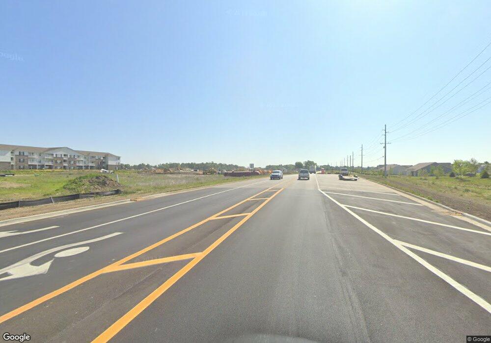
5989 E 400 S Whitestown, IN 46075
Estimated Value: $340,000 - $410,000
4
Beds
2
Baths
2,288
Sq Ft
$167/Sq Ft
Est. Value
About This Home
This home is located at 5989 E 400 S, Whitestown, IN 46075 and is currently estimated at $383,170, approximately $167 per square foot. 5989 E 400 S is a home located in Boone County with nearby schools including Perry Worth Elementary School, Lebanon Middle School, and Lebanon Senior High School.
Ownership History
Date
Name
Owned For
Owner Type
Purchase Details
Closed on
Apr 18, 2019
Sold by
Mccoy Gerald W and Mccoy Darlene
Bought by
Mccoy Leshia Lynn and Schocke Darla Beth
Current Estimated Value
Purchase Details
Closed on
Dec 20, 2012
Sold by
Mccoy Gerald and Mccoy Darlene
Bought by
The Board Of Commissioners Of Boone Coun
Create a Home Valuation Report for This Property
The Home Valuation Report is an in-depth analysis detailing your home's value as well as a comparison with similar homes in the area
Home Values in the Area
Average Home Value in this Area
Purchase History
| Date | Buyer | Sale Price | Title Company |
|---|---|---|---|
| Mccoy Leshia Lynn | -- | None Available | |
| The Board Of Commissioners Of Boone Coun | -- | None Available |
Source: Public Records
Tax History Compared to Growth
Tax History
| Year | Tax Paid | Tax Assessment Tax Assessment Total Assessment is a certain percentage of the fair market value that is determined by local assessors to be the total taxable value of land and additions on the property. | Land | Improvement |
|---|---|---|---|---|
| 2025 | $2,873 | $311,300 | $26,500 | $284,800 |
| 2024 | $2,873 | $293,400 | $26,700 | $266,700 |
| 2023 | $3,095 | $282,100 | $26,100 | $256,000 |
| 2022 | $3,488 | $266,600 | $25,600 | $241,000 |
| 2021 | $2,420 | $208,800 | $25,300 | $183,500 |
| 2020 | $2,376 | $198,400 | $25,300 | $173,100 |
| 2019 | $2,317 | $190,200 | $25,700 | $164,500 |
| 2018 | $2,243 | $185,800 | $25,700 | $160,100 |
| 2017 | $2,290 | $195,700 | $26,100 | $169,600 |
| 2016 | $976 | $164,100 | $26,200 | $137,900 |
| 2014 | $940 | $141,400 | $26,400 | $115,000 |
| 2013 | $944 | $142,200 | $27,200 | $115,000 |
Source: Public Records
Map
Nearby Homes
- 3902 Riverstone Dr
- 3922 Sterling Dr
- 3888 Riverstone Dr
- 2543 Lamar Dr
- 3784 Dusty Sands Rd
- 3830 Indigo Blue Blvd
- 3743 Indigo Blue Blvd
- 5925 Sterling Dr
- 3511 Firethorn Dr
- 6831 Orchard Run Cir
- 3413 Roundlake Ln
- 3421 Firethorn Dr
- 5792 Waterstone Way
- 3610 Duncan Ct
- 5791 Waterstone Way
- 3391 Roundlake Ln
- 3822 Limelight Ln
- 5678 Harper Dr
- Roxbury II Plan at Peabody Farms West - Peabody Farms West Cottage
- Ironwood Plan at Peabody Farms West - Peabody Farms West Venture
- 4010 Poplar Dr
- 4012 Poplar Dr
- 4014 Poplar Dr
- 3842 Dusty Sands Rd
- 4016 Poplar Dr
- 3838 Dusty Sands Rd
- 3848 Dusty Sands Rd
- 3854 Dusty Sands Rd
- 4018 Poplar Dr
- 3832 Dusty Sands Rd
- 3856 Dusty Sands Rd
- 4020 Poplar Dr
- 3862 Dusty Sands Rd
- 3824 Dusty Sands Rd
- 4022 Poplar Dr
- 4015 Poplar Dr
- 4013 Poplar Dr
- 3868 Dusty Sands Rd
- 4024 Poplar Dr
- 3816 Dusty Sands Rd
