Estimated Value: $251,633 - $279,000
3
Beds
2
Baths
1,436
Sq Ft
$184/Sq Ft
Est. Value
About This Home
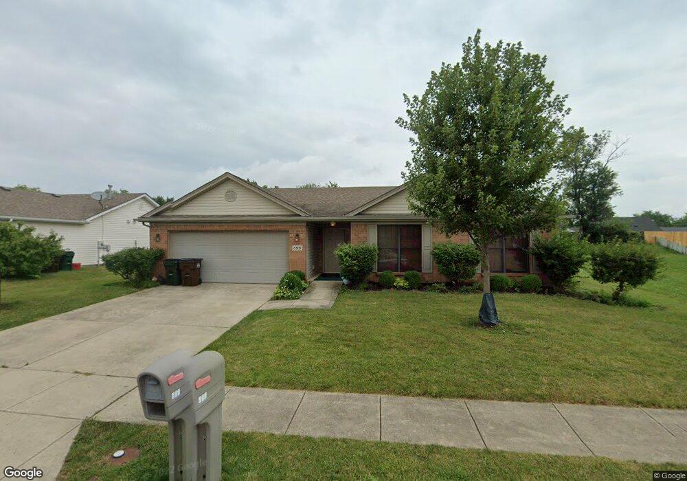
This home is located at 599 Concord Way, Xenia, OH 45385 and is currently estimated at $263,908, approximately $183 per square foot. 599 Concord Way is a home located in Greene County with nearby schools including Xenia High School and Summit Academy Community School for Alternative Learners - Xenia.
Ownership History
Date
Name
Owned For
Owner Type
Purchase Details
Closed on
Oct 22, 2013
Sold by
Koentop Marlene J and Holmes Richard E
Bought by
Holmes Richard E
Current Estimated Value
Purchase Details
Closed on
Sep 12, 2006
Sold by
Shriner Building Co Inc
Bought by
Koentop Preston Ellsworth and Koentop Marlene J
Home Financials for this Owner
Home Financials are based on the most recent Mortgage that was taken out on this home.
Original Mortgage
$167,350
Outstanding Balance
$100,664
Interest Rate
6.7%
Mortgage Type
VA
Estimated Equity
$163,244
Purchase Details
Closed on
Mar 28, 2006
Sold by
Xenia Development Co Llc
Bought by
Shriner Building Co
Home Financials for this Owner
Home Financials are based on the most recent Mortgage that was taken out on this home.
Original Mortgage
$132,000
Interest Rate
6.39%
Mortgage Type
Construction
Create a Home Valuation Report for This Property
The Home Valuation Report is an in-depth analysis detailing your home's value as well as a comparison with similar homes in the area
Home Values in the Area
Average Home Value in this Area
Purchase History
| Date | Buyer | Sale Price | Title Company |
|---|---|---|---|
| Holmes Richard E | -- | None Available | |
| Koentop Preston Ellsworth | $167,400 | None Available | |
| Shriner Building Co | $29,900 | None Available |
Source: Public Records
Mortgage History
| Date | Status | Borrower | Loan Amount |
|---|---|---|---|
| Open | Koentop Preston Ellsworth | $167,350 | |
| Previous Owner | Shriner Building Co | $132,000 |
Source: Public Records
Tax History Compared to Growth
Tax History
| Year | Tax Paid | Tax Assessment Tax Assessment Total Assessment is a certain percentage of the fair market value that is determined by local assessors to be the total taxable value of land and additions on the property. | Land | Improvement |
|---|---|---|---|---|
| 2024 | $2,872 | $67,120 | $13,760 | $53,360 |
| 2023 | $2,872 | $67,120 | $13,760 | $53,360 |
| 2022 | $2,542 | $50,680 | $9,170 | $41,510 |
| 2021 | $2,078 | $50,680 | $9,170 | $41,510 |
| 2020 | $1,989 | $50,680 | $9,170 | $41,510 |
| 2019 | $1,642 | $41,340 | $7,080 | $34,260 |
| 2018 | $1,649 | $41,340 | $7,080 | $34,260 |
| 2017 | $1,600 | $41,340 | $7,080 | $34,260 |
| 2016 | $1,578 | $39,380 | $7,080 | $32,300 |
| 2015 | $1,583 | $39,380 | $7,080 | $32,300 |
| 2014 | $2,347 | $39,380 | $7,080 | $32,300 |
Source: Public Records
Map
Nearby Homes
- 2142 Michigan Dr
- 414 Whisper Ln
- 1874 Pennsylvania Dr
- 1829 Gayhart Dr
- 219 Kansas Dr
- 2758 Wyoming Dr
- 1255 Colorado Dr
- 161 Montana Dr
- 1403 Texas Dr
- 2499 Jenny Marie Dr
- 2421 Louisiana Dr
- 1750 Roxbury Dr
- 0 Berkshire Dr Unit 949217
- 1161 Shannon Ln
- 1248 Prem Place
- 1778 Arapaho Dr
- 1348 Berkshire Dr
- 1318 Prem Place
- 1568 Cheyenne Dr
- 2784 Greystoke Dr