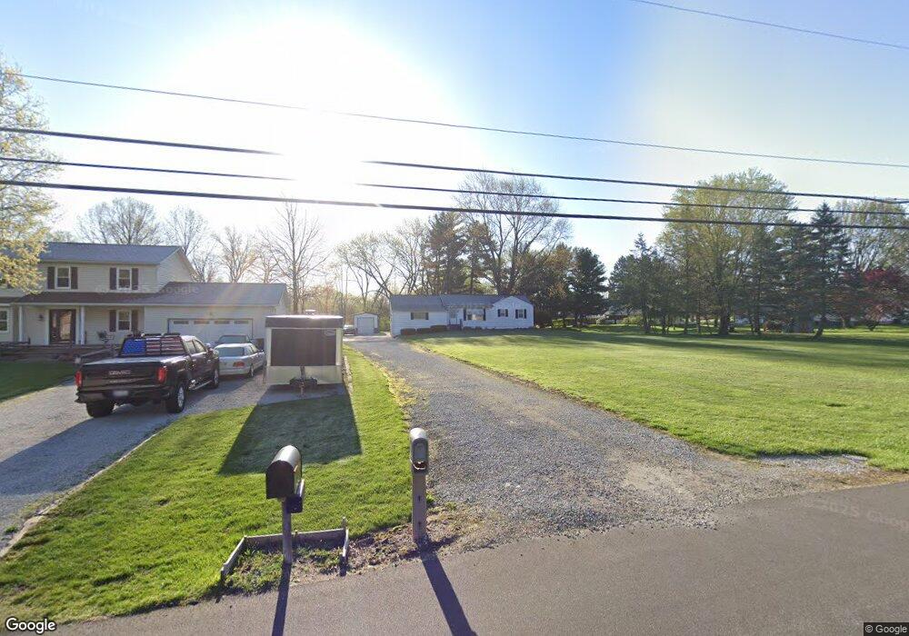
599 Dunbar Rd Tallmadge, OH 44278
Estimated Value: $175,499 - $271,000
3
Beds
1
Bath
960
Sq Ft
$224/Sq Ft
Est. Value
About This Home
This home is located at 599 Dunbar Rd, Tallmadge, OH 44278 and is currently estimated at $214,625, approximately $223 per square foot. 599 Dunbar Rd is a home located in Summit County with nearby schools including Tallmadge Middle School, Tallmadge High School, and Cornerstone Community School.
Ownership History
Date
Name
Owned For
Owner Type
Purchase Details
Closed on
Aug 10, 2019
Sold by
Harrison Beth Ann
Bought by
Harrison Michael R
Current Estimated Value
Purchase Details
Closed on
Sep 7, 2016
Sold by
Harrison Micheal R and Harrison Beth Ann
Bought by
Harrison Michael R and Harrison Beth Ann
Home Financials for this Owner
Home Financials are based on the most recent Mortgage that was taken out on this home.
Original Mortgage
$38,275
Outstanding Balance
$24,273
Interest Rate
3.48%
Mortgage Type
New Conventional
Estimated Equity
$190,352
Purchase Details
Closed on
Jul 22, 2004
Sold by
Harrison Joe and Harrison Pamela
Bought by
Harrison Michael R
Home Financials for this Owner
Home Financials are based on the most recent Mortgage that was taken out on this home.
Original Mortgage
$94,000
Interest Rate
6.4%
Mortgage Type
Stand Alone Refi Refinance Of Original Loan
Purchase Details
Closed on
May 12, 1998
Sold by
Dolores E Light Est
Bought by
Harrison Michael and Harrison Joe
Create a Home Valuation Report for This Property
The Home Valuation Report is an in-depth analysis detailing your home's value as well as a comparison with similar homes in the area
Home Values in the Area
Average Home Value in this Area
Purchase History
| Date | Buyer | Sale Price | Title Company |
|---|---|---|---|
| Harrison Michael R | -- | None Available | |
| Harrison Michael R | -- | Kingdom Title | |
| Harrison Michael R | -- | Land America-Lawyers Title | |
| Harrison Michael | $70,000 | -- |
Source: Public Records
Mortgage History
| Date | Status | Borrower | Loan Amount |
|---|---|---|---|
| Open | Harrison Michael R | $38,275 | |
| Previous Owner | Harrison Michael R | $94,000 |
Source: Public Records
Tax History Compared to Growth
Tax History
| Year | Tax Paid | Tax Assessment Tax Assessment Total Assessment is a certain percentage of the fair market value that is determined by local assessors to be the total taxable value of land and additions on the property. | Land | Improvement |
|---|---|---|---|---|
| 2025 | $2,487 | $48,437 | $13,041 | $35,396 |
| 2024 | $2,487 | $48,437 | $13,041 | $35,396 |
| 2023 | $2,487 | $48,437 | $13,041 | $35,396 |
| 2021 | $2,557 | $40,559 | $10,868 | $29,691 |
| 2020 | $2,538 | $40,560 | $10,870 | $29,690 |
| 2019 | $2,201 | $31,340 | $7,490 | $23,850 |
| 2018 | $1,947 | $31,340 | $7,490 | $23,850 |
| 2017 | $1,964 | $31,340 | $7,490 | $23,850 |
| 2016 | $2,113 | $31,340 | $7,490 | $23,850 |
| 2015 | $1,964 | $31,340 | $7,490 | $23,850 |
| 2014 | $1,951 | $31,340 | $7,490 | $23,850 |
| 2013 | $1,727 | $28,110 | $7,490 | $20,620 |
Source: Public Records
Map
Nearby Homes
- 1075 Amy Trail
- 915 Treat Blvd
- 187 Oakview Cir
- 280 Woodside Ln
- 330 Hanna Dr
- 1034 Southeast Ave
- 490 Vandalia Dr
- 549 S Munroe Rd
- 523 S Munroe Rd
- 810 Norton Dr
- 750 Danner Rd
- 315 Fawnwood Dr
- 1239 Glenoak Dr
- 228 Dunbar Rd
- 988 Beechwood Dr
- 206 Fawnwood Dr
- 288 S Munroe Rd
- 243 S Munroe Rd
- 3167 Mogadore Rd
- 758 Humble Rd
- 587 Dunbar Rd
- 577 Dunbar Rd
- 989 Eastwood Ave
- 567 Dunbar Rd
- 1017 Eastwood Ave
- 588 Dunbar Rd
- 598 Dunbar Rd
- 608 Dunbar Rd
- 1029 Eastwood Ave
- 965 Eastwood Ave
- 557 Dunbar Rd
- 1039 Eastwood Ave
- 574 Dunbar Rd
- 955 Eastwood Ave
- 641 Dunbar Rd
- 1002 Eastwood Ave
- 1045 Eastwood Ave
- 641 Eastwood Ave
- 547 Dunbar Rd
- 560 Dunbar Rd