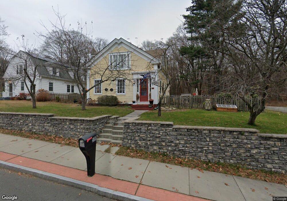
599 N Main St Manchester, CT 06042
Robertson NeighborhoodEstimated Value: $266,606 - $357,000
3
Beds
2
Baths
1,587
Sq Ft
$193/Sq Ft
Est. Value
About This Home
This home is located at 599 N Main St, Manchester, CT 06042 and is currently estimated at $306,652, approximately $193 per square foot. 599 N Main St is a home located in Hartford County with nearby schools including Robertson School, Illing Middle School, and Elisabeth M. Bennet Academy.
Ownership History
Date
Name
Owned For
Owner Type
Purchase Details
Closed on
Feb 23, 2021
Sold by
Fair Nicholas H
Bought by
Brown Dean
Current Estimated Value
Purchase Details
Closed on
Mar 3, 2009
Sold by
Lee Michael J and Kleinman Jamie M
Bought by
Fair Nicholas H
Home Financials for this Owner
Home Financials are based on the most recent Mortgage that was taken out on this home.
Original Mortgage
$171,830
Interest Rate
5%
Purchase Details
Closed on
May 1, 2001
Sold by
Driggs John D and Macleod-Driggs Mary
Bought by
Lee Michael J and Kleinman Jamie M
Create a Home Valuation Report for This Property
The Home Valuation Report is an in-depth analysis detailing your home's value as well as a comparison with similar homes in the area
Home Values in the Area
Average Home Value in this Area
Purchase History
| Date | Buyer | Sale Price | Title Company |
|---|---|---|---|
| Brown Dean | $135,000 | None Available | |
| Brown Dean | $135,000 | None Available | |
| Fair Nicholas H | $175,000 | -- | |
| Fair Nicholas H | $175,000 | -- | |
| Lee Michael J | $129,000 | -- | |
| Lee Michael J | $129,000 | -- |
Source: Public Records
Mortgage History
| Date | Status | Borrower | Loan Amount |
|---|---|---|---|
| Previous Owner | Lee Michael J | $162,027 | |
| Previous Owner | Lee Michael J | $171,830 |
Source: Public Records
Tax History Compared to Growth
Tax History
| Year | Tax Paid | Tax Assessment Tax Assessment Total Assessment is a certain percentage of the fair market value that is determined by local assessors to be the total taxable value of land and additions on the property. | Land | Improvement |
|---|---|---|---|---|
| 2025 | $5,276 | $132,500 | $41,300 | $91,200 |
| 2024 | $5,125 | $132,500 | $41,300 | $91,200 |
| 2023 | $4,929 | $132,500 | $41,300 | $91,200 |
| 2022 | $4,832 | $132,500 | $41,300 | $91,200 |
| 2021 | $3,678 | $100,700 | $37,600 | $63,100 |
| 2020 | $3,678 | $100,700 | $37,600 | $63,100 |
| 2019 | $3,678 | $100,700 | $37,600 | $63,100 |
| 2018 | $3,606 | $100,700 | $37,600 | $63,100 |
| 2017 | $3,509 | $100,700 | $37,600 | $63,100 |
| 2016 | $3,910 | $112,200 | $46,500 | $65,700 |
| 2015 | $3,891 | $112,200 | $46,500 | $65,700 |
| 2014 | $3,815 | $112,200 | $46,500 | $65,700 |
Source: Public Records
Map
Nearby Homes
- 634 N Main St
- 13 Oak Forest Dr Unit 6
- 75 Gianna Dr Unit 75
- 1769 Tolland Turnpike
- 15 Stock Place
- 226 Hilliard St
- 180 Hilliard St
- 310 Hilliard St
- 96 Westerly St
- 100 Westerly St
- 233 Woodland St
- 50 North St
- 65 Broad St
- 74 North St
- 23 Chatsworth Ct
- 21 Chatsworth Ct
- 25 Chatsworth Ct
- 205 Homestead St Unit B2
- 205 Homestead St Unit B3
- 12 Buckland Alley
- 599 N Main St Unit 2
- 605 N Main St
- 611 N Main St
- 617 N Main St
- 91 Oak Forest Dr Unit 91
- 619 N Main St
- 587 N Main St
- 92 Oak Forest Dr Unit 92
- 93 Oak Forest Dr Unit 3
- 94 Oak Forest Dr Unit 94
- 604 N Main St
- 590 N Main St
- 610 N Main St
- 81 Oak Forest Dr Unit 8-1
- 81 Oak Forest Dr
- 622 N Main St
- 584 N Main St
- 106 Oak Forest Dr Unit BLD 10
- 84 Oak Forest Dr Unit 84
- 11 Oak Forest Dr Unit 7