Estimated Value: $190,000 - $283,000
3
Beds
2
Baths
1,666
Sq Ft
$142/Sq Ft
Est. Value
About This Home
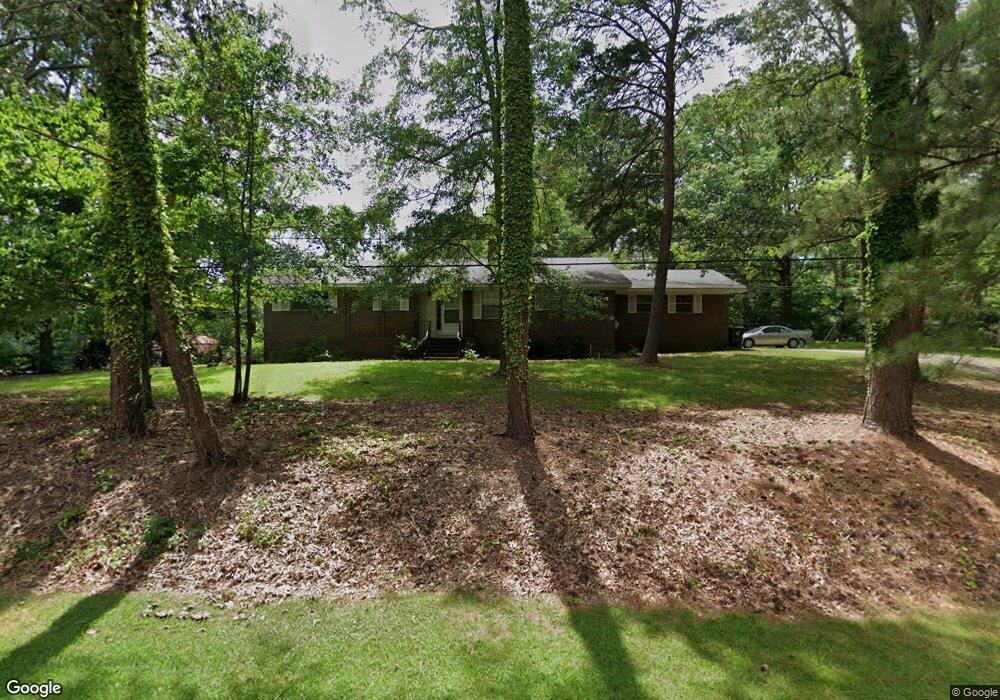
This home is located at 5990 Old Port Rd, Mulga, AL 35118 and is currently estimated at $237,051, approximately $142 per square foot. 5990 Old Port Rd is a home located in Jefferson County with nearby schools including Concord Elementary School, Hueytown Middle School, and Hueytown High School.
Ownership History
Date
Name
Owned For
Owner Type
Purchase Details
Closed on
Jul 5, 2017
Sold by
Honeycutt Ralph G
Bought by
Wyatt John Jacob
Current Estimated Value
Home Financials for this Owner
Home Financials are based on the most recent Mortgage that was taken out on this home.
Original Mortgage
$134,343
Interest Rate
3.89%
Mortgage Type
New Conventional
Purchase Details
Closed on
Oct 6, 2016
Sold by
Spartan Value Investors Ll
Bought by
Black Debbie
Purchase Details
Closed on
Aug 29, 2016
Sold by
Key James N
Bought by
Spartan Value Investors Llc
Create a Home Valuation Report for This Property
The Home Valuation Report is an in-depth analysis detailing your home's value as well as a comparison with similar homes in the area
Home Values in the Area
Average Home Value in this Area
Purchase History
| Date | Buyer | Sale Price | Title Company |
|---|---|---|---|
| Wyatt John Jacob | $133,000 | -- | |
| Black Debbie | $85,600 | -- | |
| Spartan Value Investors Llc | $71,356 | -- |
Source: Public Records
Mortgage History
| Date | Status | Borrower | Loan Amount |
|---|---|---|---|
| Previous Owner | Wyatt John Jacob | $134,343 |
Source: Public Records
Tax History Compared to Growth
Tax History
| Year | Tax Paid | Tax Assessment Tax Assessment Total Assessment is a certain percentage of the fair market value that is determined by local assessors to be the total taxable value of land and additions on the property. | Land | Improvement |
|---|---|---|---|---|
| 2024 | $1,233 | $22,520 | -- | -- |
| 2022 | $1,118 | $20,500 | $10,500 | $10,000 |
| 2021 | $943 | $17,430 | $8,100 | $9,330 |
| 2020 | $904 | $16,760 | $8,100 | $8,660 |
| 2019 | $890 | $16,520 | $0 | $0 |
| 2018 | $823 | $15,340 | $0 | $0 |
| 2017 | $997 | $36,740 | $0 | $0 |
| 2016 | $997 | $18,380 | $0 | $0 |
| 2015 | $997 | $18,380 | $0 | $0 |
| 2014 | -- | $18,520 | $0 | $0 |
| 2013 | -- | $18,520 | $0 | $0 |
Source: Public Records
Map
Nearby Homes
- 159 Brandy Ln Unit 1
- 150 Brandy Ln Unit 1
- 290 Maple Leaf Trail
- 6165 Birmingport Rd
- 6635 Woodland Hills Ave
- 5588 Birmingport Rd
- 254 Woodland Way
- 251 Parkview Dr Unit 34
- 252 Parkview Dr Unit 35
- 258 Parkview Dr Unit 36
- 6027 Parkview Trail Unit 37
- 6021 Parkview Trail Unit 310
- 6026 Parkview Trail Unit 310
- 5405 Pine St
- 224 Oak Ln
- 5064 Birmingport Rd
- 5635 Victory Ln
- 1104 Washington Ave
- 1033 Justice Dr
- 6380 Warrior River Rd
- 5990 Old Port Rd
- 5982 Old Port Rd
- 5989 Old Port Rd
- 5999 Old Port Rd
- 5983 Birmingport Rd
- 5998 Old Port Rd
- 5970 Old Port Rd
- 5974 Old Port Rd
- 159 Brandy Ln
- 159 Brandy Ln Unit 159
- 159 Brandy Ln Unit 33.515369
- 150 Brandy Ln
- 5987 Birmingport Rd
- 5979 Birmingport Rd
- 5962 Old Port Rd
- 6055 Old Port Rd
- 5991 Birmingport Rd
- 6035 Old Port Rd
- 5995 Birmingport Rd
- 168 Brandy Ln