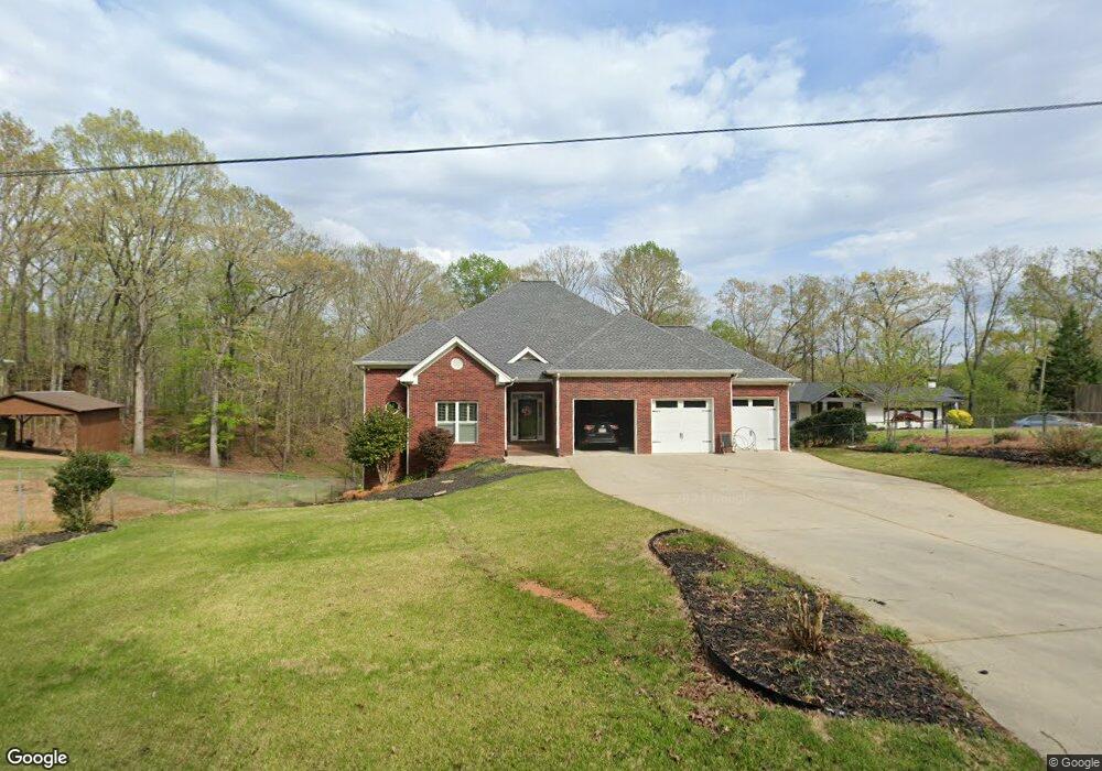
5991 Warpath Rd Flowery Branch, GA 30542
Estimated Value: $807,000 - $1,105,000
3
Beds
4
Baths
3,315
Sq Ft
$286/Sq Ft
Est. Value
About This Home
This home is located at 5991 Warpath Rd, Flowery Branch, GA 30542 and is currently estimated at $948,944, approximately $286 per square foot. 5991 Warpath Rd is a home located in Hall County with nearby schools including Flowery Branch Elementary School, West Hall Middle School, and West Hall High School.
Ownership History
Date
Name
Owned For
Owner Type
Purchase Details
Closed on
Jul 6, 2003
Sold by
Lauck Wilfried
Bought by
Johnson Linda Marie
Current Estimated Value
Purchase Details
Closed on
May 2, 2003
Sold by
Johnson Linda Marie
Bought by
Spence V Blane
Purchase Details
Closed on
Jul 6, 1999
Sold by
Lauck Wilfried
Bought by
Johnson Linda Marie
Purchase Details
Closed on
Jan 11, 1990
Sold by
Bozeman Lawrence C and Bozeman Juanita C
Bought by
Bozeman Ronald Lawrence
Create a Home Valuation Report for This Property
The Home Valuation Report is an in-depth analysis detailing your home's value as well as a comparison with similar homes in the area
Home Values in the Area
Average Home Value in this Area
Purchase History
| Date | Buyer | Sale Price | Title Company |
|---|---|---|---|
| Johnson Linda Marie | -- | -- | |
| Spence V Blane | $138,500 | -- | |
| Johnson Linda Marie | $138,500 | -- | |
| Bozeman Ronald Lawrence | -- | -- |
Source: Public Records
Tax History Compared to Growth
Tax History
| Year | Tax Paid | Tax Assessment Tax Assessment Total Assessment is a certain percentage of the fair market value that is determined by local assessors to be the total taxable value of land and additions on the property. | Land | Improvement |
|---|---|---|---|---|
| 2024 | $7,711 | $330,400 | $166,520 | $163,880 |
| 2023 | $7,320 | $330,400 | $166,520 | $163,880 |
| 2022 | $5,861 | $336,320 | $166,520 | $169,800 |
| 2021 | $5,980 | $245,440 | $80,000 | $165,440 |
| 2020 | $5,976 | $238,800 | $80,000 | $158,800 |
| 2019 | $5,173 | $243,760 | $80,000 | $163,760 |
| 2018 | $5,890 | $226,680 | $67,800 | $158,880 |
| 2017 | $5,622 | $226,080 | $72,080 | $154,000 |
| 2016 | $5,792 | $217,280 | $58,440 | $158,840 |
| 2015 | $5,448 | $205,120 | $46,280 | $158,840 |
| 2014 | $5,448 | $249,000 | $96,320 | $152,680 |
Source: Public Records
Map
Nearby Homes
- 5995 Warpath Rd
- 0 Warpath Rd Unit 7467088
- 0 Warpath Rd Unit 7434452
- 0 Warpath Rd Unit 7260522
- 0 Warpath Rd Unit 7154056
- 0 Warpath Rd Unit 7525781
- 0 Warpath Rd Unit 8187264
- 0 Warpath Rd Unit 7429359
- 5971 Warpath Rd
- 6000 Warpath Rd
- 6005 Warpath Rd
- 5969 Warpath Rd
- 5967 Warpath Rd
- 5965 Warpath Rd
- 6020 Warpath Rd
- 5991 Wigwam Way
- 5961 Warpath Rd
- 6024 Warpath Rd
- 6040 Seminole Dr
- 5964 Warpath Rd