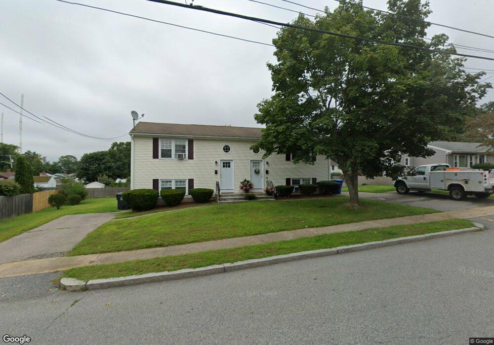
6-8 Hospital Rd Riverside, RI 02915
Riverside NeighborhoodEstimated Value: $416,071 - $559,000
4
Beds
2
Baths
1,196
Sq Ft
$414/Sq Ft
Est. Value
About This Home
This home is located at 6-8 Hospital Rd, Riverside, RI 02915 and is currently estimated at $495,518, approximately $414 per square foot. 6-8 Hospital Rd is a home located in Providence County with nearby schools including East Providence High School, St Mary Academy-Bay View, and The Gordon School.
Ownership History
Date
Name
Owned For
Owner Type
Purchase Details
Closed on
May 2, 2018
Sold by
Briggs Joseph C and Santander Bank Na
Bought by
Palumbo Richard J
Current Estimated Value
Purchase Details
Closed on
Sep 28, 2007
Sold by
Dambra Gary F and Sullivan Gail
Bought by
Briggs Joseph C
Home Financials for this Owner
Home Financials are based on the most recent Mortgage that was taken out on this home.
Original Mortgage
$272,500
Interest Rate
6.65%
Mortgage Type
Purchase Money Mortgage
Create a Home Valuation Report for This Property
The Home Valuation Report is an in-depth analysis detailing your home's value as well as a comparison with similar homes in the area
Home Values in the Area
Average Home Value in this Area
Purchase History
| Date | Buyer | Sale Price | Title Company |
|---|---|---|---|
| Palumbo Richard J | $180,000 | -- | |
| Palumbo Richard J | $180,000 | -- | |
| Briggs Joseph C | $303,000 | -- | |
| Briggs Joseph C | $303,000 | -- |
Source: Public Records
Mortgage History
| Date | Status | Borrower | Loan Amount |
|---|---|---|---|
| Previous Owner | Briggs Joseph C | $272,500 |
Source: Public Records
Tax History Compared to Growth
Tax History
| Year | Tax Paid | Tax Assessment Tax Assessment Total Assessment is a certain percentage of the fair market value that is determined by local assessors to be the total taxable value of land and additions on the property. | Land | Improvement |
|---|---|---|---|---|
| 2025 | $5,542 | $424,000 | $73,500 | $350,500 |
| 2024 | $4,757 | $310,300 | $61,300 | $249,000 |
| 2023 | $4,580 | $310,300 | $61,300 | $249,000 |
| 2022 | $5,096 | $233,100 | $45,500 | $187,600 |
| 2021 | $5,012 | $233,100 | $41,900 | $191,200 |
| 2020 | $4,800 | $233,100 | $41,900 | $191,200 |
| 2019 | $4,667 | $233,100 | $41,900 | $191,200 |
| 2018 | $4,681 | $204,600 | $50,100 | $154,500 |
| 2017 | $4,577 | $204,600 | $50,100 | $154,500 |
| 2016 | $4,554 | $204,600 | $50,100 | $154,500 |
| 2015 | $4,668 | $203,400 | $57,200 | $146,200 |
| 2014 | $4,668 | $203,400 | $57,200 | $146,200 |
Source: Public Records
Map
Nearby Homes
- 7 Jill Ct
- 36 Woodbine St
- 46 Tanglewood Dr
- 25 Woodbine St
- 25 Winslow St
- 536 Willett Ave
- 6 Hazelton Rd
- 57 Harris St
- 151 Willett Ave Unit 2
- 151 Willett Ave Unit 5
- 735 Willett Ave Unit 806
- 25 Arnold St
- 81 Sprague Ave
- 146 Becker Ave
- 6 Hilton Ave
- 1 Fales St
- 6 Kenmore Ct
- 22 Mayfield Rd
- 0 Mabel Dr
- 81 Pine Crest Dr
- 6 Hospital Rd
- 68 Hospital Rd
- 601 Forbes St
- 5 Hospital Rd
- 7 Hospital Rd
- 5 Hospital Rd
- 10 Hospital Rd
- 57 Hospital Rd
- 0 Hospital Rd
- 17 Julie Ann Cir
- 9 Hospital Rd Unit 11
- 585 Forbes St Unit A
- 585 Forbes St Unit 2D
- 585 Forbes St Unit D
- 585 Forbes St
- 605 Forbes St
- 14 Hospital Rd Unit 16
- 18 Julie Ann Cir
- 575 Forbes St
- 609 Forbes St