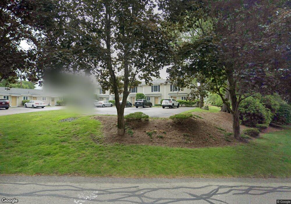
6 Adam St South Easton, MA 02375
Estimated Value: $358,980 - $380,000
2
Beds
2
Baths
1,052
Sq Ft
$351/Sq Ft
Est. Value
About This Home
This home is located at 6 Adam St, South Easton, MA 02375 and is currently estimated at $368,745, approximately $350 per square foot. 6 Adam St is a home located in Bristol County with nearby schools including Easton Middle School and Dovecrest Montessori Academy.
Ownership History
Date
Name
Owned For
Owner Type
Purchase Details
Closed on
Jul 29, 2020
Sold by
Sahir Omar and Tourabi Amal
Bought by
Badin Thery
Current Estimated Value
Home Financials for this Owner
Home Financials are based on the most recent Mortgage that was taken out on this home.
Original Mortgage
$243,000
Outstanding Balance
$214,995
Interest Rate
3.1%
Mortgage Type
New Conventional
Estimated Equity
$153,750
Purchase Details
Closed on
Apr 28, 2008
Sold by
Easton Xing Llc
Bought by
Grendal Michael and Nawrocki Christine
Home Financials for this Owner
Home Financials are based on the most recent Mortgage that was taken out on this home.
Original Mortgage
$212,800
Interest Rate
6.22%
Mortgage Type
Purchase Money Mortgage
Create a Home Valuation Report for This Property
The Home Valuation Report is an in-depth analysis detailing your home's value as well as a comparison with similar homes in the area
Home Values in the Area
Average Home Value in this Area
Purchase History
| Date | Buyer | Sale Price | Title Company |
|---|---|---|---|
| Badin Thery | $263,000 | None Available | |
| Badin Thery | $263,000 | None Available | |
| Grendal Michael | $224,000 | -- | |
| Grendal Michael | $224,000 | -- |
Source: Public Records
Mortgage History
| Date | Status | Borrower | Loan Amount |
|---|---|---|---|
| Open | Badin Thery | $243,000 | |
| Closed | Badin Thery | $243,000 | |
| Previous Owner | Grendal Michael | $212,800 |
Source: Public Records
Tax History Compared to Growth
Tax History
| Year | Tax Paid | Tax Assessment Tax Assessment Total Assessment is a certain percentage of the fair market value that is determined by local assessors to be the total taxable value of land and additions on the property. | Land | Improvement |
|---|---|---|---|---|
| 2025 | $4,020 | $322,100 | $0 | $322,100 |
| 2024 | $3,958 | $296,500 | $0 | $296,500 |
| 2023 | $3,865 | $264,900 | $0 | $264,900 |
| 2022 | $3,647 | $237,000 | $0 | $237,000 |
| 2021 | $3,598 | $232,400 | $0 | $232,400 |
| 2020 | $3,394 | $220,700 | $0 | $220,700 |
| 2019 | $3,462 | $216,900 | $0 | $216,900 |
| 2018 | $2,984 | $187,200 | $0 | $187,200 |
| 2017 | $2,827 | $174,300 | $0 | $174,300 |
| 2016 | $2,613 | $161,400 | $0 | $161,400 |
| 2015 | $2,821 | $168,100 | $0 | $168,100 |
| 2014 | $2,799 | $168,100 | $0 | $168,100 |
Source: Public Records
Map
Nearby Homes
- 741 Washington St Unit 7
- 66 Depot St
- 24 Pine St
- 63 Pine St
- 20 Church St
- 13 Welch Rd Unit 13
- 4 County Ln
- 165 Pine Street (23 Lili Way)
- 6 Beatty Ln
- 40 Bristol Dr
- 26 Short St
- 27 Short St
- 21 Scotch Dam Rd
- 15 Scotch Dam Rd
- 305 Turnpike St Unit 26 2nd St
- 305 Turnpike St=237 5th St Unit 237
- 24 Eisenhower Dr
- 366 Center St
- 7 Coolidge Cir
- 23 Windchime Rd
- 6 Adam St Unit 10
- 6 Adam St Unit 9
- 6 Adam St Unit 7
- 6 Adam St Unit 5
- 6 Adam St Unit 4
- 6 Adam St Unit 3
- 6 Adam St Unit 2506
- 6 Adam St Unit 2505
- 6 Adam St Unit 2503
- 6 Adam St Unit 6
- 4 Nancy Rd Unit 10
- 4 Nancy Rd Unit 9
- 4 Nancy Rd Unit 8
- 4 Nancy Rd Unit 7
- 4 Nancy Rd Unit 6
- 4 Nancy Rd Unit 5
- 4 Nancy Rd
- 4 Nancy Rd Unit 3
- 4 Nancy Rd Unit 2
- 4 Nancy Rd Unit 1