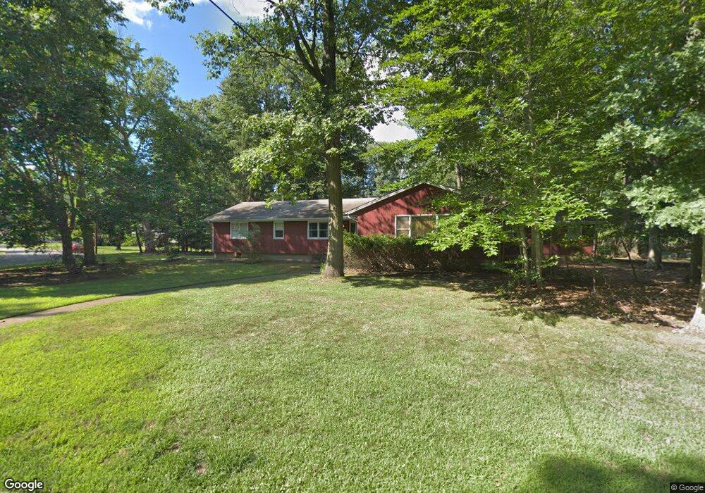
6 Anderson Ct Woodcliff Lake, NJ 07677
Estimated Value: $1,190,000 - $1,391,000
4
Beds
3
Baths
2,673
Sq Ft
$493/Sq Ft
Est. Value
About This Home
This home is located at 6 Anderson Ct, Woodcliff Lake, NJ 07677 and is currently estimated at $1,316,706, approximately $492 per square foot. 6 Anderson Ct is a home located in Bergen County with nearby schools including Dorchester Elementary School, Woodcliff Middle School, and Pascack Hills High School.
Ownership History
Date
Name
Owned For
Owner Type
Purchase Details
Closed on
Aug 29, 2018
Sold by
King Scott
Bought by
Wrfe Llc
Current Estimated Value
Home Financials for this Owner
Home Financials are based on the most recent Mortgage that was taken out on this home.
Original Mortgage
$659,250
Interest Rate
4.6%
Mortgage Type
New Conventional
Purchase Details
Closed on
Jun 8, 2018
Sold by
Helen B King Eight Year T
Bought by
King Scott
Create a Home Valuation Report for This Property
The Home Valuation Report is an in-depth analysis detailing your home's value as well as a comparison with similar homes in the area
Home Values in the Area
Average Home Value in this Area
Purchase History
| Date | Buyer | Sale Price | Title Company |
|---|---|---|---|
| Wrfe Llc | $572,500 | -- | |
| King Scott | -- | -- |
Source: Public Records
Mortgage History
| Date | Status | Borrower | Loan Amount |
|---|---|---|---|
| Previous Owner | Wrfe Llc | $659,250 |
Source: Public Records
Tax History Compared to Growth
Tax History
| Year | Tax Paid | Tax Assessment Tax Assessment Total Assessment is a certain percentage of the fair market value that is determined by local assessors to be the total taxable value of land and additions on the property. | Land | Improvement |
|---|---|---|---|---|
| 2025 | $20,971 | $996,100 | $422,100 | $574,000 |
| 2024 | $20,290 | $970,000 | $412,100 | $557,900 |
| 2023 | $18,926 | $937,200 | $404,600 | $532,600 |
| 2022 | $18,926 | $865,000 | $358,200 | $506,800 |
| 2021 | $17,905 | $817,600 | $323,200 | $494,400 |
| 2020 | $17,161 | $816,800 | $325,700 | $491,100 |
| 2019 | $13,662 | $654,000 | $321,200 | $332,800 |
| 2018 | $13,383 | $645,600 | $317,200 | $328,400 |
| 2017 | $13,383 | $639,700 | $313,200 | $326,500 |
| 2016 | $13,464 | $628,000 | $308,200 | $319,800 |
| 2015 | $13,205 | $622,000 | $303,200 | $318,800 |
| 2014 | $13,287 | $601,500 | $289,700 | $311,800 |
Source: Public Records
Map
Nearby Homes