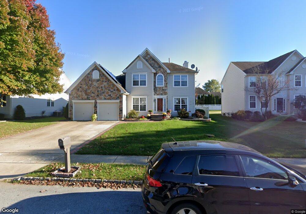
6 Arbor Ln Bordentown, NJ 08505
Estimated Value: $612,000 - $727,000
--
Bed
--
Bath
2,524
Sq Ft
$268/Sq Ft
Est. Value
About This Home
This home is located at 6 Arbor Ln, Bordentown, NJ 08505 and is currently estimated at $677,382, approximately $268 per square foot. 6 Arbor Ln is a home located in Burlington County with nearby schools including Number 5, Roebling Elementary School, Riverfront Middle School, and Florence Twp Mem High School.
Ownership History
Date
Name
Owned For
Owner Type
Purchase Details
Closed on
Jul 21, 2000
Sold by
Beazer Homes Corp
Bought by
Najem Ali Jawad and Najem Frozan Z
Current Estimated Value
Home Financials for this Owner
Home Financials are based on the most recent Mortgage that was taken out on this home.
Original Mortgage
$199,000
Outstanding Balance
$70,351
Interest Rate
8.06%
Estimated Equity
$607,031
Create a Home Valuation Report for This Property
The Home Valuation Report is an in-depth analysis detailing your home's value as well as a comparison with similar homes in the area
Home Values in the Area
Average Home Value in this Area
Purchase History
| Date | Buyer | Sale Price | Title Company |
|---|---|---|---|
| Najem Ali Jawad | $221,135 | Congress Title Corp | |
| -- | $221,100 | -- |
Source: Public Records
Mortgage History
| Date | Status | Borrower | Loan Amount |
|---|---|---|---|
| Open | -- | $199,000 |
Source: Public Records
Tax History Compared to Growth
Tax History
| Year | Tax Paid | Tax Assessment Tax Assessment Total Assessment is a certain percentage of the fair market value that is determined by local assessors to be the total taxable value of land and additions on the property. | Land | Improvement |
|---|---|---|---|---|
| 2025 | $10,499 | $376,700 | $116,600 | $260,100 |
| 2024 | $10,050 | $376,700 | $116,600 | $260,100 |
| 2023 | $10,050 | $376,700 | $116,600 | $260,100 |
| 2022 | $9,214 | $352,900 | $116,600 | $236,300 |
| 2021 | $9,132 | $352,900 | $116,600 | $236,300 |
| 2020 | $9,098 | $352,900 | $116,600 | $236,300 |
| 2019 | $9,017 | $352,900 | $116,600 | $236,300 |
| 2018 | $8,939 | $352,900 | $116,600 | $236,300 |
| 2017 | $8,830 | $352,900 | $116,600 | $236,300 |
| 2016 | $8,660 | $352,900 | $116,600 | $236,300 |
| 2015 | $8,484 | $352,900 | $116,600 | $236,300 |
| 2014 | $8,247 | $352,900 | $116,600 | $236,300 |
Source: Public Records
Map
Nearby Homes
- 26 Creekwood Dr
- 74 Creekwood Dr
- 85 Creekwood Dr
- 1031 Potts Mill Rd
- 1007 Potts Mill Rd
- 71 Amboy Ave
- 15 Railroad Ave
- 12 Brookside Dr
- 606 Archibald Ln
- 1036 Potts Mill Rd
- 406 Arnold Dr
- 149 2nd Ave
- 136 4th Ave
- 227 5th Ave
- 132 4th Ave
- 125 4th Ave
- 36 3rd Ave
- 149 7th Ave
- 67 Ridgway Dr
- 28 Magnolia Ct Unit 10