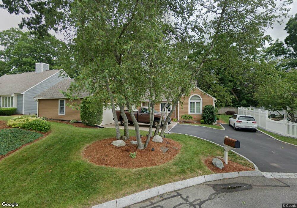
6 Aspen Cir Framingham, MA 01701
Estimated Value: $721,382 - $817,000
2
Beds
2
Baths
1,929
Sq Ft
$389/Sq Ft
Est. Value
About This Home
This home is located at 6 Aspen Cir, Framingham, MA 01701 and is currently estimated at $751,096, approximately $389 per square foot. 6 Aspen Cir is a home located in Middlesex County with nearby schools including Framingham High School, Summit Montessori School, and Saint Bridget School.
Ownership History
Date
Name
Owned For
Owner Type
Purchase Details
Closed on
Oct 18, 2021
Sold by
Lee Patricia M
Bought by
Chase William H
Current Estimated Value
Purchase Details
Closed on
Sep 17, 2010
Sold by
Lee Patricia M and Lee Richard G
Bought by
Lee Patricia M
Purchase Details
Closed on
Aug 10, 1999
Sold by
Roberts A James A and Roberts Janet M
Bought by
Lee Richard G and Lee Patricia M
Create a Home Valuation Report for This Property
The Home Valuation Report is an in-depth analysis detailing your home's value as well as a comparison with similar homes in the area
Home Values in the Area
Average Home Value in this Area
Purchase History
| Date | Buyer | Sale Price | Title Company |
|---|---|---|---|
| Chase William H | $500,000 | None Available | |
| Chase William H | $500,000 | None Available | |
| Lee Patricia M | -- | -- | |
| Lee Patricia M | -- | -- | |
| Lee Richard G | $300,000 | -- |
Source: Public Records
Mortgage History
| Date | Status | Borrower | Loan Amount |
|---|---|---|---|
| Previous Owner | Lee Richard G | $180,000 | |
| Previous Owner | Lee Richard G | $180,000 |
Source: Public Records
Tax History Compared to Growth
Tax History
| Year | Tax Paid | Tax Assessment Tax Assessment Total Assessment is a certain percentage of the fair market value that is determined by local assessors to be the total taxable value of land and additions on the property. | Land | Improvement |
|---|---|---|---|---|
| 2025 | $7,818 | $654,800 | $276,000 | $378,800 |
| 2024 | $7,364 | $591,000 | $246,000 | $345,000 |
| 2023 | $7,062 | $539,500 | $219,500 | $320,000 |
| 2022 | $7,935 | $577,500 | $199,500 | $378,000 |
| 2021 | $7,959 | $566,500 | $191,800 | $374,700 |
| 2020 | $8,089 | $540,000 | $174,500 | $365,500 |
| 2019 | $8,011 | $520,900 | $174,500 | $346,400 |
| 2018 | $7,871 | $482,300 | $171,000 | $311,300 |
| 2017 | $7,743 | $463,400 | $153,700 | $309,700 |
| 2016 | $7,943 | $457,000 | $153,700 | $303,300 |
| 2015 | $8,158 | $457,800 | $167,900 | $289,900 |
Source: Public Records
Map
Nearby Homes
- 1186 Worcester Rd Unit 720
- 139 Salem End Rd
- 341 Pleasant St
- 1327 Old Worcester Rd
- 10 Main St Unit 507
- 26 Knight Rd
- 337 Edgell Rd
- 15 Clearview Dr
- 401 Belknap Rd
- 18 Auburn Street Extension
- 17 Lilian Rd
- 29 Prescott St
- 609 Union Ave Unit 609
- 10 Kings Row Ln
- 477 Edgell Rd
- 53 Long Ave
- 484 Edgell Rd
- 10 Millwood St
- 1500 Worcester Rd Unit 202
- 1500 Worcester Rd Unit 502
- 4 Aspen Cir
- 8 Aspen Cir
- 2 Aspen Cir
- 5 Aspen Cir
- 154 Pleasant St
- 10 Aspen Cir
- 176 Pleasant St
- 7 Aspen Cir
- 198 Pleasant St
- 159 Pleasant St
- 138 Pleasant St
- 149 Pleasant St
- 200 Pleasant St
- 200 Pleasant St Unit 2
- 165 Pleasant St
- 139 Pleasant St
- 169 Pleasant St
- 10 Sundial Place
- 204 Pleasant St
- 8 Sundial Place